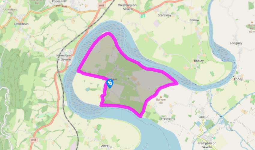
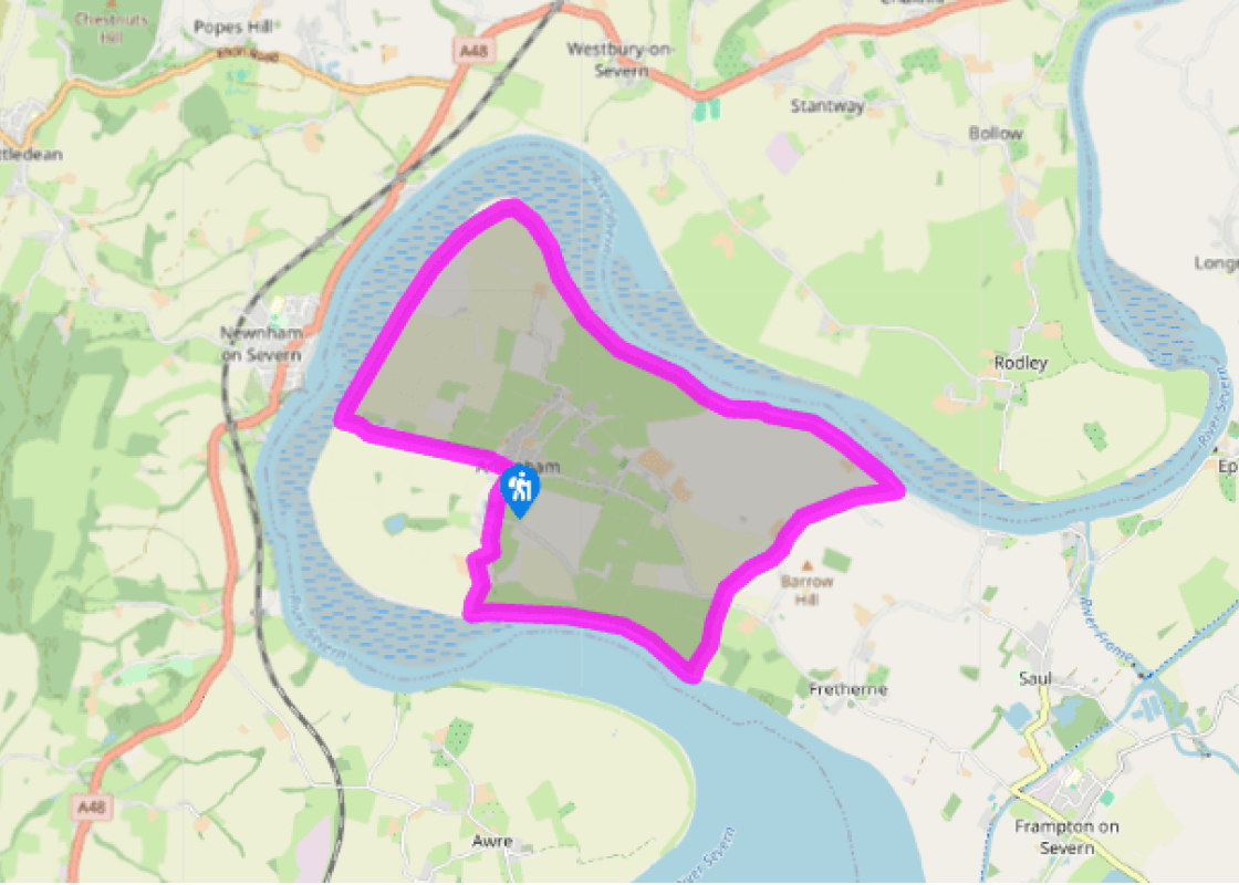
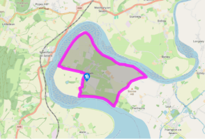
From the centre of the village, with The Red Lion Inn at your back, walk along a ‘No Through Road’. Pass the church and continue along the road. It becomes a track which brings you to a kissing gate. Go to the top of the bank.
With the River Severn in front of you, turn left through a kissing gate. Continue along this route, passing through kissing gates where they arise, until you see Hock Cliff in front of you. Pass into the field that begins to slope up towards the cliff.
Turn sharp left to walk down the bank and along the left side of a field. Cross a bridge into the next field. When the field-edge swings right go ahead to two stiles with a farm track between them. Follow the path ahead between hedges.
Cross a road and enter the ‘No Through Road’ in front of you. Follow it towards some houses. Just before a gateway turn left through two kissing gates into a field. Follow its right-hand side to a stile and then continue on the same line. Just beyond two big houses on your right, and about 100yds (91m) before some farm buildings, turn right at a gate into a field. Crossing this diagonally brings you to a kissing gate and a lane.
Turn left and follow the lane through Overton for just over 0.5 miles (800m). Where the road goes sharply right beside a long house, turn left to rejoin the Severn Way. The path will lead away from the river briefly, among trees, to emerge at a stile beside a meadow. Continue walking ahead, maintaining your direction, passing through gates, always with the River Severn on your right and again ignoring any paths leading inland.
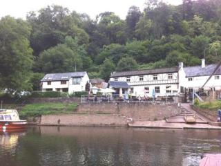
The footpath soon takes the form of a raised bank, or dyke. It reaches its northernmost point then swings to the south, just after passing a farm – the town of Newnham on Severn should now be clearly visible on the opposite bank. Continue to a pub, The Old Passage Inn, on your left.
Beyond the inn take the long, straight lane on your left, which leads across the flood plain, all the way back to Arlingham.
The River Severn is at its most impressive around Arlingham, in its lower reaches before opening up to the Bristol Channel. Here Gloucestershire juts out into the river to form a large promontory, forcing the river into a huge sweeping loop, widening to well over half a mile (800m) at certain... points. To the west it is overlooked by the Forest of Dean ridge, to the east by the Cotswold escarpment. Shallow and placid though it might appear here, the River Severn has a capricious nature. The area has been devastated by floods in the past, most notably in the 16th century. Flooding is rarely a problem here now, as the flood control measures you see as you walk have succeeded in containing the river. It does, though, continue to create havoc every winter further upstream. The Severn Bore, for which the river is justly famous, is a tidal wave that is formed a little way downstream, where the river narrows at Sharpness. The fundamental cause behind the bore is the combination of a large volume of tidal water, funnelled into a quickly narrowing channel, hastening onto rock rising from the riverbed. A wave is created, which is then free to roll on to the Severn’s middle reaches. Significant sea tides at the river’s wide mouth make the Severn Bore such a spectacle. In fortnightly cycles over the course of each month the tides reach their highest and lowest points. Near the Severn Bridge the second highest rise and fall of tide in the world has been recorded (the first is in Canada, on the Petitcodiac River). Once a month, for a few days, the spring tides occur, reaching a height of 31 feet (9.4m) at Sharpness. Whenever the tides reach 26ft (8m) or more, a bore will be unleashed. Because of its tendency to extremes, the Severn can be dangerous. Nonetheless, there are those who love to ride the bore. Surfers and canoeists ride it for the thrill, and the waves will sometimes reach almost 10ft (3m) and travel at 12mph (19kph), finally losing impetus near Gloucester.
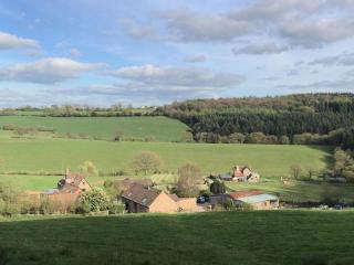
Gloucestershire is home to a variety of landscapes, including the Cotswolds, a region of gentle hills, valleys and gem-like villages that roll through the county. To their west is the Severn Plain, watered by Britain’s longest river and characterised by orchards and farms marked out by hedgerows that blaze with mayflower in the spring; beyond the Severn are the Forest of Dean and the Wye Valley.
From the centre of the village, with The Red Lion Inn at your back, walk along a ‘No Through Road’. Pass the church and continue along the road. It becomes a track which brings you to a kissing gate. Go to the top of the bank.
1 of 7
With the River Severn in front of you, turn left through a kissing gate. Continue along this route, passing through kissing gates where they arise, until you see Hock Cliff in front of you. Pass into the field that begins to slope up towards the cliff.
2 of 7
Turn sharp left to walk down the bank and along the left side of a field. Cross a bridge into the next field. When the field-edge swings right go ahead to two stiles with a farm track between them. Follow the path ahead between hedges.
3 of 7
Cross a road and enter the ‘No Through Road’ in front of you. Follow it towards some houses. Just before a gateway turn left through two kissing gates into a field. Follow its right-hand side to a stile and then continue on the same line. Just beyond two big houses on your right, and about 100yds (91m) before some farm buildings, turn right at a gate into a field. Crossing this diagonally brings you to a kissing gate and a lane.
4 of 7
Turn left and follow the lane through Overton for just over 0.5 miles (800m). Where the road goes sharply right beside a long house, turn left to rejoin the Severn Way. The path will lead away from the river briefly, among trees, to emerge at a stile beside a meadow. Continue walking ahead, maintaining your direction, passing through gates, always with the River Severn on your right and again ignoring any paths leading inland.
5 of 7
The footpath soon takes the form of a raised bank, or dyke. It reaches its northernmost point then swings to the south, just after passing a farm – the town of Newnham on Severn should now be clearly visible on the opposite bank. Continue to a pub, The Old Passage Inn, on your left.
6 of 7
Beyond the inn take the long, straight lane on your left, which leads across the flood plain, all the way back to Arlingham.
The River Severn is at its most impressive around Arlingham, in its lower reaches before opening up to the Bristol Channel. Here Gloucestershire juts out into the river to form a large promontory, forcing the river into a huge sweeping loop, widening to well over half a mile (800m) at certain... points. To the west it is overlooked by the Forest of Dean ridge, to the east by the Cotswold escarpment. Shallow and placid though it might appear here, the River Severn has a capricious nature. The area has been devastated by floods in the past, most notably in the 16th century. Flooding is rarely a problem here now, as the flood control measures you see as you walk have succeeded in containing the river. It does, though, continue to create havoc every winter further upstream. The Severn Bore, for which the river is justly famous, is a tidal wave that is formed a little way downstream, where the river narrows at Sharpness. The fundamental cause behind the bore is the combination of a large volume of tidal water, funnelled into a quickly narrowing channel, hastening onto rock rising from the riverbed. A wave is created, which is then free to roll on to the Severn’s middle reaches. Significant sea tides at the river’s wide mouth make the Severn Bore such a spectacle. In fortnightly cycles over the course of each month the tides reach their highest and lowest points. Near the Severn Bridge the second highest rise and fall of tide in the world has been recorded (the first is in Canada, on the Petitcodiac River). Once a month, for a few days, the spring tides occur, reaching a height of 31 feet (9.4m) at Sharpness. Whenever the tides reach 26ft (8m) or more, a bore will be unleashed. Because of its tendency to extremes, the Severn can be dangerous. Nonetheless, there are those who love to ride the bore. Surfers and canoeists ride it for the thrill, and the waves will sometimes reach almost 10ft (3m) and travel at 12mph (19kph), finally losing impetus near Gloucester.
Gloucestershire is home to a variety of landscapes, including the Cotswolds, a region of gentle hills, valleys and gem-like villages that roll through the county. To their west is the Severn Plain, watered by Britain’s longest river and characterised by orchards and farms marked out by hedgerows that blaze with mayflower in the spring; beyond the Severn are the Forest of Dean and the Wye Valley.