"Experience quintessential Exmoor among the barrows and tumuli of its Bronze Age farmers."
Walk directions
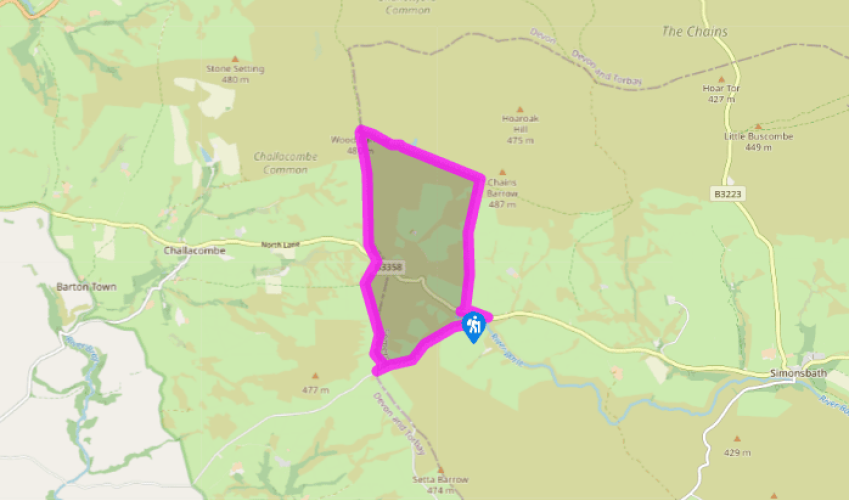
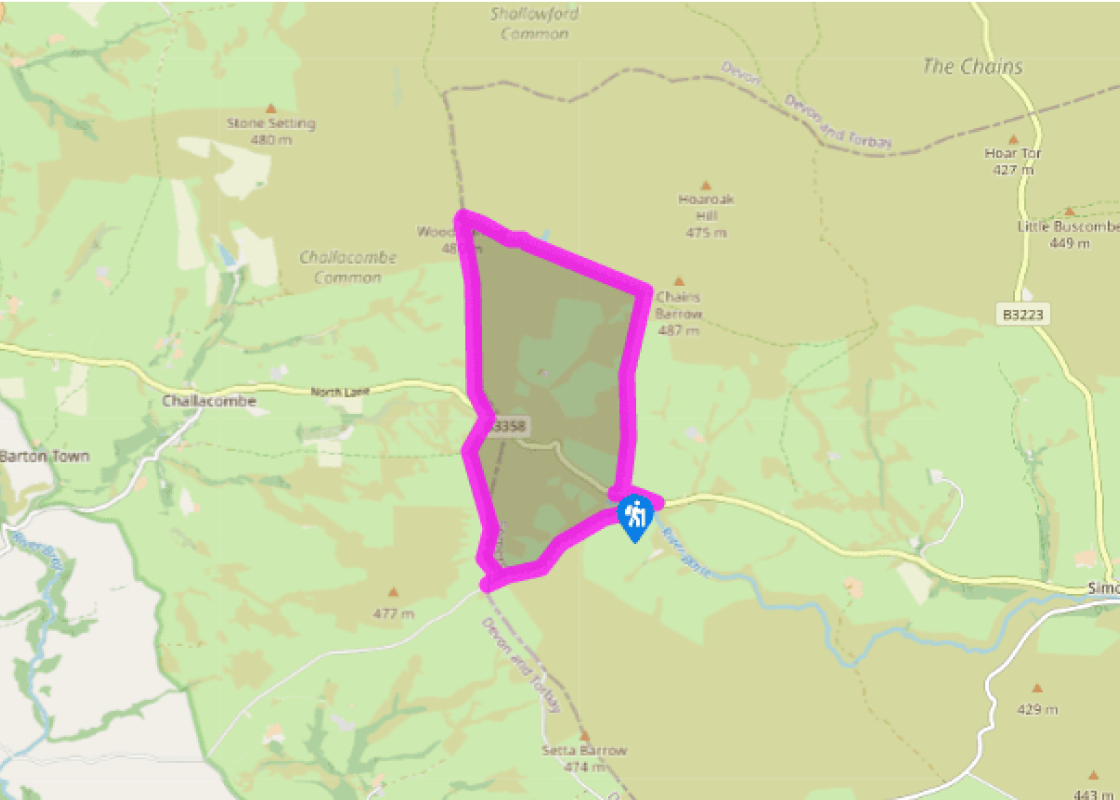
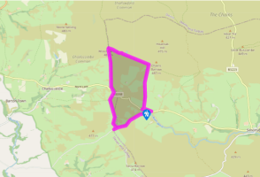
At the Simonsbath end of the pull-off is a gate with a bridleway sign for Chains Barrow. Go up the right-hand edges of two fields, then head 35yds (32m) left, to a gate. The way across the following rough moorland is marked by occasional blue-topped posts. Walk gently uphill, keeping parallel with a hedge away on the left. The marked way bends slightly right, up the crest of a wide moorland spur. At the top is a bank with a gateway.
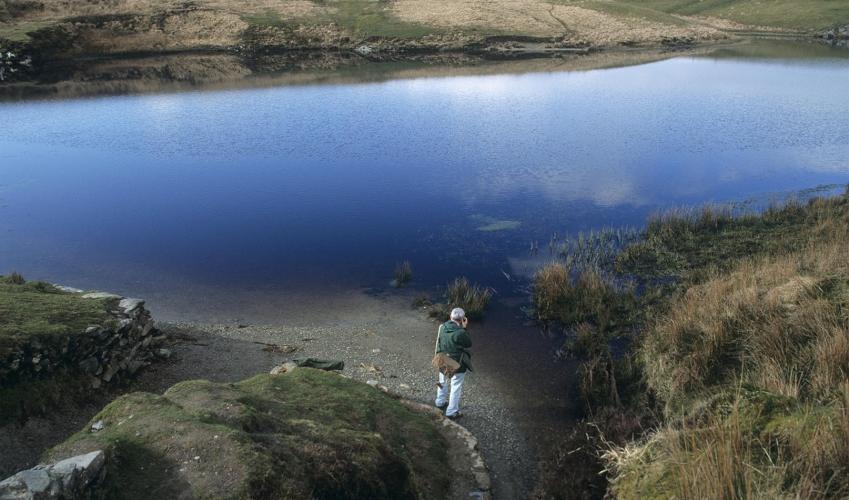
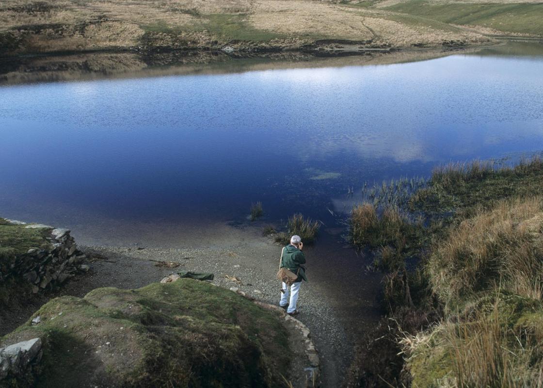
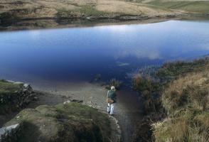
A signpost indicates a sketchy path out over the moor to Chains Barrow. Return to the gateway and follow the path ahead, signed 'Pinkery Pond' (there is some confusion here regarding Pinkery vs Pinkworthy), running along and above the fenced bank. It leads across the moor top to Pinkworthy Pond; this is crossed on its dam.
Follow the fence as it continues uphill to a gate with a blue spot. Maintain your direction across moorland for 350yds (320m) to join a high bank and fence from the right, and follow this to Wood Barrow.
The gate ahead leads into Devon. Beyond, Wood Barrow is one of many put to more conventional use, originally by the Saxons, as markers of the Devon boundary. In front of Woodbarrow Gate turn left on a signed bridleway track, with a high bank on its right. This leads off the moor. Bear left around a sheep-pen made of disused metal crash barriers. A gate leads on to the B3358.
Cross the B3358 into a track signposted 'Mole's Chamber'. This climbs for 0.25 miles (400m) to a signpost. Here you must bear left, keeping to the left of a fence, for 550yds (503m). A junction of high banks soon comes into sight: take the gate ahead and go downhill to the left of the high bank beyond. Go straight downhill to the right-hand of two narrow gates, with a stream and the start of a track beyond. Follow this up and to the right, to just before the corner of a tarred road. A faintly inscribed boundary marker, the Sloley Stone, is just above the track.
Turn down sharp left, away from the road. A faint old track runs down across a stream to a narrow gate with a blue paint spot. An improving path runs down to the right of the stream, gradually slanting up to a gate. Here join a larger track, and immediately after the gate keep ahead, slanting slightly downhill. A faint green track runs parallel with the river down on the left, to a signposted gate. Turn left on a concrete track, to join the B3358. Turn left to the parking pull-off.
Chains Barrow is the highest point on the waterlogged Exmoor plateau of purple moor grass and deer sedge. Other walks hereabouts are Exmoor more or less; this one is Exmoor pure and simple. It has views out to the sea and to the sheltered lands below. It's a walk for a sunny day with skylarks, or... for a chill one in autumn. In cloud and rain, with the bog at full squelch, you absorb a lot of atmosphere (and quite a bit of the rain), though this may not be everyone's idea of fun. Bronze Age Exmoor In about 2000 BC the hunter-gatherer lifestyle of the Stone Age came to an end on Exmoor. In the Bronze Age that followed we find traces of agriculture, with crops, such as barley, and livestock (mostly cattle and sheep). We also find the round barrows, for example, Chains Barrow and Longstone Barrow, scattered across the moorland summits. Elsewhere in Somerset the standing stones are of the Bronze Age – charred wood accidentally buried under the stones can be carbon-dated. More doubtfully, Tarr Steps in the south of Exmoor are also credited to the Bronze-Age people. It used to be thought that the change from the Stone Age to the Bronze Age came about by conquest: better swords and axes allowed the new people to kill or enslave the old. Today, tree pollen preserved in peat bogs can be dated very accurately, and shows that the clearance of the moors for farming was a gradual process. The scratch-plough was perhaps more important than the sword: experts believe that it was the idea of sitting still and starting a farm that conquered, rather than a particular tribe. The climate was warmer and drier in those days, and the moorland was grass rather than peat. Large areas will have been hedged and banked for pasture: on Dartmoor, 25,000 acres (10,000ha) of Bronze Age-enclosures have been mapped out. High society The shepherds belonged to a wider social unit than the family or farmstead. At least some of the people in charge had enough importance to build up a substantial collections of 50 or 60 axe heads, implying that the Bronze Age farmers weren't entirely peaceful people. Someone else had enough spare time to build the long barrows and raise the standing stones, and there were jewellers working in jadeite and bronze. It isn't known why Bronze Age people chose to build their barrows here on the bleakest of hilltops. Perhaps they were scared of the spirits of the dead and wanted to keep them out of the way, or perhaps a really large, conspicuous barrow would intimidate the people on the next hill.
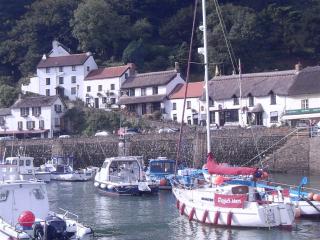
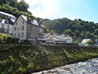
Somerset remains rural and unspoiled, and ever popular areas to visit are the limestone and red sandstone Mendip Hills rising to over 1,000 feet, and by complete contrast, to the south and southwest, the flat landscape of the Somerset Levels. Another popular spot, the Quantocks, once the haunt of poets Coleridge and Wordsworth, are noted for their gentle slopes, heather-covered moorland expanses and red deer.
"Experience quintessential Exmoor among the barrows and tumuli of its Bronze Age farmers."
Walk details
3hrs
Difficulty:
Hard
Gradient:
Moderate
Distance:
5.75 miles (9.2kms)
Ascent:
700ft (213m)
Walk directions
At the Simonsbath end of the pull-off is a gate with a bridleway sign for Chains Barrow. Go up the right-hand edges of two fields, then head 35yds (32m) left, to a gate. The way across the following rough moorland is marked by occasional blue-topped posts. Walk gently uphill, keeping parallel with a hedge away on the left. The marked way bends slightly right, up the crest of a wide moorland spur. At the top is a bank with a gateway.
1 of 6
A signpost indicates a sketchy path out over the moor to Chains Barrow. Return to the gateway and follow the path ahead, signed 'Pinkery Pond' (there is some confusion here regarding Pinkery vs Pinkworthy), running along and above the fenced bank. It leads across the moor top to Pinkworthy Pond; this is crossed on its dam.
2 of 6
Follow the fence as it continues uphill to a gate with a blue spot. Maintain your direction across moorland for 350yds (320m) to join a high bank and fence from the right, and follow this to Wood Barrow.
3 of 6
The gate ahead leads into Devon. Beyond, Wood Barrow is one of many put to more conventional use, originally by the Saxons, as markers of the Devon boundary. In front of Woodbarrow Gate turn left on a signed bridleway track, with a high bank on its right. This leads off the moor. Bear left around a sheep-pen made of disused metal crash barriers. A gate leads on to the B3358.
4 of 6
Cross the B3358 into a track signposted 'Mole's Chamber'. This climbs for 0.25 miles (400m) to a signpost. Here you must bear left, keeping to the left of a fence, for 550yds (503m). A junction of high banks soon comes into sight: take the gate ahead and go downhill to the left of the high bank beyond. Go straight downhill to the right-hand of two narrow gates, with a stream and the start of a track beyond. Follow this up and to the right, to just before the corner of a tarred road. A faintly inscribed boundary marker, the Sloley Stone, is just above the track.
5 of 6
Turn down sharp left, away from the road. A faint old track runs down across a stream to a narrow gate with a blue paint spot. An improving path runs down to the right of the stream, gradually slanting up to a gate. Here join a larger track, and immediately after the gate keep ahead, slanting slightly downhill. A faint green track runs parallel with the river down on the left, to a signposted gate. Turn left on a concrete track, to join the B3358. Turn left to the parking pull-off.
Chains Barrow is the highest point on the waterlogged Exmoor plateau of purple moor grass and deer sedge. Other walks hereabouts are Exmoor more or less; this one is Exmoor pure and simple. It has views out to the sea and to the sheltered lands below. It's a walk for a sunny day with skylarks, or... for a chill one in autumn. In cloud and rain, with the bog at full squelch, you absorb a lot of atmosphere (and quite a bit of the rain), though this may not be everyone's idea of fun. Bronze Age Exmoor In about 2000 BC the hunter-gatherer lifestyle of the Stone Age came to an end on Exmoor. In the Bronze Age that followed we find traces of agriculture, with crops, such as barley, and livestock (mostly cattle and sheep). We also find the round barrows, for example, Chains Barrow and Longstone Barrow, scattered across the moorland summits. Elsewhere in Somerset the standing stones are of the Bronze Age – charred wood accidentally buried under the stones can be carbon-dated. More doubtfully, Tarr Steps in the south of Exmoor are also credited to the Bronze-Age people. It used to be thought that the change from the Stone Age to the Bronze Age came about by conquest: better swords and axes allowed the new people to kill or enslave the old. Today, tree pollen preserved in peat bogs can be dated very accurately, and shows that the clearance of the moors for farming was a gradual process. The scratch-plough was perhaps more important than the sword: experts believe that it was the idea of sitting still and starting a farm that conquered, rather than a particular tribe. The climate was warmer and drier in those days, and the moorland was grass rather than peat. Large areas will have been hedged and banked for pasture: on Dartmoor, 25,000 acres (10,000ha) of Bronze Age-enclosures have been mapped out. High society The shepherds belonged to a wider social unit than the family or farmstead. At least some of the people in charge had enough importance to build up a substantial collections of 50 or 60 axe heads, implying that the Bronze Age farmers weren't entirely peaceful people. Someone else had enough spare time to build the long barrows and raise the standing stones, and there were jewellers working in jadeite and bronze. It isn't known why Bronze Age people chose to build their barrows here on the bleakest of hilltops. Perhaps they were scared of the spirits of the dead and wanted to keep them out of the way, or perhaps a really large, conspicuous barrow would intimidate the people on the next hill.
Somerset remains rural and unspoiled, and ever popular areas to visit are the limestone and red sandstone Mendip Hills rising to over 1,000 feet, and by complete contrast, to the south and southwest, the flat landscape of the Somerset Levels. Another popular spot, the Quantocks, once the haunt of poets Coleridge and Wordsworth, are noted for their gentle slopes, heather-covered moorland expanses and red deer.