AA Easy Read Atlas France 2027
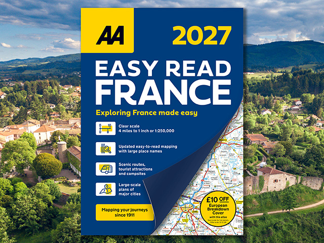
Clear mapping for your complete journey
The AA Easy Read Atlas France 2027 is your trusted travel companion for exploring France. Coverage includes road mapping for Corsica, terminal plans of Folkestone and Calais, a 2-page plan of central Paris, plus super-scale detailed plans of major, popular cities including Bordeaux, Lille, Lyon, Marseille, Nice, Strasbourg and Toulouse. An overview map of major routes enables quick and easy route planning, and travel rules and information is included for driving in France, Monaco and Andorra.
In addition to scenic routes, golf courses and campsites, toll and toll-free motorways, steep gradients, winter road closures and places of interest are highlighted, ensuring you can plan your route. Produced by expert European cartographers MairDumont, the detailed mapping is perfect for every trip.
ISBN: 978-0-7495-8458-0
Publication date: 9 April 2026
Pages: 240pp
Dimensions: 350 x 250mm (Spiral)