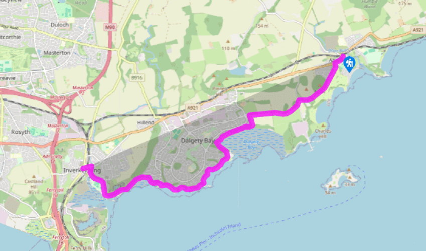
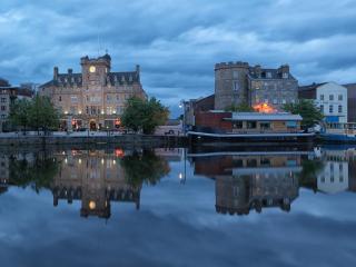
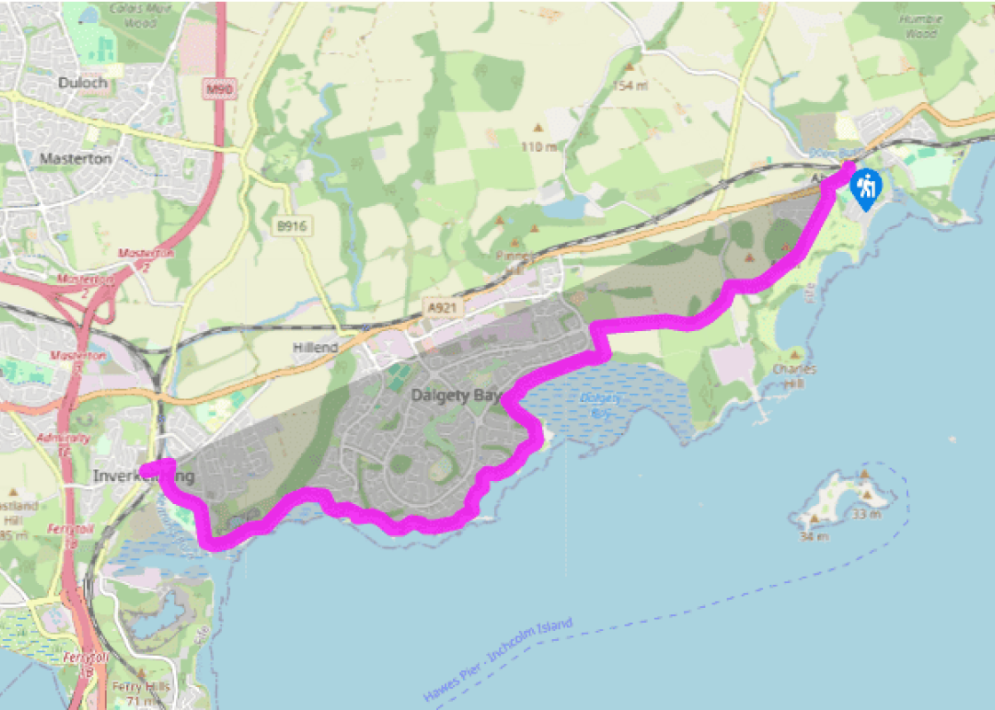
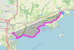
From Aberdour to Dalgety Bay, which is a 3-mile (5km) walk, the coast is largely out of reach, due to rocks, a golf course, and the Braefoot Bay oil terminal. From the station follow the main road round a double bend and turn left through a handsome gateway. The road, soon a cycle path, is the original driveway leading in about a mile (1.6km) to St Colme House. The house, built in 1835 for the Commissioner of the Moray Estates, is now apartments.
Past the woodlands around the house, turn down left to a subway under the road serving the oil terminal, to turn left on another tarmac bike path. In a further 300yds (275m), earth steps down to the left could take you between fields to another minor road nearer the sea; but the waymarked path keeps ahead along the cycle track to the edge of Dalgety Bay town. Here turn left, down to the shore at St Bridget’s Kirk, dating from the 13th century.
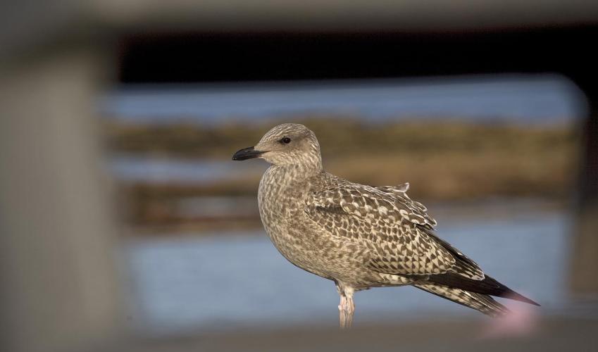
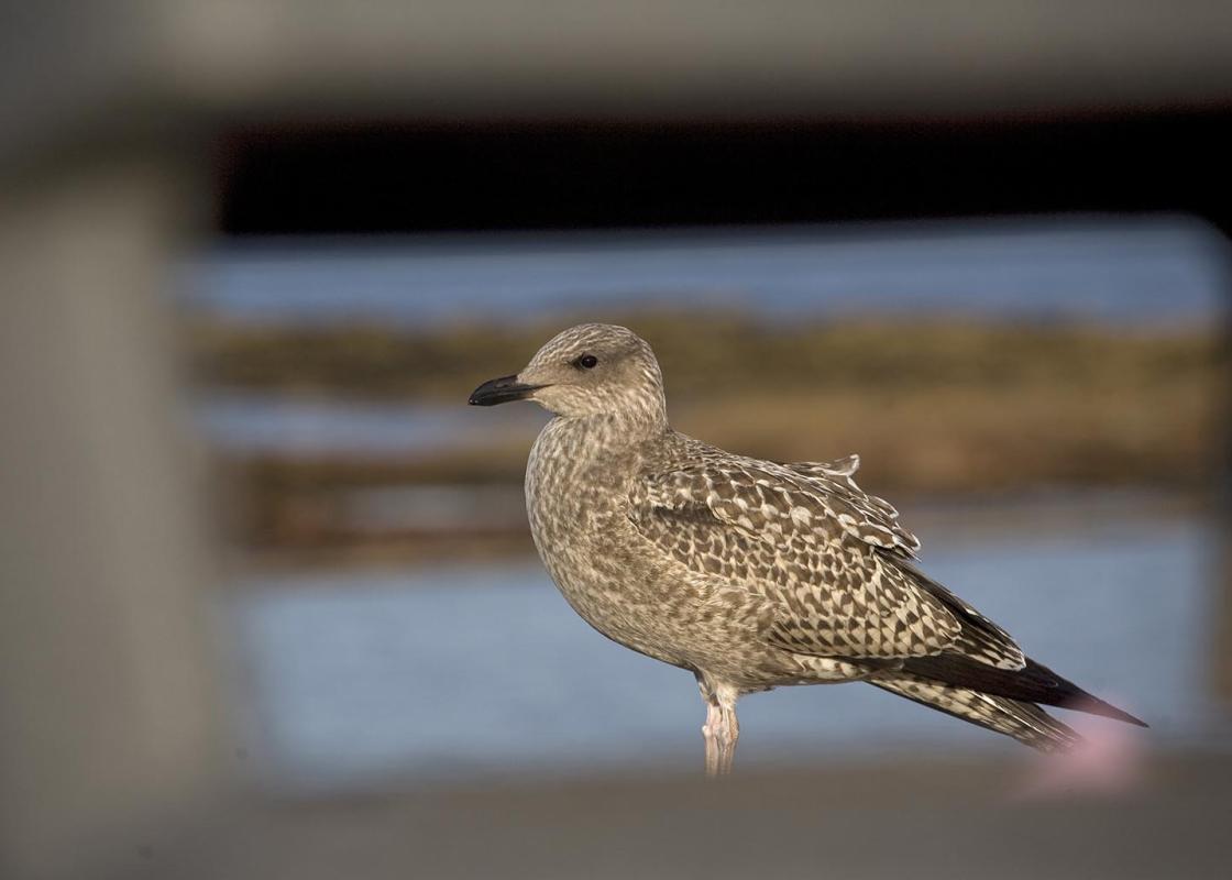
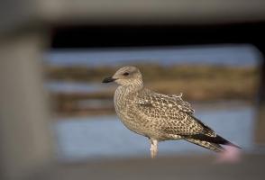
From the kirk, continue along the shore path around the bay from which the town takes its name – regrettably, this foreshore is polluted with radioactivity, from the luminous dials of RAF planes dumped offshore at the end of World War II. Offshore, seals may be spotted and there is a good variety of birdlife.
At the corner of the bay the path turns left through Ross Plantation. It runs into a housing estate, with the street ahead leading back to the shore of Donibristle Bay. The Coast Path now follows streets and sections of path alongside the sea, to pass Donibristle House. Its central section was destroyed by fire in 1858, but the superb wrought-iron gateway still stands, said to have been a gift from William of Orange to the Earl of Moray, whose home this was.
The path continues, to cross the base of Downing Point through a small wood, and then pass a little above Hopewood Point, to reach St David’s Bay: once a busy port exporting coal from mines at Fordell, just inland.
Here you pick up a tarmac cycle path. Seafield House, built in the mid-19th century for the Fordell Estate manager, is passed, and then a large boundary cairn.
The Forth Bridges are visible and the end of the walk is near. Go through the former Prestonhill Quarry, which produced greenstone, and swing right, into Inverkeithing. Keep ahead to cross a footbridge over an industrial railway. Keep ahead up Port Street to a junction, where you turn left up Townhall Street to the ancient Mercat Cross at the end of the town's High Street.
The gas terminal at Braefoot Bay is one sign of how the Forth is the communication highway between Scotland's heartland around Edinburgh and the world. But it's been that way for the best part of 1,000 years – back when the commercial life of the land was in the hardworking hands of monks. Canons... and Cannons Inchcolm, St Colm's island, dominates the sea view along this section of the Coast Path. 'Colm' is Columba, and Inchcolm is the eastern equivalent of Columba's foundation on Iona.Because of the abbey's island setting it has not been raided for its building stone, and it remains the best preserved in Scotland. However, the island's strategic position meant that, at various times, the Canons (administrative priests) were replaced by cannons. Fortifications on the island date from the Middle Ages to the Napoleonic Wars and right through to World War II. The Queen's Ferry Queensferry refers to Margaret, wife of King Malcom III. It was in his reign that a ferry crossing of the Forth was established for pilgrims to St Andrews. The ferry service ran continuously for the next 834 years. Its road slipways can still be seen at either side of the Firth. The First Forth Bridge The Forth Bridge is the magnificent railway bridge, opened in 1890, and in 2015 bidding for World Heritage status as 'a masterpiece of human creative genius'. Its trussed cantilever construction was bold and utterly novel. It's rumoured that one of the connecting sections between the great cantilevers was only secured at the third attempt, with two earlier ones dropped and still lying on the sea bed.As the single most striking artefact in the United Kingdom, the bridge appears on Scottish banknotes and is the setting of a science-fiction novel The Bridge by North Queensferry author Iain Banks. Painting the Forth Bridge has entered the English language as a proverbially unending task. The second and third Forth Bridges Just 75 years later, the Forth Road Bridge was equally novel and daring. The main cables are spun from 30,000 miles (nearly 50,000km) of steel wire – enough to reach right around the world. After 50 years, however, serious corrosion is starting to take place within those main cables. Its eastern footway, accessed by steps from North Queensferry, offers outstanding views of the Firth of Forth, the railway bridge, and the last stages of the Coast Path. (Children under 14 must be accompanied.) Return by train, or by the western footway overlooking the replacement Queensferry Crossing, whose piers started to rise from the water in 2014.
This 20-mile wide peninsula between the Firth of Forth and the Firth of Tay is an ancient kingdom, once the home of Scotland’s kings and saints. Despite its modern bridges it still seems curiously detached from the rest of the country.
From Aberdour to Dalgety Bay, which is a 3-mile (5km) walk, the coast is largely out of reach, due to rocks, a golf course, and the Braefoot Bay oil terminal. From the station follow the main road round a double bend and turn left through a handsome gateway. The road, soon a cycle path, is the original driveway leading in about a mile (1.6km) to St Colme House. The house, built in 1835 for the Commissioner of the Moray Estates, is now apartments.
1 of 5
Past the woodlands around the house, turn down left to a subway under the road serving the oil terminal, to turn left on another tarmac bike path. In a further 300yds (275m), earth steps down to the left could take you between fields to another minor road nearer the sea; but the waymarked path keeps ahead along the cycle track to the edge of Dalgety Bay town. Here turn left, down to the shore at St Bridget’s Kirk, dating from the 13th century.
2 of 5
From the kirk, continue along the shore path around the bay from which the town takes its name – regrettably, this foreshore is polluted with radioactivity, from the luminous dials of RAF planes dumped offshore at the end of World War II. Offshore, seals may be spotted and there is a good variety of birdlife.
At the corner of the bay the path turns left through Ross Plantation. It runs into a housing estate, with the street ahead leading back to the shore of Donibristle Bay. The Coast Path now follows streets and sections of path alongside the sea, to pass Donibristle House. Its central section was destroyed by fire in 1858, but the superb wrought-iron gateway still stands, said to have been a gift from William of Orange to the Earl of Moray, whose home this was.
3 of 5
The path continues, to cross the base of Downing Point through a small wood, and then pass a little above Hopewood Point, to reach St David’s Bay: once a busy port exporting coal from mines at Fordell, just inland.
4 of 5
Here you pick up a tarmac cycle path. Seafield House, built in the mid-19th century for the Fordell Estate manager, is passed, and then a large boundary cairn.
The Forth Bridges are visible and the end of the walk is near. Go through the former Prestonhill Quarry, which produced greenstone, and swing right, into Inverkeithing. Keep ahead to cross a footbridge over an industrial railway. Keep ahead up Port Street to a junction, where you turn left up Townhall Street to the ancient Mercat Cross at the end of the town's High Street.
The gas terminal at Braefoot Bay is one sign of how the Forth is the communication highway between Scotland's heartland around Edinburgh and the world. But it's been that way for the best part of 1,000 years – back when the commercial life of the land was in the hardworking hands of monks. Canons... and Cannons Inchcolm, St Colm's island, dominates the sea view along this section of the Coast Path. 'Colm' is Columba, and Inchcolm is the eastern equivalent of Columba's foundation on Iona.Because of the abbey's island setting it has not been raided for its building stone, and it remains the best preserved in Scotland. However, the island's strategic position meant that, at various times, the Canons (administrative priests) were replaced by cannons. Fortifications on the island date from the Middle Ages to the Napoleonic Wars and right through to World War II. The Queen's Ferry Queensferry refers to Margaret, wife of King Malcom III. It was in his reign that a ferry crossing of the Forth was established for pilgrims to St Andrews. The ferry service ran continuously for the next 834 years. Its road slipways can still be seen at either side of the Firth. The First Forth Bridge The Forth Bridge is the magnificent railway bridge, opened in 1890, and in 2015 bidding for World Heritage status as 'a masterpiece of human creative genius'. Its trussed cantilever construction was bold and utterly novel. It's rumoured that one of the connecting sections between the great cantilevers was only secured at the third attempt, with two earlier ones dropped and still lying on the sea bed.As the single most striking artefact in the United Kingdom, the bridge appears on Scottish banknotes and is the setting of a science-fiction novel The Bridge by North Queensferry author Iain Banks. Painting the Forth Bridge has entered the English language as a proverbially unending task. The second and third Forth Bridges Just 75 years later, the Forth Road Bridge was equally novel and daring. The main cables are spun from 30,000 miles (nearly 50,000km) of steel wire – enough to reach right around the world. After 50 years, however, serious corrosion is starting to take place within those main cables. Its eastern footway, accessed by steps from North Queensferry, offers outstanding views of the Firth of Forth, the railway bridge, and the last stages of the Coast Path. (Children under 14 must be accompanied.) Return by train, or by the western footway overlooking the replacement Queensferry Crossing, whose piers started to rise from the water in 2014.
This 20-mile wide peninsula between the Firth of Forth and the Firth of Tay is an ancient kingdom, once the home of Scotland’s kings and saints. Despite its modern bridges it still seems curiously detached from the rest of the country.