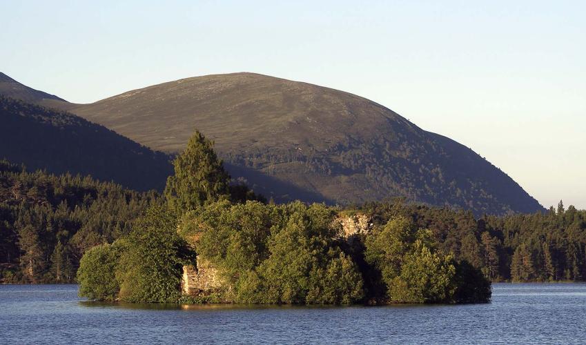
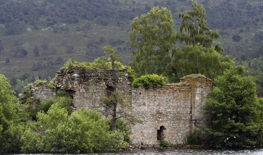
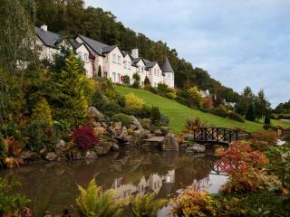
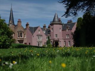
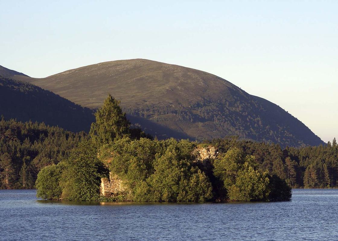
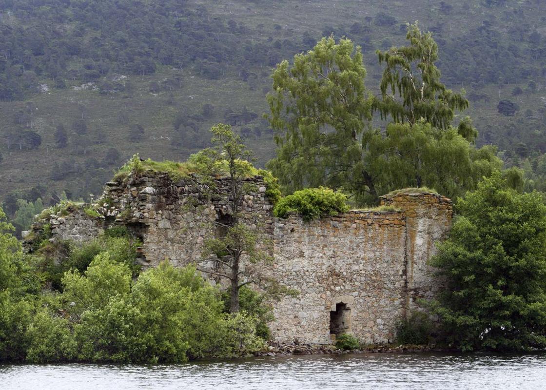
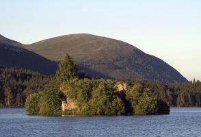
"The castle on the island in the loch is the heart of the Rothiemurchus Forest."
Walk directions
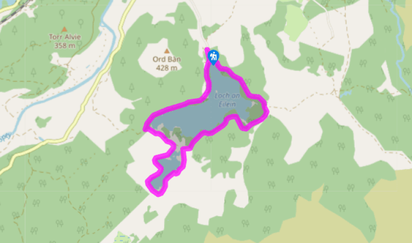
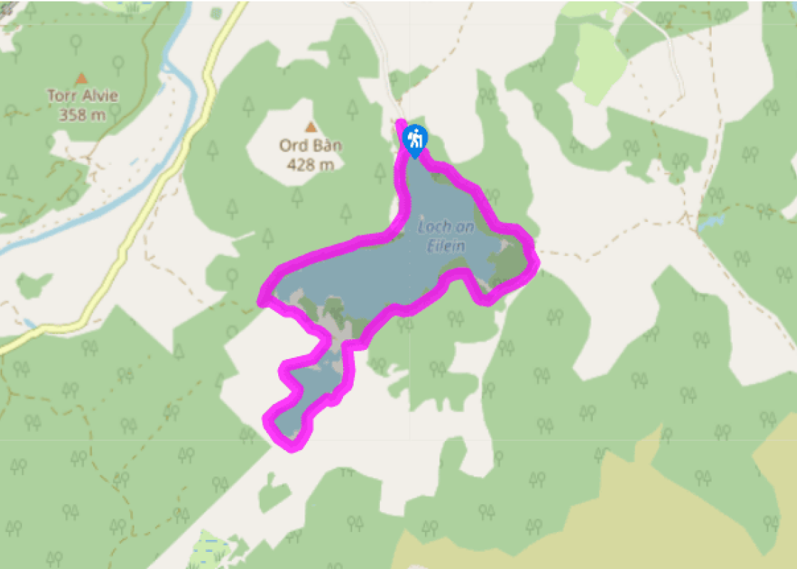
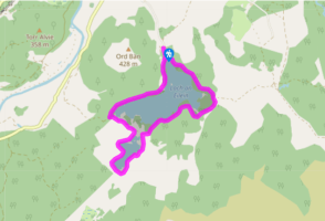
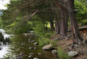
From the end of the car park at the beginning of the walk, a made-up path leads to the visitor centre. Turn left to cross the end of Loch an Eilein, then turn right on a smooth sandy track. The loch shore is nearby on the right. There are small paths leading down to it if you wish to visit. Just past a red-roofed house, a deer fence runs across, with a gate.
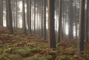
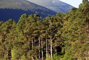
The track now becomes a wide, smooth path, which runs close to the loch side. After a bridge, the main track keeps ahead through a gate to pass a bench backed by a flat boulder. (The smaller path on the left leads high into the hills and through the famous pass of the Lairig Ghru, eventually to Braemar.) The wide path winds through the pinewood, with the lake always nearby on the right. After crossing a stream at a low wooden footbridge, the path bends right for 120yds (110m) to a junction. Just beyond you'll find a footbridge with wooden handrails.
To shorten the walk, cross this footbridge and continue along the main track, passing Point 4 in another 170yds (155m). For a longer walk, turn left before the footbridge on to a narrower path (marked 'path not maintained') that will pass around Loch Gamhna. This second loch soon appears on your right-hand side. Where the path forks, keep right to pass along the loch side, across its head (rather boggy) and back along its further side, to rejoin the wider path around Loch an Eilein. Turn left here.
Continue around Loch an Eilein, with the water on your right, to a reedy corner of the loch and a bench. About 55yds (50m) further, the path turns sharply right, signed 'path'. Just after a gate, turn right to the loch side and a memorial to Major General Brook Rice who drowned here while skating. Follow the shore to the point opposite the castle, then back up to the wide track above. A deer fence on the left leads back to the visitor centre.
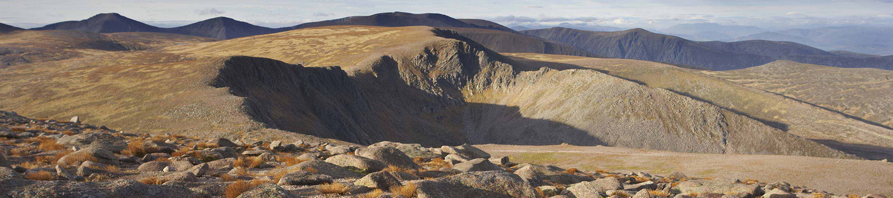
From here, a stiff climb (500ft/152m) can be made on to the rocky little hill of Ord Ban, a superb viewpoint. Go through a heavy gate immediately to the right of the toilet block and follow the deer fence to the right for 150yds (137m), to a point behind the car park. Just behind one of the lowest birches on the slope, a small indistinct path zig-zags up the steep slope. It slants to the left to avoid crags, then crosses a small rock slab (take care if wet) and continues to the summit. Descend by the same path.
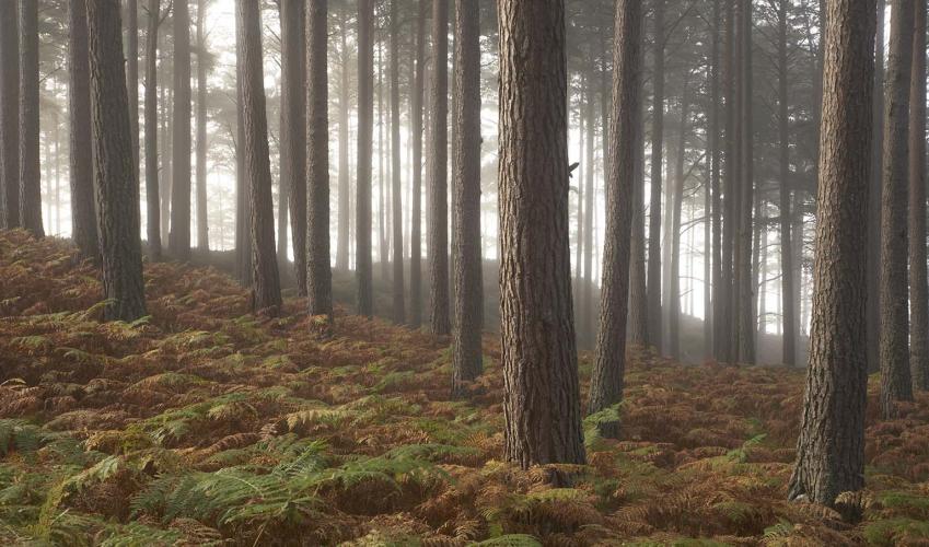
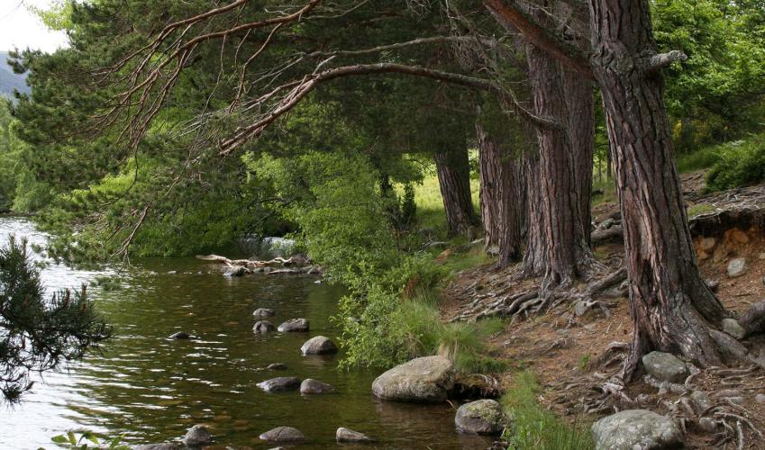
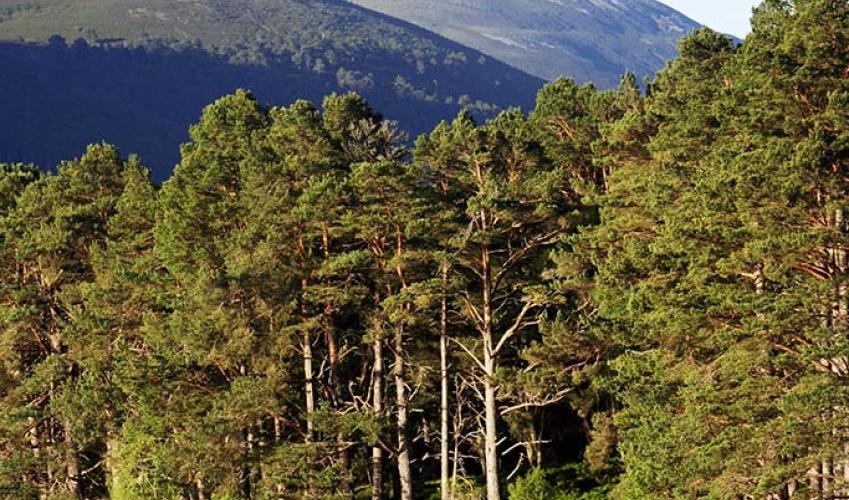
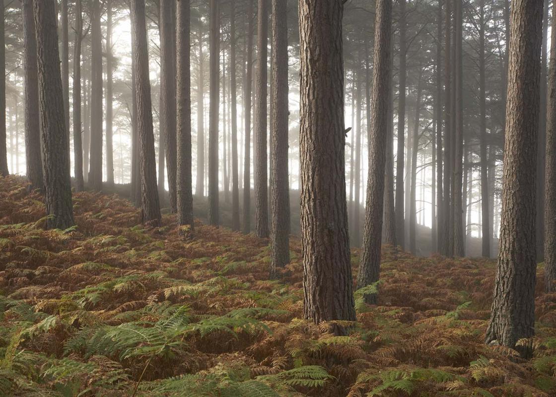
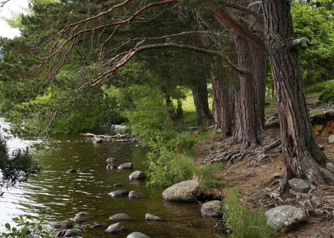
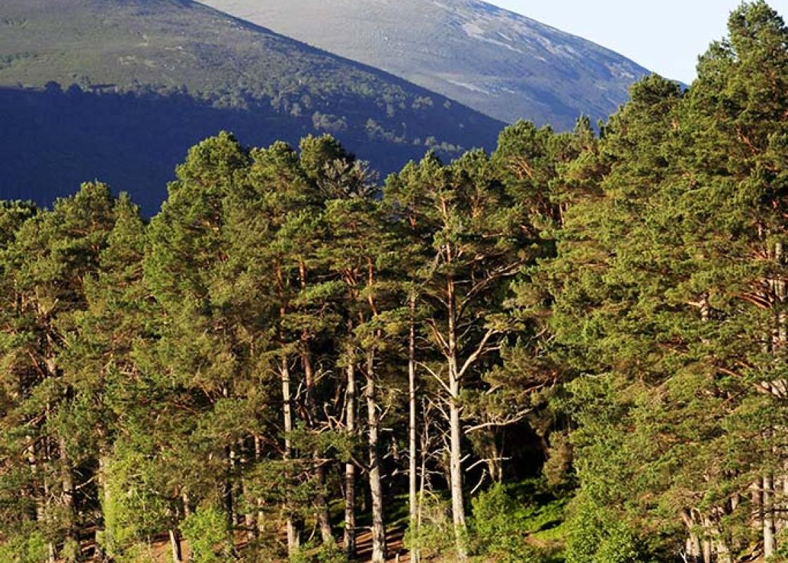
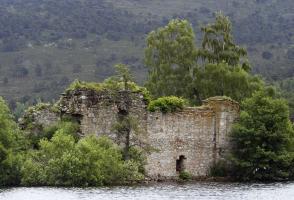
An island castle, surrounded by ancient pines, and the mountains rising behind – you hardly have to bother with the rest of Scotland, Loch an Eilein has it all. Castle for cattle thieves Loch an Eilein Castle was built by John Comyn II, known as the Red Comyn, in the 13th century. It guards the... strategic cattle-stealing route which runs along the shore of the loch. Locals used to keep a cow tied to a tree in the hope that the raiders would take that and leave the rest alone. The three murderers of a Macintosh chieftain were imprisoned in chains here for seven years, before being executed in 1531. The castle was most recently fought over in 1690, when Grizzel Mhor (Big Grizelda), the chieftain's wife, held it for Clan Grant against the king. There is said to be an underwater zig-zag causeway leading out to the island. Life in the pines Walk quietly with binoculars and you may see some of the unique birdlife of the forest. The crested tit resembles the more familiar coal tit, with brown body and striped head, but its crest has a Mohican hair-style effect. It nests in holes in old, rotten trees, so will only be found in wild forest. The Scottish crossbill, found only in Scotland, has a parrot-like beak, adapted for cracking open pine cones. The capercaillie is the large grouse of the forest and its name means 'horse of the woods'. The male challenges and intimidates other males with a noise like the clip-clop of hooves, or like a wine-bottle being opened. Your only real chance of seeing it in the wild is at dawn, in spring, at the RSPB reserve at Loch Garten (better known for its ospreys). Osprey island Ospreys used to nest in the castle ruins. An egg collector once swam across wearing nothing but his cap, which he used to bring back his plunder. Ospreys are back in the Cairngorms, and though they won't return to this over-public island, you might see them elsewhere, plunging feet-first as they strike for a trout. Try the trout farm at Inverdruie, on the edge of Aviemore. Sadly, the egg-collectors are back as well. In 2000, a man in Leicester was caught with three stolen osprey eggs. Romantic setting In the romantic novel The Key above the Door by Maurice Walsh (1926), the hero and heroine spend half the book gazing at each other from cottages on opposite sides of Loch an Eilein before accidentally getting shipwrecked on the island. More recently, Archie and Katrina, from the popular TV series Monarch of the Glen, enjoyed their own romantic encounter on the island.
Apart from the Orkneys and the Shetlands, Highland is Scotland’s northernmost county. Probably its most famous feature is the mysterious and evocative Loch Ness, allegedly home to an ancient monster that has embedded itself in the world’s modern mythology, and the region’s tourist industry.
"The castle on the island in the loch is the heart of the Rothiemurchus Forest."
Walk details
1hr 45min
Difficulty:
Medium
Gradient:
Moderate
Distance:
4.5 miles (7.2kms)
Ascent:
100ft (30m)
Walk directions
From the end of the car park at the beginning of the walk, a made-up path leads to the visitor centre. Turn left to cross the end of Loch an Eilein, then turn right on a smooth sandy track. The loch shore is nearby on the right. There are small paths leading down to it if you wish to visit. Just past a red-roofed house, a deer fence runs across, with a gate.
1 of 5
The track now becomes a wide, smooth path, which runs close to the loch side. After a bridge, the main track keeps ahead through a gate to pass a bench backed by a flat boulder. (The smaller path on the left leads high into the hills and through the famous pass of the Lairig Ghru, eventually to Braemar.) The wide path winds through the pinewood, with the lake always nearby on the right. After crossing a stream at a low wooden footbridge, the path bends right for 120yds (110m) to a junction. Just beyond you'll find a footbridge with wooden handrails.
2 of 5
To shorten the walk, cross this footbridge and continue along the main track, passing Point 4 in another 170yds (155m). For a longer walk, turn left before the footbridge on to a narrower path (marked 'path not maintained') that will pass around Loch Gamhna. This second loch soon appears on your right-hand side. Where the path forks, keep right to pass along the loch side, across its head (rather boggy) and back along its further side, to rejoin the wider path around Loch an Eilein. Turn left here.
3 of 5
Continue around Loch an Eilein, with the water on your right, to a reedy corner of the loch and a bench. About 55yds (50m) further, the path turns sharply right, signed 'path'. Just after a gate, turn right to the loch side and a memorial to Major General Brook Rice who drowned here while skating. Follow the shore to the point opposite the castle, then back up to the wide track above. A deer fence on the left leads back to the visitor centre.
4 of 5
From here, a stiff climb (500ft/152m) can be made on to the rocky little hill of Ord Ban, a superb viewpoint. Go through a heavy gate immediately to the right of the toilet block and follow the deer fence to the right for 150yds (137m), to a point behind the car park. Just behind one of the lowest birches on the slope, a small indistinct path zig-zags up the steep slope. It slants to the left to avoid crags, then crosses a small rock slab (take care if wet) and continues to the summit. Descend by the same path.
An island castle, surrounded by ancient pines, and the mountains rising behind – you hardly have to bother with the rest of Scotland, Loch an Eilein has it all. Castle for cattle thieves Loch an Eilein Castle was built by John Comyn II, known as the Red Comyn, in the 13th century. It guards the... strategic cattle-stealing route which runs along the shore of the loch. Locals used to keep a cow tied to a tree in the hope that the raiders would take that and leave the rest alone. The three murderers of a Macintosh chieftain were imprisoned in chains here for seven years, before being executed in 1531. The castle was most recently fought over in 1690, when Grizzel Mhor (Big Grizelda), the chieftain's wife, held it for Clan Grant against the king. There is said to be an underwater zig-zag causeway leading out to the island. Life in the pines Walk quietly with binoculars and you may see some of the unique birdlife of the forest. The crested tit resembles the more familiar coal tit, with brown body and striped head, but its crest has a Mohican hair-style effect. It nests in holes in old, rotten trees, so will only be found in wild forest. The Scottish crossbill, found only in Scotland, has a parrot-like beak, adapted for cracking open pine cones. The capercaillie is the large grouse of the forest and its name means 'horse of the woods'. The male challenges and intimidates other males with a noise like the clip-clop of hooves, or like a wine-bottle being opened. Your only real chance of seeing it in the wild is at dawn, in spring, at the RSPB reserve at Loch Garten (better known for its ospreys). Osprey island Ospreys used to nest in the castle ruins. An egg collector once swam across wearing nothing but his cap, which he used to bring back his plunder. Ospreys are back in the Cairngorms, and though they won't return to this over-public island, you might see them elsewhere, plunging feet-first as they strike for a trout. Try the trout farm at Inverdruie, on the edge of Aviemore. Sadly, the egg-collectors are back as well. In 2000, a man in Leicester was caught with three stolen osprey eggs. Romantic setting In the romantic novel The Key above the Door by Maurice Walsh (1926), the hero and heroine spend half the book gazing at each other from cottages on opposite sides of Loch an Eilein before accidentally getting shipwrecked on the island. More recently, Archie and Katrina, from the popular TV series Monarch of the Glen, enjoyed their own romantic encounter on the island.
Apart from the Orkneys and the Shetlands, Highland is Scotland’s northernmost county. Probably its most famous feature is the mysterious and evocative Loch Ness, allegedly home to an ancient monster that has embedded itself in the world’s modern mythology, and the region’s tourist industry.