"Discover the creeks of Newtown Estuary and the history of the Island’s former capital."
Walk directions
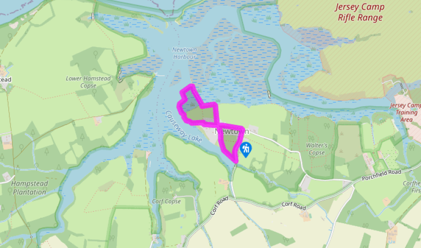
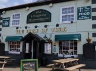
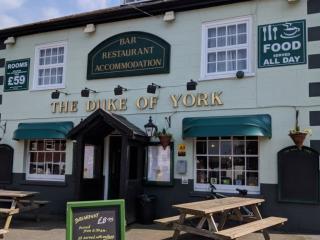
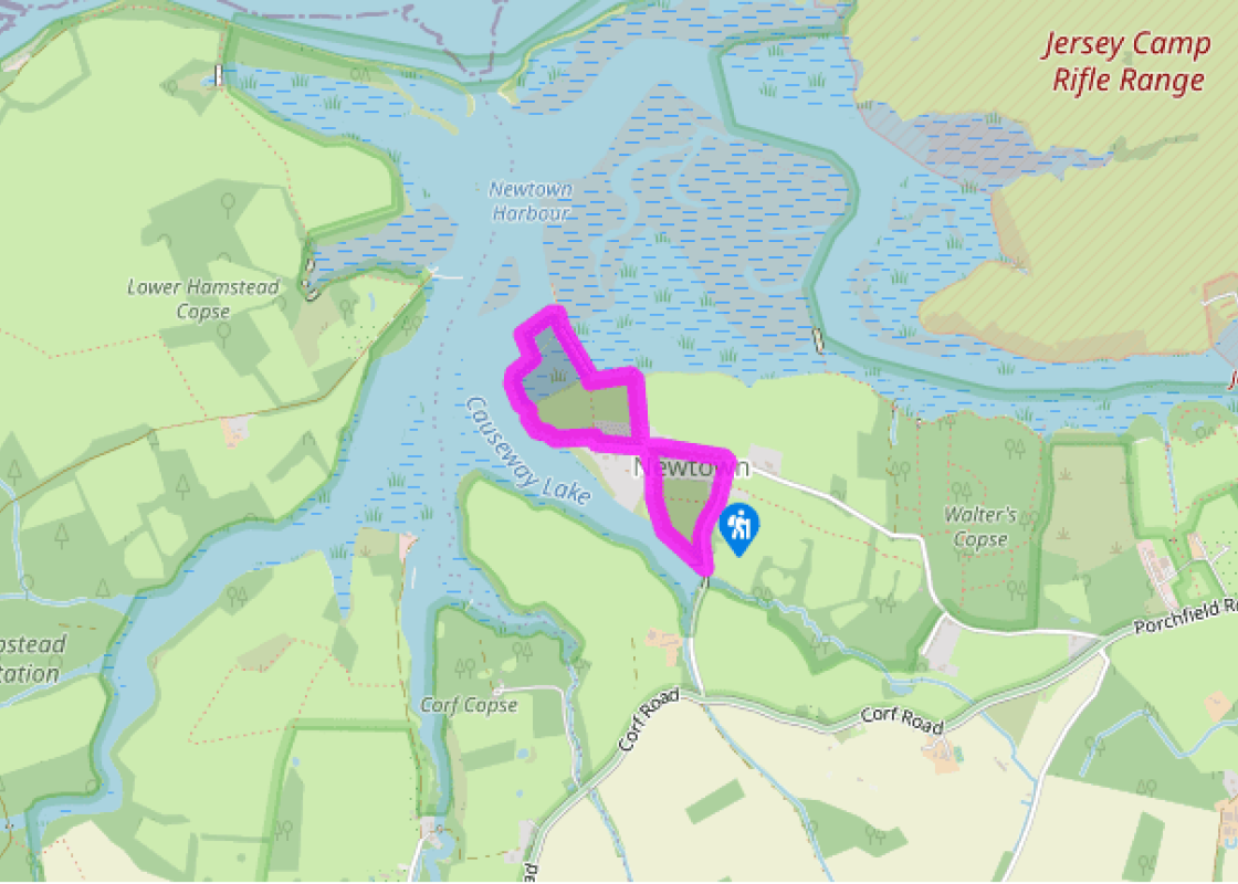
Turn right out of the car park and walk down Town Lane almost to the bridge at the head of Causeway Lake.
Turn right onto footpath Cb16a towards Newtown village and walk along the edge of the tidal creek to a gate. Go through and continue along the lower edge of Hay Meadow. In the second field, keep to the path as it bears up right to a gate to join a tree-lined path leading into Newtown.
Keep ahead past the church (to your right) and follow the lane left to pass a parking area. Take the path beside the Old Coastguard Station and beyond the gate keep to the left-hand edge of the meadow to reach a gate. Now follow the raised path alongside the estuary to the boatshed at Newtown Quay.
Head inland across the narrow wooden boardwalk to a gate. Go through, and in a few paces turn left and follow the footpath towards the bird hide. Turn right at the gate and head inland to a drive and the lane.
Turn left, cross the stile on your left and proceed through a long, narrow field behind the houses to a stile and lane. (A sign warns of bulls in this field – if there is one, follow the road past the church instead.) Turn right and walk down the lane to the Old Town Hall and the car park where you began your walk.
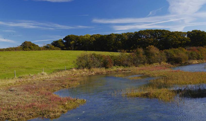
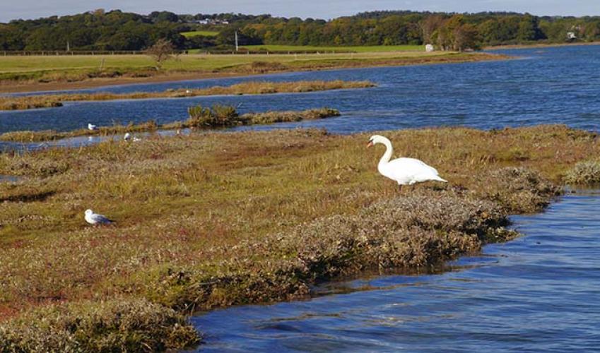
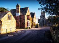
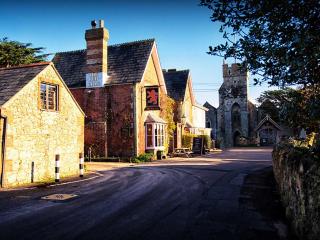
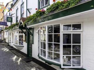
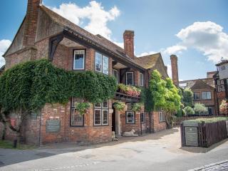
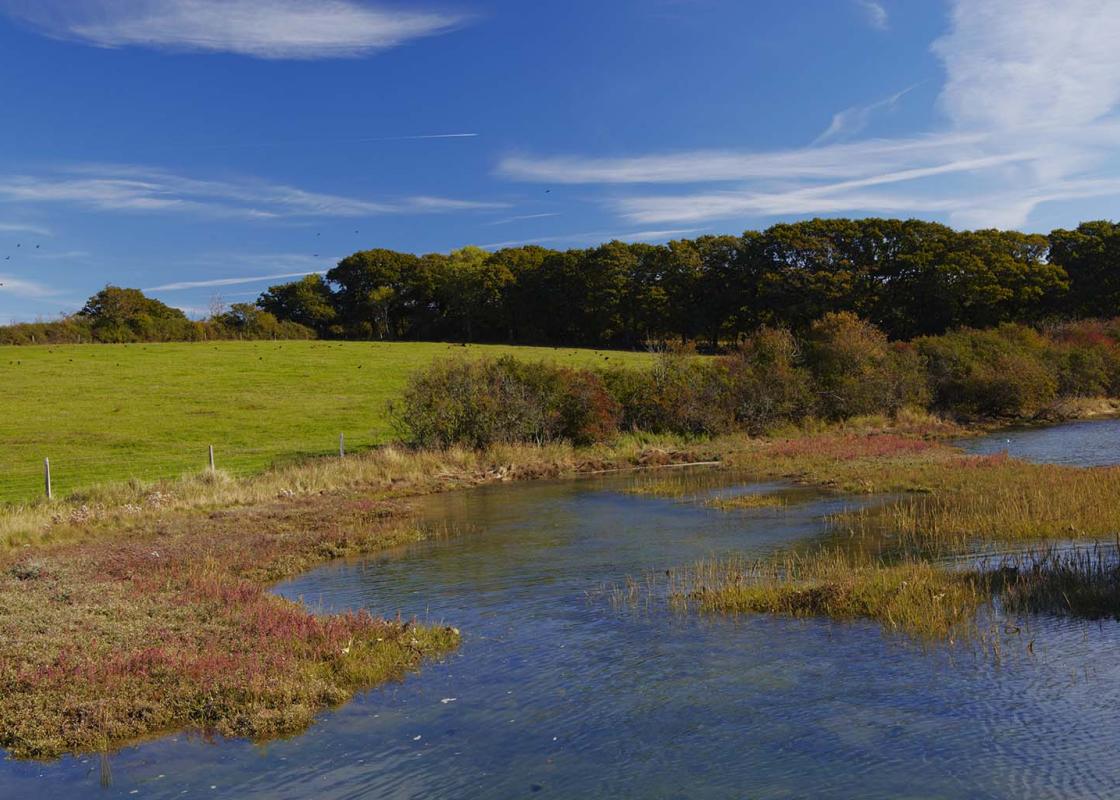
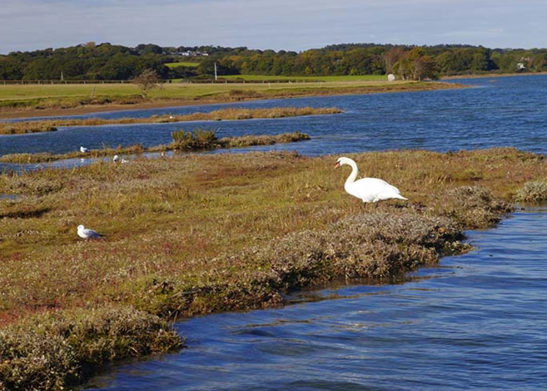
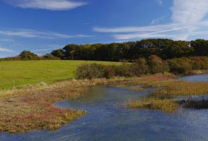
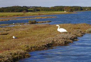
The most ancient of the Island’s boroughs, Newtown was once known as Francheville and was the Island’s capital after it was laid out by the Bishop of Winchester in 1256. It soon developed into a major seaport on the Newtown River estuary, with great sailing ships dwarfing its bustling quays and a... thriving trade in local salt and oysters. Its streets were designed on a grid system and their names recall the medieval merchants and craftsmen – Gold Street, Drapers Alley – although most are now only grassy lanes. Everything changed in 1377 when the town was burned down by a combined French and Spanish raid. It was never fully rebuilt but the ‘town’ continued to return two MPs until the Reform Act of 1832. The Old Town Hall, a 17th-century building, stands as a monument to Newtown’s past eminence. It houses an exhibition about the Ferguson’s Gang, a masked group of anonymous National Trust supporters that was formed in the late 1920s. With pseudonyms like Red Biddy, Bill Stickers and The Bishop, the gang bought the dilapidated Town Hall for £5 and presented it to the Trust in 1933, later raising £1,000 to restore the building. Wildlife haven Today, Newtown, which has no through traffic, is a tranquil place and best explored on foot. You can wander along the network of footpaths through the old streets and visit the beautifully restored Victorian church. Perhaps surprisingly, the windswept salt marshes and mudflats were only created in their present form as late as 1954, following a violent winter storm that breached the sea wall. The shallow creeks and estuary are a magical area and a paradise for both birds and the birders who come to admire the abundant wildfowl and waders. Oystercatchers and redshanks probe the mudflats for morsels, a variety of ducks dabble in the shallows, nesting gulls squabble on Gull Island and both common and little terns glide gracefully through the shimmering summer air. Flocks of geese wheel overhead in winter and everywhere you’ll hear the evocative bubbling call of the curlew. Friendly volunteers man the National Trust's hide – call in to find out what's out there.
Small and intimate – at just 23 miles by 13 miles, the Isle of Wight is a popular holiday destination; with its mild climate, long hours of sunshine and colourful architecture, it has something of a continental flavour. Visitors can walk along the island’s varied coastline using the well-established Coast Path or step back in time to explore the island’s history at some of the forts and castles.
"Discover the creeks of Newtown Estuary and the history of the Island’s former capital."
Walk details
45min
Difficulty:
Easy
Gradient:
Gentle
Distance:
1.5 miles (2.4kms)
Ascent:
49ft (15m)
Walk directions
Turn right out of the car park and walk down Town Lane almost to the bridge at the head of Causeway Lake.
1 of 5
Turn right onto footpath Cb16a towards Newtown village and walk along the edge of the tidal creek to a gate. Go through and continue along the lower edge of Hay Meadow. In the second field, keep to the path as it bears up right to a gate to join a tree-lined path leading into Newtown.
2 of 5
Keep ahead past the church (to your right) and follow the lane left to pass a parking area. Take the path beside the Old Coastguard Station and beyond the gate keep to the left-hand edge of the meadow to reach a gate. Now follow the raised path alongside the estuary to the boatshed at Newtown Quay.
3 of 5
Head inland across the narrow wooden boardwalk to a gate. Go through, and in a few paces turn left and follow the footpath towards the bird hide. Turn right at the gate and head inland to a drive and the lane.
4 of 5
Turn left, cross the stile on your left and proceed through a long, narrow field behind the houses to a stile and lane. (A sign warns of bulls in this field – if there is one, follow the road past the church instead.) Turn right and walk down the lane to the Old Town Hall and the car park where you began your walk.
The most ancient of the Island’s boroughs, Newtown was once known as Francheville and was the Island’s capital after it was laid out by the Bishop of Winchester in 1256. It soon developed into a major seaport on the Newtown River estuary, with great sailing ships dwarfing its bustling quays and a... thriving trade in local salt and oysters. Its streets were designed on a grid system and their names recall the medieval merchants and craftsmen – Gold Street, Drapers Alley – although most are now only grassy lanes. Everything changed in 1377 when the town was burned down by a combined French and Spanish raid. It was never fully rebuilt but the ‘town’ continued to return two MPs until the Reform Act of 1832. The Old Town Hall, a 17th-century building, stands as a monument to Newtown’s past eminence. It houses an exhibition about the Ferguson’s Gang, a masked group of anonymous National Trust supporters that was formed in the late 1920s. With pseudonyms like Red Biddy, Bill Stickers and The Bishop, the gang bought the dilapidated Town Hall for £5 and presented it to the Trust in 1933, later raising £1,000 to restore the building. Wildlife haven Today, Newtown, which has no through traffic, is a tranquil place and best explored on foot. You can wander along the network of footpaths through the old streets and visit the beautifully restored Victorian church. Perhaps surprisingly, the windswept salt marshes and mudflats were only created in their present form as late as 1954, following a violent winter storm that breached the sea wall. The shallow creeks and estuary are a magical area and a paradise for both birds and the birders who come to admire the abundant wildfowl and waders. Oystercatchers and redshanks probe the mudflats for morsels, a variety of ducks dabble in the shallows, nesting gulls squabble on Gull Island and both common and little terns glide gracefully through the shimmering summer air. Flocks of geese wheel overhead in winter and everywhere you’ll hear the evocative bubbling call of the curlew. Friendly volunteers man the National Trust's hide – call in to find out what's out there.
Small and intimate – at just 23 miles by 13 miles, the Isle of Wight is a popular holiday destination; with its mild climate, long hours of sunshine and colourful architecture, it has something of a continental flavour. Visitors can walk along the island’s varied coastline using the well-established Coast Path or step back in time to explore the island’s history at some of the forts and castles.