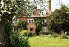
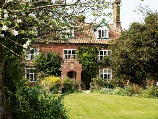
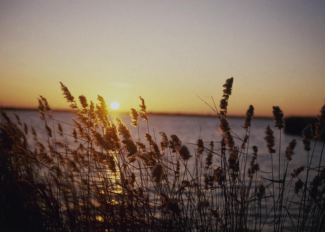
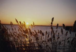
"Wander in the steps of diarist Parson Woodforde to five churches he knew and loved."
Walk directions
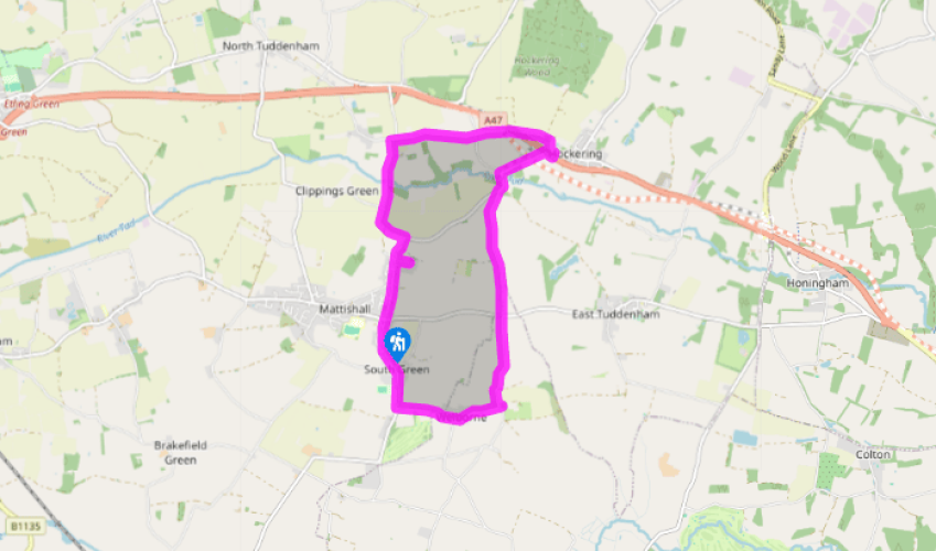
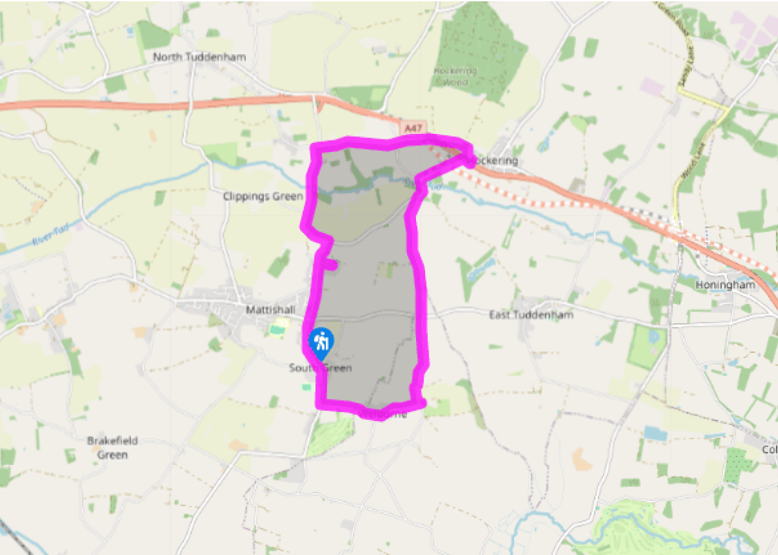
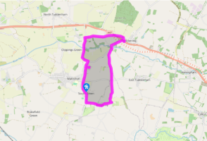
Leave the car park next to the circular village sign with four panels depicting aspects of Mattishall’s history, and walk around the charming 14th-century All Saints' Church. Cross Dereham Road and head for Burgh Lane opposite. Walk up this, past the cemetery and through a residential area until you see Church Lane on your right. Walk down the lane to reach Mattishall Burgh's St Peter's Church (originally Norman, with later additions).
Leave the church and retrace your steps to Burgh Lane. Turn right and continue walking until you reach a T-junction. Turn left, following the signs to North Tuddenham. The lane narrows, and winds down a hill to go over a bridge and up the other side. Keep going straight ahead until you reach an unpaved lane on your right after about 0.75 miles (1.2km).
Turn right and follow the track to charming 14th-century St Mary's Church, North Tuddenham. Retrace your steps to the paved lane, turn right and continue to another T-junction. Go right, along the lane signed to Hockering and Honingham. Stay on this lane past High Grove Farm and Two Acre Kennels, until you reach a crossroads.
Keep straight ahead along a narrow single-track lane, aiming for the battlemented tower of Hockering's St Michael's Church (early 1300s). Cross the A47 carefully, and aim for the lane opposite. There is a notice board outside the church giving details of the Eight Parishes Project and Parson Woodforde.
Walk through the churchyard and look for two brick buttresses. Opposite these is a gate. Go through this, and the field ahead to reach the lane. Turn left, then right and recross the A47, aiming for the lane opposite and to your right, called Mattishall Lane. Continue past a road that joins from the right to reach a bridge.
Cross over Whitford Bridge, and – ignoring a farm track to the left – keep left at the following junction called Blind Lane (not signed). Walk for about a mile (1.6km) until you reach a crossroads.
Go straight through the crossroads, walking down Church Lane until you reach Welborne. When you reach the junction, continue a few paces past the village hall to see All Saints' Church, which has a 12th-century round tower. Retrace your steps and turn left along Church Road, and then bear right at the next junction back towards Mattishall.
Turn right towards Mattishall at the end of Welborne Road, and keep walking until you reach Church Plain again.
In 1776 a 36-year-old parson arrived at the village of Weston Longville, northeast of Mattishall, and began to keep a diary. His name was James Woodforde and he continued to write his account of life in his parish, and other parishes to which he had occasion to visit, until his death in 1803. These... were turbulent times: the colonists were rebelling in North America, King George III suffered periodic bouts of insanity, the French Revolution was in full swing, Napoleon Bonaparte was moving across Europe and there were rebellions in Ireland. Yet none of these momentous events sully the pages of the country parson. Woodforde was more interested in his dinner and the activities of his parishioners than in world affairs. Inebriated pigs In 1778 France joined the colonies against the British and the philosopher Voltaire died, but Woodforde wrote about how his two pigs got into a beer barrel and became intoxicated to the point where they were unable to stand. The poor beasts apparently remained inebriated the whole night, not even flinching when Woodforde 'slit their ears' to assess whether they could feel anything. A veritable feast In 1780, the year that the American Revolution saw the British fighting in Charleston and that anti-Catholic riots took place in London, Woodforde's diary for 28 January reads: 'We had for dinner a calf's head, boiled fowl and tongue, a saddle of mutton roasted on the side table, and a fine swan roasted with currant jelly sauce for the first course. The second course a couple of wild fowl called dun fowls, larks, blancmange, tarts etc, etc and a good dessert of fruit after amongst which was a damson cheese.' He went on to comment that this was his first taste of swan, but that he did not consider it spoiled by the fact that it had been killed some three weeks previously. Perhaps this was due to the 'sweet sauce' that went with it. His diaries recount the daily happenings in the life of a comfortable 18th-century country parson who boasted a great many friends and a taste for good food. From Weston Longville, he visited all his neighbours in the parishes round about – Mattishall, North Tuddenham, East Tuddenham, Hockering, Honingham, Lyng and Elsing – and attended services in the churches you will see on this walk. Woodforde's accounts went undiscovered until 1924, when they were published. The parishes that he knew have joined together to design the Eight Parishes Circular Walk, moving in the footsteps of the jolly parson as he ate and drank his way around the region. You will walk along part of the route on this delightful stroll as you visit this unspoiled part of Norfolk.
The North Norfolk Coast is designated an Area of Outstanding Natural Beauty and probably the finest of its kind in Europe. Here you’ll find a string of quaint villages and small towns – Holkham, Wells-next-the-Sea and Cley next the Sea are 21st-century favourites, while Sheringham and Cromer are classic examples of a good old-fashioned seaside resort where grand Victorian hotels look out to sea.
"Wander in the steps of diarist Parson Woodforde to five churches he knew and loved."
Walk details
2hrs 30min
Difficulty:
Medium
Gradient:
Challenging
Distance:
7 miles (11.3kms)
Ascent:
131ft (40m)
Walk directions
Leave the car park next to the circular village sign with four panels depicting aspects of Mattishall’s history, and walk around the charming 14th-century All Saints' Church. Cross Dereham Road and head for Burgh Lane opposite. Walk up this, past the cemetery and through a residential area until you see Church Lane on your right. Walk down the lane to reach Mattishall Burgh's St Peter's Church (originally Norman, with later additions).
1 of 8
Leave the church and retrace your steps to Burgh Lane. Turn right and continue walking until you reach a T-junction. Turn left, following the signs to North Tuddenham. The lane narrows, and winds down a hill to go over a bridge and up the other side. Keep going straight ahead until you reach an unpaved lane on your right after about 0.75 miles (1.2km).
2 of 8
Turn right and follow the track to charming 14th-century St Mary's Church, North Tuddenham. Retrace your steps to the paved lane, turn right and continue to another T-junction. Go right, along the lane signed to Hockering and Honingham. Stay on this lane past High Grove Farm and Two Acre Kennels, until you reach a crossroads.
3 of 8
Keep straight ahead along a narrow single-track lane, aiming for the battlemented tower of Hockering's St Michael's Church (early 1300s). Cross the A47 carefully, and aim for the lane opposite. There is a notice board outside the church giving details of the Eight Parishes Project and Parson Woodforde.
4 of 8
Walk through the churchyard and look for two brick buttresses. Opposite these is a gate. Go through this, and the field ahead to reach the lane. Turn left, then right and recross the A47, aiming for the lane opposite and to your right, called Mattishall Lane. Continue past a road that joins from the right to reach a bridge.
5 of 8
Cross over Whitford Bridge, and – ignoring a farm track to the left – keep left at the following junction called Blind Lane (not signed). Walk for about a mile (1.6km) until you reach a crossroads.
6 of 8
Go straight through the crossroads, walking down Church Lane until you reach Welborne. When you reach the junction, continue a few paces past the village hall to see All Saints' Church, which has a 12th-century round tower. Retrace your steps and turn left along Church Road, and then bear right at the next junction back towards Mattishall.
7 of 8
Turn right towards Mattishall at the end of Welborne Road, and keep walking until you reach Church Plain again.
In 1776 a 36-year-old parson arrived at the village of Weston Longville, northeast of Mattishall, and began to keep a diary. His name was James Woodforde and he continued to write his account of life in his parish, and other parishes to which he had occasion to visit, until his death in 1803. These... were turbulent times: the colonists were rebelling in North America, King George III suffered periodic bouts of insanity, the French Revolution was in full swing, Napoleon Bonaparte was moving across Europe and there were rebellions in Ireland. Yet none of these momentous events sully the pages of the country parson. Woodforde was more interested in his dinner and the activities of his parishioners than in world affairs. Inebriated pigs In 1778 France joined the colonies against the British and the philosopher Voltaire died, but Woodforde wrote about how his two pigs got into a beer barrel and became intoxicated to the point where they were unable to stand. The poor beasts apparently remained inebriated the whole night, not even flinching when Woodforde 'slit their ears' to assess whether they could feel anything. A veritable feast In 1780, the year that the American Revolution saw the British fighting in Charleston and that anti-Catholic riots took place in London, Woodforde's diary for 28 January reads: 'We had for dinner a calf's head, boiled fowl and tongue, a saddle of mutton roasted on the side table, and a fine swan roasted with currant jelly sauce for the first course. The second course a couple of wild fowl called dun fowls, larks, blancmange, tarts etc, etc and a good dessert of fruit after amongst which was a damson cheese.' He went on to comment that this was his first taste of swan, but that he did not consider it spoiled by the fact that it had been killed some three weeks previously. Perhaps this was due to the 'sweet sauce' that went with it. His diaries recount the daily happenings in the life of a comfortable 18th-century country parson who boasted a great many friends and a taste for good food. From Weston Longville, he visited all his neighbours in the parishes round about – Mattishall, North Tuddenham, East Tuddenham, Hockering, Honingham, Lyng and Elsing – and attended services in the churches you will see on this walk. Woodforde's accounts went undiscovered until 1924, when they were published. The parishes that he knew have joined together to design the Eight Parishes Circular Walk, moving in the footsteps of the jolly parson as he ate and drank his way around the region. You will walk along part of the route on this delightful stroll as you visit this unspoiled part of Norfolk.
The North Norfolk Coast is designated an Area of Outstanding Natural Beauty and probably the finest of its kind in Europe. Here you’ll find a string of quaint villages and small towns – Holkham, Wells-next-the-Sea and Cley next the Sea are 21st-century favourites, while Sheringham and Cromer are classic examples of a good old-fashioned seaside resort where grand Victorian hotels look out to sea.