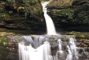
"An exhilarating circuit of the Mellte, Hepste, Nedd Fechan and Pyrddin waterfalls"
Walk directions
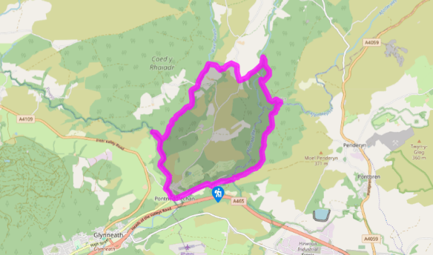
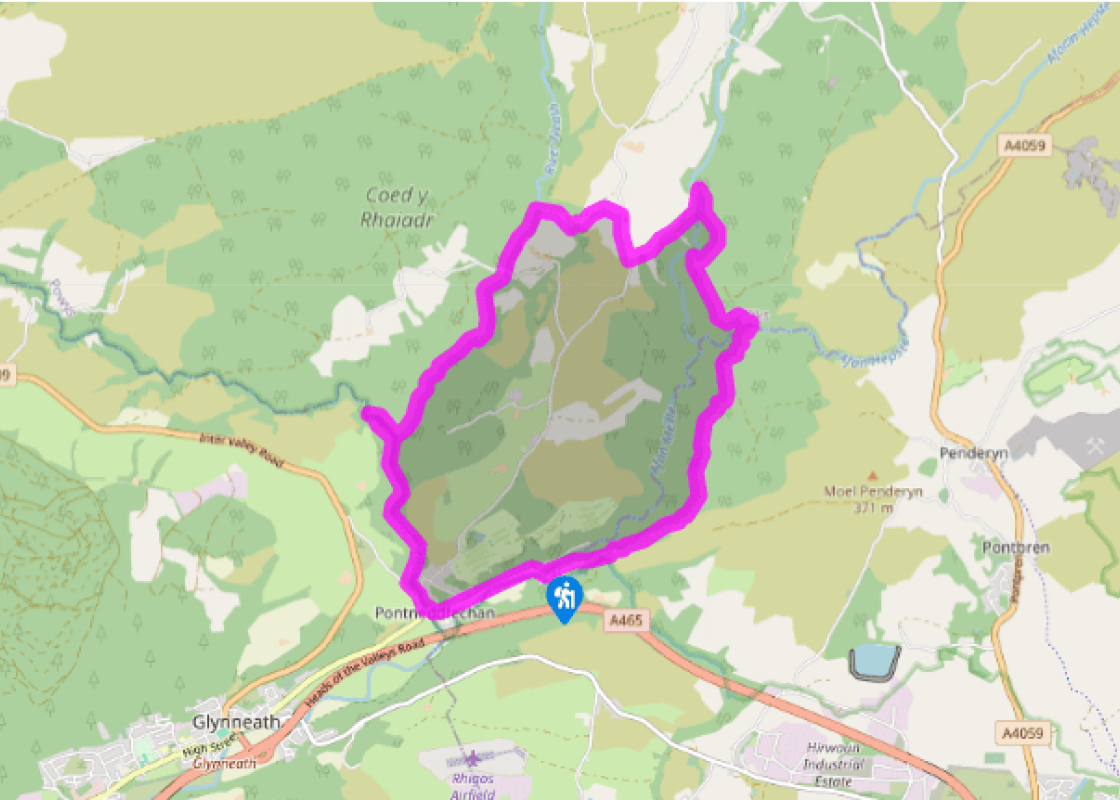
From the car park entrance, take a steeply climbing track signed to Sgwd yr Eira. After an initial stony ascent, the path continues more easily. Keep left where a stonier path forks downhill to the right. At the next fork, bear slightly right (‘Sgwd yr Eira’) and follow a well-marked path to a signed junction by an information board.
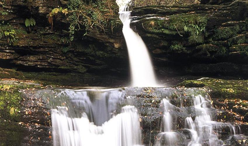
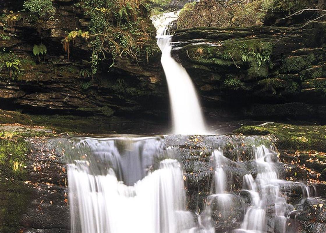
Turn left and drop steeply along a gravel path to the waterfall. Pass behind the curtain of water and clamber across wet, slippery boulders. Climb steeply (numerous steps) to a junction with a wide gravel path. Turn left and follow a well-marked path along the top edge of the valley.
Ignore a signed path on the left to Sgwd y Pannwr and continue to Sgwd Clun-gwyn. Keep ahead here (‘Cwm Porth’), and take the next waymarked path descending left to the river. Continue upstream to a footbridge on the left.
Cross the bridge and climb along a gravel path above Sgwd Clun-gwyn. Bear left at a gravel drive to emerge at a road. Turn right and follow the road past a petrol station and tiny shop to reach a stile on the left, opposite a chapel. Walk diagonally across a field and follow markers to a junction with a drive.
Turn left and keep ahead past a house (Heol-fawr) on to a rough track. Pass round right- and left-hand bends to reach a permissive path on the right (‘Tir Gofal’). Bearing slightly right, walk down a field to a gate. Bear left in the next field, then keep ahead (dropping steeply) to a stile above the Nedd Fechan river.
Turn left on to a narrow path, which follows the river downstream to a road. Turn right to cross a bridge and then left into the Pont Melin-fach picnic area. Follow the riverside path past a number of falls and rapids to a wooden footbridge on your left. Ignore this and continue to another bridge directly ahead.
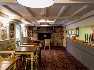
Do not cross the bridge, but turn right on to a signed path to Sgwd Gwladus. After viewing the fall, retrace your steps to cross the bridge and continue along a wide gravel path down to the road at Pontneddfechan. Turn left to pass the Old White Horse Inn and then left again, on to the main road.
Where the main road bears left towards Ystradfellte, keep ahead past the Dinas Inn. Follow the road up to a footbridge on the right. Cross this to a junction with an enclosed track and turn left. At the end of the track, drop left to reach the entrance to the Craig y Ddinas car park.
During the 19th century, the southern edge of Waterfall Country was an important silica-mining area. Silica rock or quartzite was mined on a small scale in the Pontneddfechan area from the late 18th century, but the first large-scale mining operation began in 1822, when the Quaker entrepreneur... William Weston Young took out a 21-year lease on land near the village. Major passageways were opened along the lower course of the Nedd Fechan (the path on the west bank is a former tramway) and in the Sychryd gorge near Craig y Ddinas. Young wanted silica to make firebricks, which he had found he could produce from high-quality ‘Dinas’ silica. After extraction, the rock was crushed in the valley then transported by horse-drawn tram to Pont Walby. A factory here turned the silica into firebricks, which were exported to line furnaces, lime kilns and domestic fireplaces across the globe. Another important local industry was gunpowder, which was made on the Mellte river, north of Craig y Ddinas. The site was chosen for its isolation in the event of an explosion, its plentiful supply of water for powering machinery, and its ample supplies of timber for making charcoal. To contain any explosion, banks of earth were constructed between buildings, the latter usually being whitewashed so that any accumulation of powder could be more easily spotted. Workers on the site wore special safety slippers made out of leather, while horses were shod with copper shoes to prevent sparks. The works continued to make gunpowder until 1931, when a change in the law forced its closure. Most of the buildings were demolished for safety reasons the following year. Craig y Ddinas was also quarried for limestone (the car park is actually inside the former quarry). Sgwd Gwladus on the Afon Pyrddin is often regarded as the prettiest of the Neath Valley waterfalls. The name of the fall is associated in legend with Gwladus, a daughter of King Brychan of Brycheiniog. According to the story, Gwladus fell in love with a man called Einion, who for political reasons she was unable to marry. After death, their spirits were both invested in waterfalls along the Pyrddin river, Gwladus’ in Sgwd Gwladus and Einion’s in a fall about half a mile further upstream, Sgwd Einion Gam. Kept apart during life, their souls now merge in the pool below Sgwd Gwladus.
The largest unitary authority in Wales, Powys covers an area of approximately 2,000 square miles. Much of that is mountainous because it actually has the lowest population density of all the Welsh counties.
"An exhilarating circuit of the Mellte, Hepste, Nedd Fechan and Pyrddin waterfalls"
Walk details
3hrs 30min
Difficulty:
Medium
Gradient:
Moderate
Distance:
7.75 miles (12.5kms)
Ascent:
1540ft (470m)
Walk directions
From the car park entrance, take a steeply climbing track signed to Sgwd yr Eira. After an initial stony ascent, the path continues more easily. Keep left where a stonier path forks downhill to the right. At the next fork, bear slightly right (‘Sgwd yr Eira’) and follow a well-marked path to a signed junction by an information board.
1 of 8
Turn left and drop steeply along a gravel path to the waterfall. Pass behind the curtain of water and clamber across wet, slippery boulders. Climb steeply (numerous steps) to a junction with a wide gravel path. Turn left and follow a well-marked path along the top edge of the valley.
2 of 8
Ignore a signed path on the left to Sgwd y Pannwr and continue to Sgwd Clun-gwyn. Keep ahead here (‘Cwm Porth’), and take the next waymarked path descending left to the river. Continue upstream to a footbridge on the left.
3 of 8
Cross the bridge and climb along a gravel path above Sgwd Clun-gwyn. Bear left at a gravel drive to emerge at a road. Turn right and follow the road past a petrol station and tiny shop to reach a stile on the left, opposite a chapel. Walk diagonally across a field and follow markers to a junction with a drive.
4 of 8
Turn left and keep ahead past a house (Heol-fawr) on to a rough track. Pass round right- and left-hand bends to reach a permissive path on the right (‘Tir Gofal’). Bearing slightly right, walk down a field to a gate. Bear left in the next field, then keep ahead (dropping steeply) to a stile above the Nedd Fechan river.
5 of 8
Turn left on to a narrow path, which follows the river downstream to a road. Turn right to cross a bridge and then left into the Pont Melin-fach picnic area. Follow the riverside path past a number of falls and rapids to a wooden footbridge on your left. Ignore this and continue to another bridge directly ahead.
6 of 8
Do not cross the bridge, but turn right on to a signed path to Sgwd Gwladus. After viewing the fall, retrace your steps to cross the bridge and continue along a wide gravel path down to the road at Pontneddfechan. Turn left to pass the Old White Horse Inn and then left again, on to the main road.
7 of 8
Where the main road bears left towards Ystradfellte, keep ahead past the Dinas Inn. Follow the road up to a footbridge on the right. Cross this to a junction with an enclosed track and turn left. At the end of the track, drop left to reach the entrance to the Craig y Ddinas car park.
During the 19th century, the southern edge of Waterfall Country was an important silica-mining area. Silica rock or quartzite was mined on a small scale in the Pontneddfechan area from the late 18th century, but the first large-scale mining operation began in 1822, when the Quaker entrepreneur... William Weston Young took out a 21-year lease on land near the village. Major passageways were opened along the lower course of the Nedd Fechan (the path on the west bank is a former tramway) and in the Sychryd gorge near Craig y Ddinas. Young wanted silica to make firebricks, which he had found he could produce from high-quality ‘Dinas’ silica. After extraction, the rock was crushed in the valley then transported by horse-drawn tram to Pont Walby. A factory here turned the silica into firebricks, which were exported to line furnaces, lime kilns and domestic fireplaces across the globe. Another important local industry was gunpowder, which was made on the Mellte river, north of Craig y Ddinas. The site was chosen for its isolation in the event of an explosion, its plentiful supply of water for powering machinery, and its ample supplies of timber for making charcoal. To contain any explosion, banks of earth were constructed between buildings, the latter usually being whitewashed so that any accumulation of powder could be more easily spotted. Workers on the site wore special safety slippers made out of leather, while horses were shod with copper shoes to prevent sparks. The works continued to make gunpowder until 1931, when a change in the law forced its closure. Most of the buildings were demolished for safety reasons the following year. Craig y Ddinas was also quarried for limestone (the car park is actually inside the former quarry). Sgwd Gwladus on the Afon Pyrddin is often regarded as the prettiest of the Neath Valley waterfalls. The name of the fall is associated in legend with Gwladus, a daughter of King Brychan of Brycheiniog. According to the story, Gwladus fell in love with a man called Einion, who for political reasons she was unable to marry. After death, their spirits were both invested in waterfalls along the Pyrddin river, Gwladus’ in Sgwd Gwladus and Einion’s in a fall about half a mile further upstream, Sgwd Einion Gam. Kept apart during life, their souls now merge in the pool below Sgwd Gwladus.
The largest unitary authority in Wales, Powys covers an area of approximately 2,000 square miles. Much of that is mountainous because it actually has the lowest population density of all the Welsh counties.