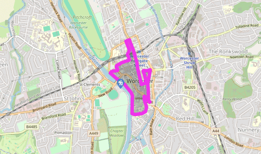
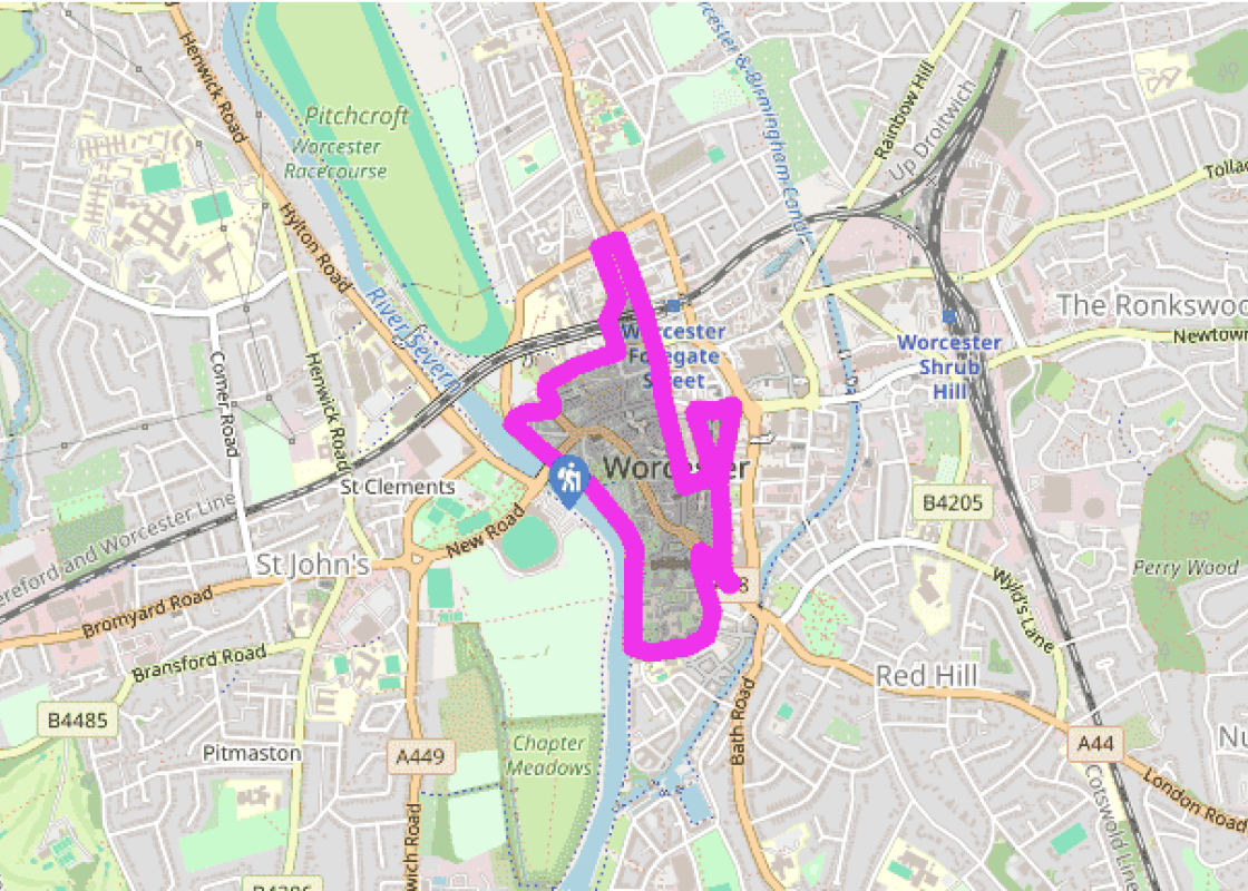
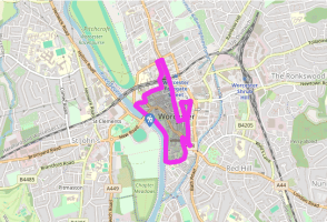
Additional information
Terrain
- City streets and tarmac riverside path
Landscape
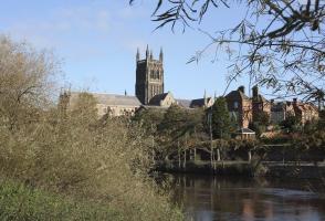
- Urban with riverside
Dog friendliness
- Not dog friendly (except short stretch by river)
Parking
- Long-stay pay-and-display car parks at New Road, Tybridge Street and Croft Road (and elsewhere)
Toilets en route
- Near start at Croft Road and bus station; several elsewhere
About the walk
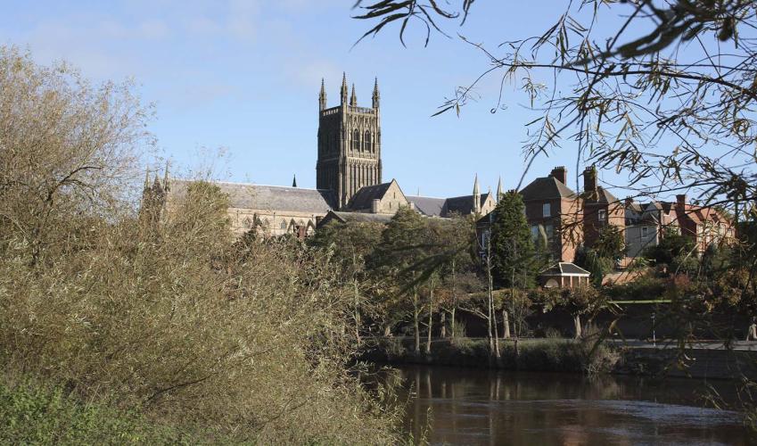
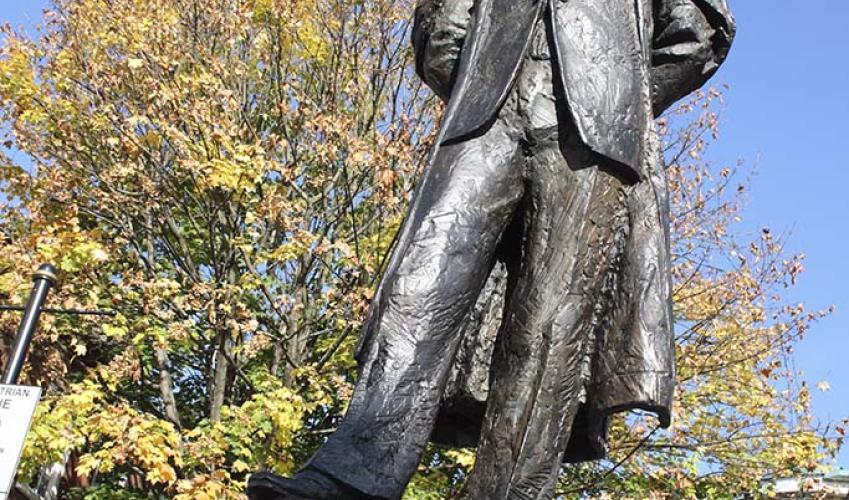
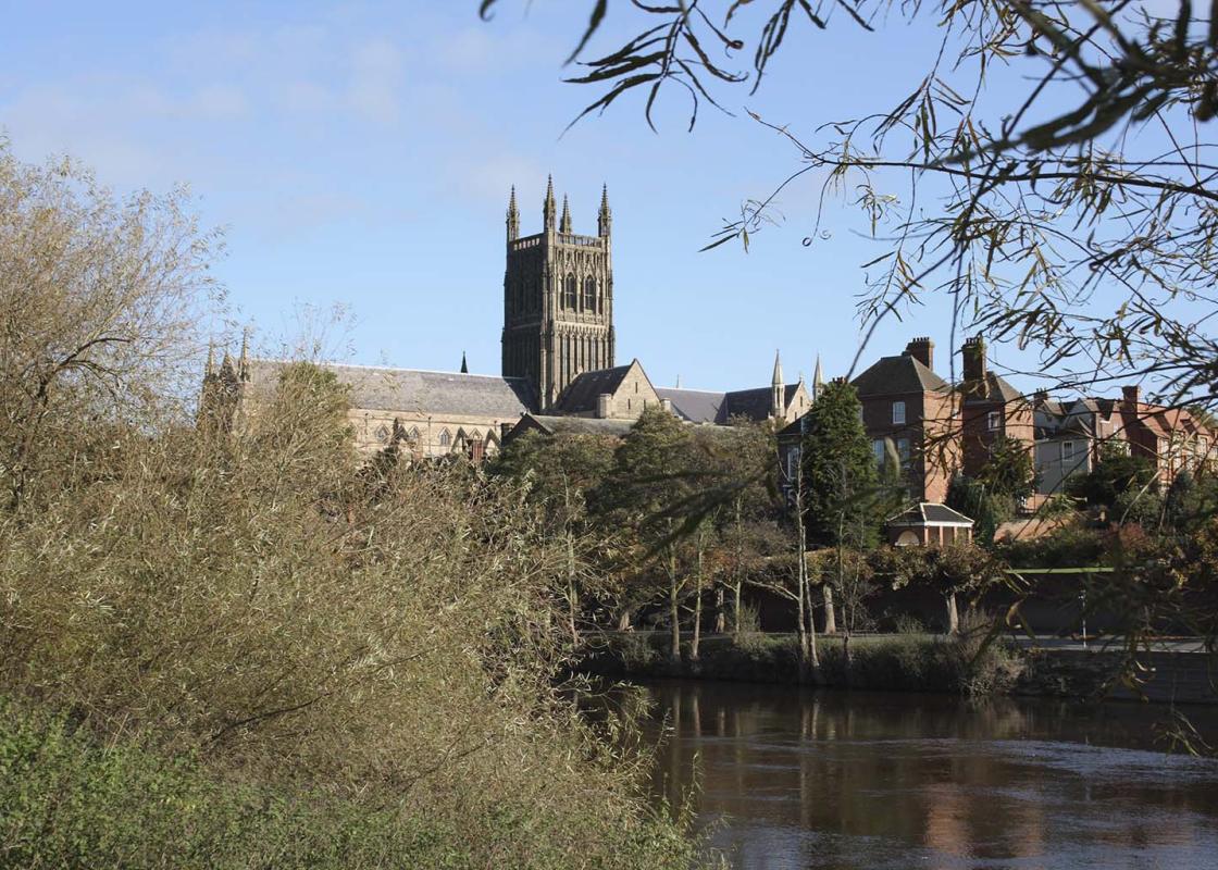
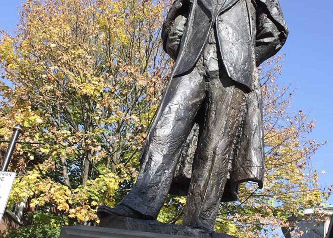
The development of Lea & Perrins’ Worcester Sauce was largely accidental. The story goes that the two chemists, who ran a store between Broad Street and Bank Street (just off High Street), were asked to make up a recipe brought back from abroad in the 1820s. This they did, making an extra jar for... themselves. Finding it excessively hot, they put the jar aside. Some years later they stumbled upon it and, quite bravely, sipped it – eureka! It had mellowed to a pleasant piquancy. The secrecy surrounding the recipe is (apparently) retained, eccentrically but effectively, firstly by employing any given worker only on part of the process, and secondly by giving the ingredients meaningless code names. HP Foods, which is now owned by Kraft Heinz, bought the business in 1930. It has since gone on to achieve worldwide brand status. Keep your eyes directed at least 10ft (3m) off the ground and New Street – actually rather old – is a visual feast. In the late 18th century, many merchants migrated from here, making their houses tenements and workshops. The merchants left partly because of the stench. Nowadays the most likely smell wafting down New Street is of fast food. An 1832 report said of The Shambles that ‘filth of all description remains until it is perfectly alive’, and in 1846 another said that in parts of Worcester ‘pools of liquid filth perpetually stagnate the surface.’ Charles Hastings was a brilliant youth. He attended anatomy school in London when 16, became house surgeon to Worcester Infirmary aged 18, went to Edinburgh University aged 21, and returned to Worcester Infirmary. (He declined a professorship at Edinburgh.) Ahead of his time, Hastings believed that the state should be responsible for the health of its public. He conducted much research into what nowadays would be called ‘occupational health’ – of local porcelain workers, glovers, and salt workers, for example – and founded the Provincial Medical and Surgical Association. Twenty-four years later, with Hastings still at the helm, legislation formally established this body as the British Medical Association, which still oversees the work of medical practitioners today. It is said that he attended every case during the three cholera outbreaks in 1832, 1849 and 1853. In 1854 Dr Hastings put much of his own money into innovative ‘modern dwellings’ (long-demolished, off Copenhagen Street) for artisans. He at least had the satisfaction of seeing the local death rate fall by 45 per cent in a decade. However, he still had a fight on his hands to persuade the city council to provide clean water. Amazingly, legislation compelling local councils to do this did not reach the statute books until 1872. He benefited the people of Worcester in several other ways too, such as by founding a natural history museum in the city. His grave lies in Worcester’s Astwood Cemetery. When he died in 1866, aged 72, Sir Charles Hastings was Worcester’s most lauded citizen; at that time Edward Elgar was only nine years old. One could argue as to which brought about the greater benefit to Worcester city.
Read more