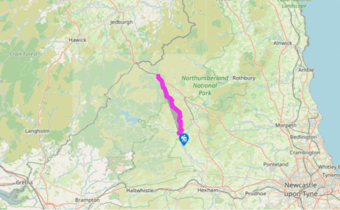
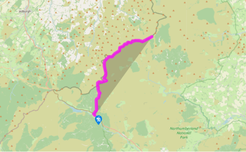
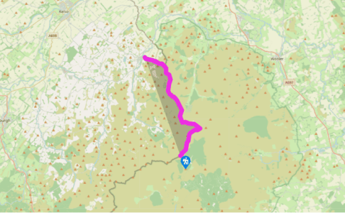
Clennell street,
Recommended by
11.4
miles
mi
| Hard | 5hrs 15min
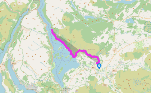
Drymen,
Recommended by
15.1
miles
mi
| Medium | 7hrs 30min
Across Conic Hill into the Highlands
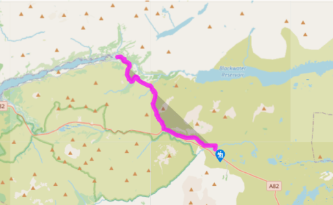
Kings house,
Recommended by
8.8
miles
mi
| Medium | 4hrs 15min
Climbing the Devil's Staircase
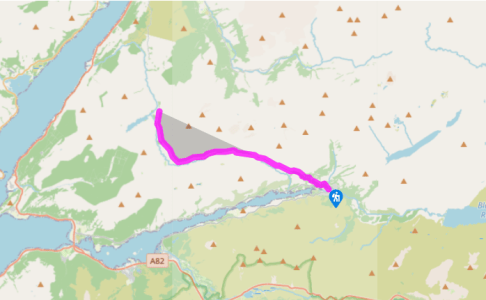
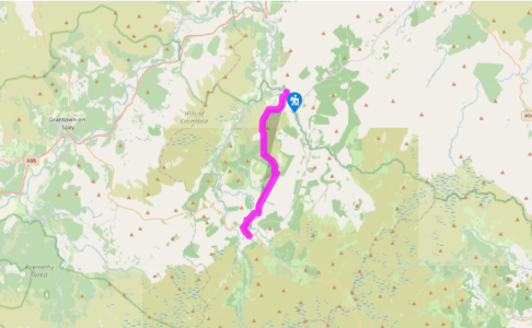
Kinlochleven,
Recommended by
7.5
miles
mi
| Medium | 4hrs
Through the Great Pass to Lochaber
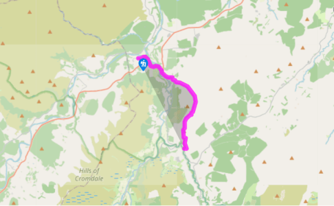
Ballindalloch station,
Recommended by
6.5
miles
mi
| Hard | 3hrs 15min
Crossing the high flank of Ben Rinnes
Glenlivet,
Recommended by
9.1
miles
mi
| Hard | 4hrs 30min
Across the stags' hill to the Highlands' highest village
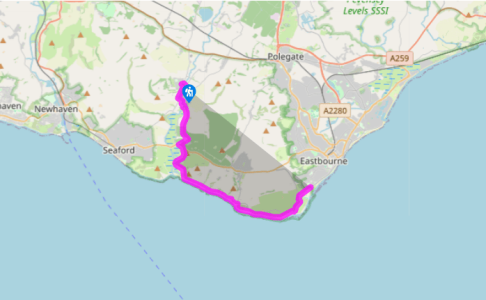
Alfriston,
Recommended by
10.7
miles
mi
| Medium | 3hrs 40min
From Alfriston, the final section of the South Downs Way divides into inland or coastal options
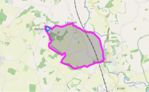
Alphamstone, Essex
Recommended by
5.25
miles
mi
| Medium | 2hrs
A walk along an attractive stretch of the River Stour
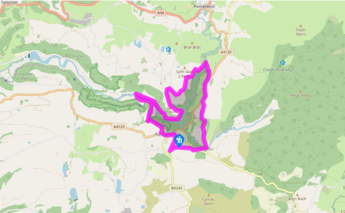
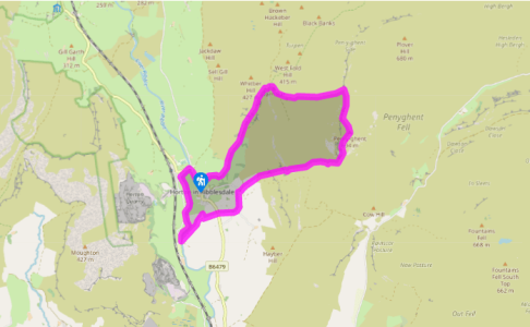
Devil's bridge, Ceredigion
Recommended by
7
miles
mi
| Hard | 3hrs 30min
Mining ruins and a deep river gorge in the spectacular valley of Cwm Rheidol
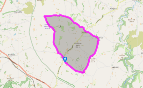
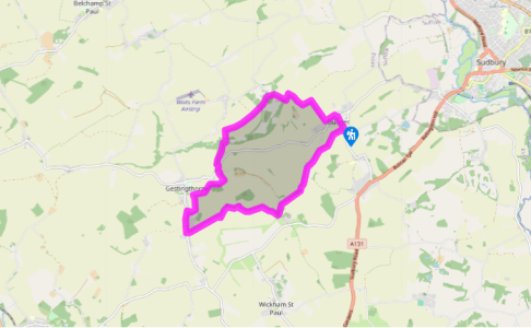
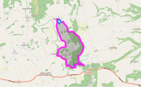
Onecote, Staffordshire
Recommended by
8.25
miles
mi
| Hard | 5hrs
Far-reaching hilltop views and tucked away hamlets
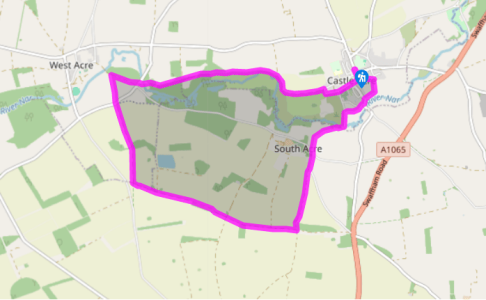
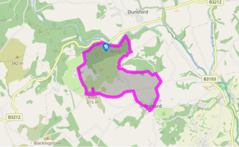
Castle acre, Norfolk
Recommended by
6.5
miles
mi
| Hard | 2hrs 45min
A walk between Castle Acre and West Acre, once dominated by religious houses.
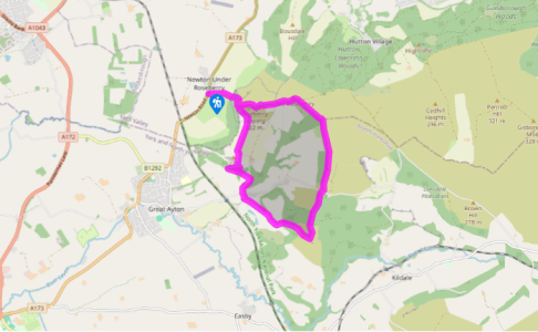
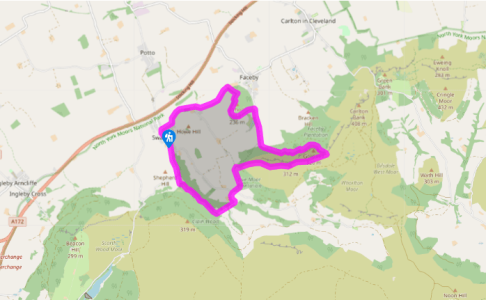
Roseberry topping, North yorkshire
Recommended by
7
miles
mi
| Hard | 3hrs 15min
Visible for miles around and one of the most distinctive of all English hills, Roseberry Topping
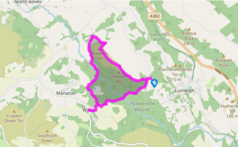
Steps bridge, Devon
Recommended by
5.5
miles
mi
| Medium | 2hrs 45min