"A waterfall, a shooting lodge and a ramble down the West Highland Way."
Walk directions
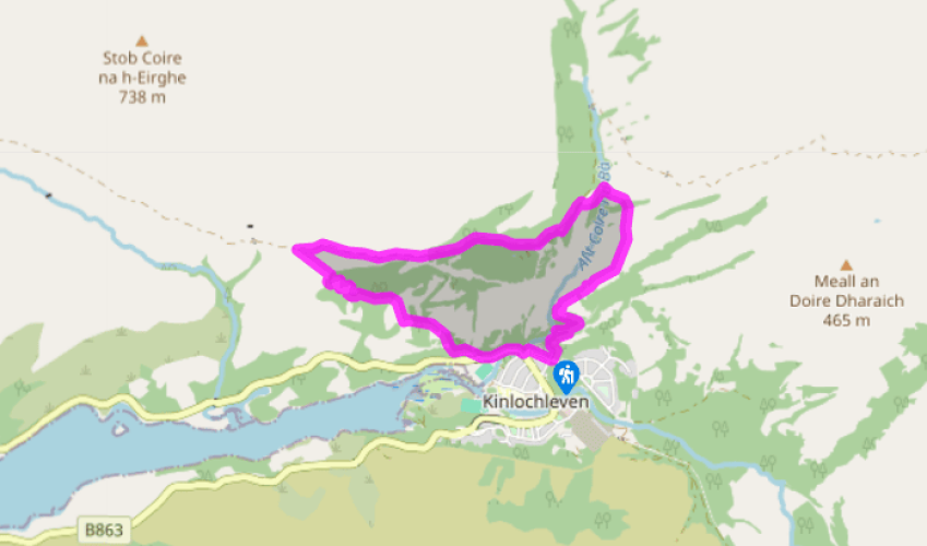
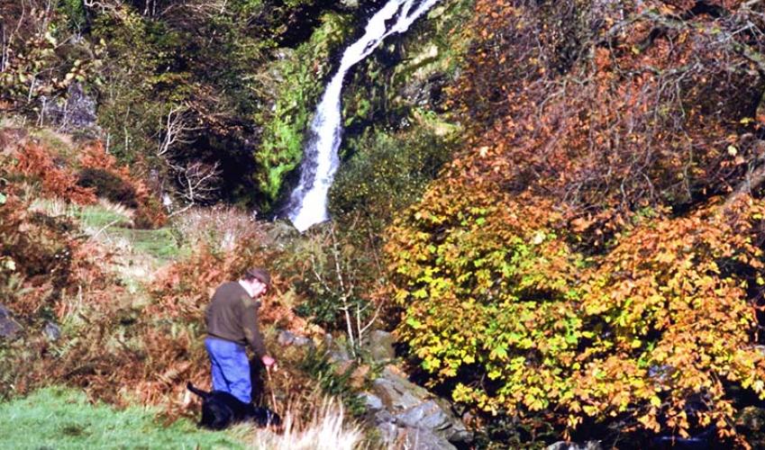
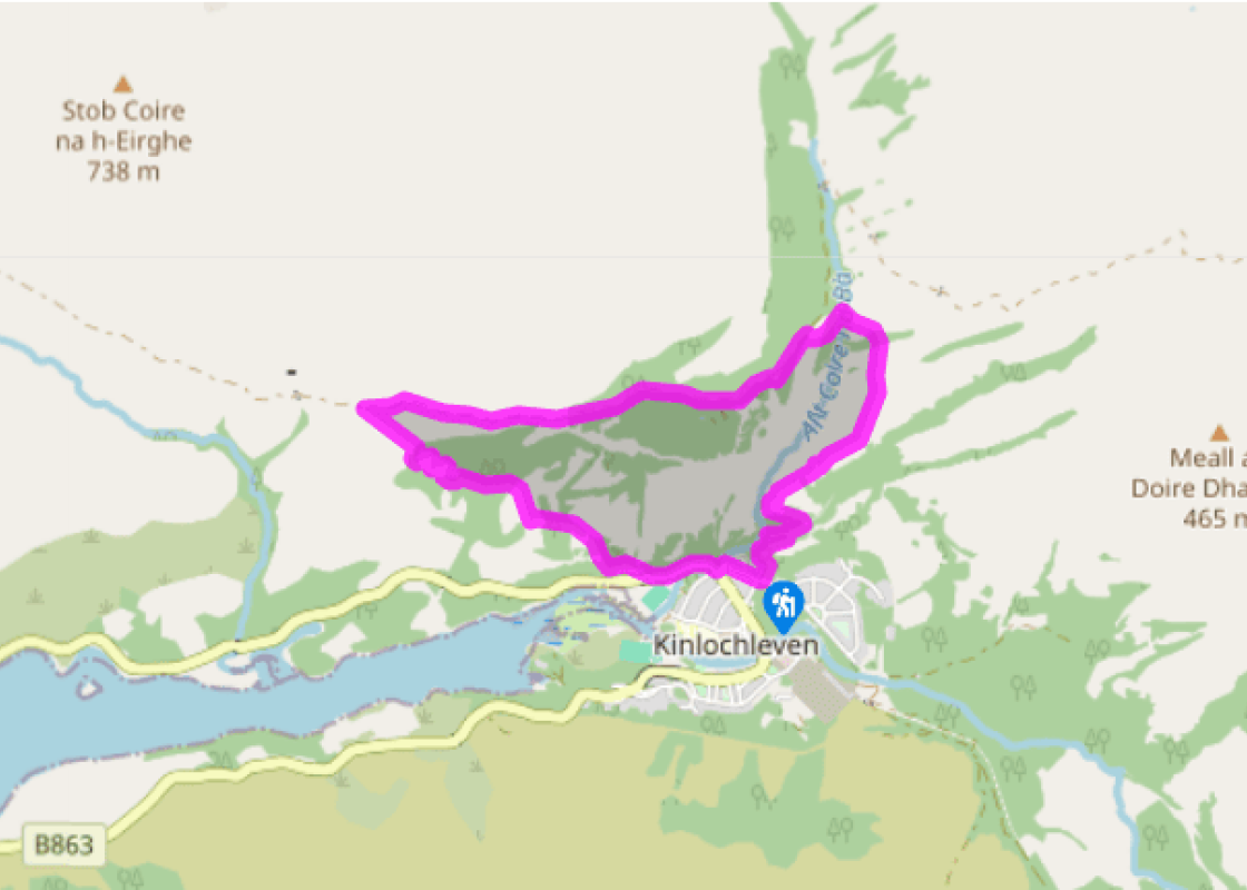
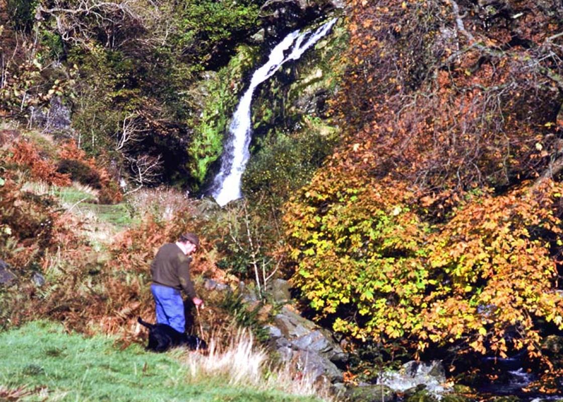
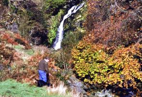
A smooth gravel path leads up out of the car park to a T-junction. Turn left, signed for Grey Mare's Tail Waterfall. The path rises to a view through trees of the waterfall, then descends to a footbridge. Here turn left beside a side stream to visit the foot of the spectacular waterfall. Return upstream past the footbridge. After another 100yds (91m) the path turns sharply to the left. The path, quite steep and loose, zig-zags up through birches to reach more open ground.
Here the path forks. Take the right-hand branch, with a yellow-and-green waymarker, to pass under two power lines. The path runs through scattered birch to a gate in a deer fence, then bends left to cross over two streams. Immediately after the second stream is another junction.
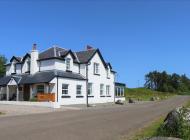
The confusing waymarker here has eight arrows in four colours. Turn left, following a white arrow slightly downhill, to cross a footbridge above a waterfall and red rhyolite rocks. The path leads up under birches. Here the ground cover includes the aromatic bog myrtle, which can be used to discourage midges. When the path reaches a track, turn left. Below the track is a tin deer used by stalkers for target practice: it's more convenient than the real thing as it doesn't wander off just when you're creeping up on it. A signed footpath bypasses down left of the Stalkers' Cottages, then rejoins the track beyond, to a junction above Mamore Lodge.
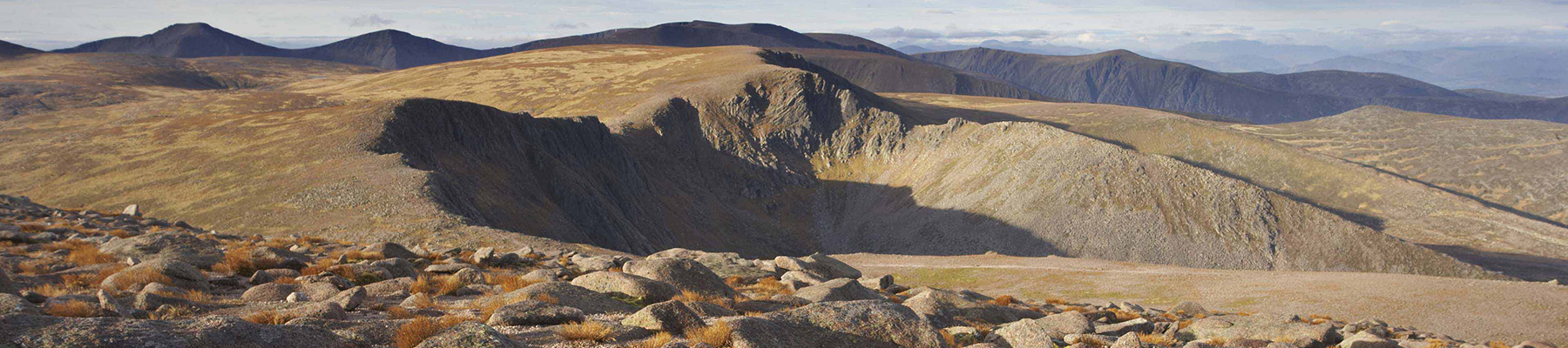
Keep ahead, above the lodge, climbing gently past two green-and-red tin huts. At the high point of the track there is a TV mast on the right, a bench on the left and a view along Loch Leven ahead. The track descends gently, with one outcrop of reddish rhyolite and then smoother slabs of whitish quartzite above. The wide path of the West Highland Way (WHW) can be seen below and gradually rises to join the track, with a large waymarker post.
Turn left down the West Highland Way path, which drops into the woods below. It zig-zags down, then fords a stream with a curved metal handrail. Shortly after this, watch out for a junction where the main path seems to double back to the right; take the smaller path, continuing ahead with a WHW waymarker. After crossing the tarred access track of Mamore Lodge, the path reaches the village. Turn left along the pavement and fork left into Wades Road to regain the car park.
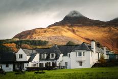
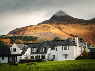
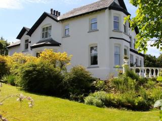
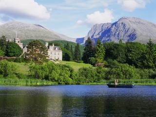
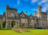
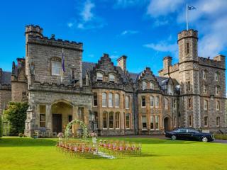
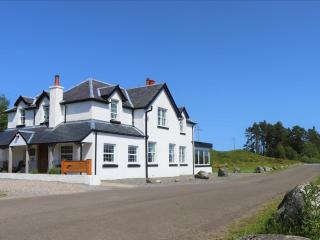
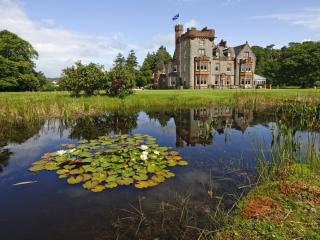
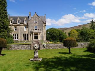
The upper part of this walk shows the stalkers' houses and former grand lodge of the 19th-century sport of deer stalking, but at the start is an altogether more modern form of outdoor adventure. The Iron Way The 'via ferrata', or iron pathway, was devised during World War I in the Dolomites of... northern Italy. On both the Italian and the Austrian sides, walkways with chains and cables, and iron spikes driven into the rockface, allowed soldiers to move about on their vertical battlefield. At the end of that war, the routes were strengthened and made safer, and many others were developed, as mountaineers found them an exciting way into the steepest mountain terrain without the need for special mountaineering skills and equipment. Today there are several thousand in the Alps of Austria and Italy – and just one in Scotland. The route uses metal staples, cables and plank walkways, with a continuous safety cable so that the scrambler is attached to the rockface at all times. From the waterfall base, the 1,640ft (500m) route works its way up the sheer rockface to the left of the waterfall, often splashed by its spray. High above, you can see the final set of wooden rungs as it tops the skyline. In Scotland there has always been a climbing ethic that only the natural rock face should be used, with no artificial attachments. If a precipice could not be climbed without driving in metal spikes, then it remained unclimbed (though in practice, a more skilled climber would eventually manage it anyway). So the Grey Mare's Tail installation has attracted some controversy. Visitors can make up their own minds whether the intrusive affect of the planks and cables is justified by the pleasure it gives to intrepid scramblers and the income it creates for the village. The first few metres of it do give a much better view of the falls than was previously possible without wading upstream over the slippery boulders. Mamore Lodge High above the gorge, Mamore Lodge once provided another scenically spectacular sporting venue – the sport in question being deer stalking. Smaller cottages were for the ghillies, professional guides who carried the rifles and led the gentry into position for a fine 'twelve-pointer' stag. Ponies brought the dead deer down off the hill, and the well-built pony paths still lead up to the summits of the Mamores. For a while the lodge acted as a hotel, but its special situation was outweighed by its narrow and difficult driveway track, which ascends through 650ft (198m) of vertical height. It closed altogether in 2012.
Apart from the Orkneys and the Shetlands, Highland is Scotland’s northernmost county. Probably its most famous feature is the mysterious and evocative Loch Ness, allegedly home to an ancient monster that has embedded itself in the world’s modern mythology, and the region’s tourist industry.
"A waterfall, a shooting lodge and a ramble down the West Highland Way."
Walk details
2hrs 15min
Difficulty:
Medium
Gradient:
Moderate
Distance:
3.5 miles (5.7kms)
Ascent:
984ft (300m)
Walk directions
A smooth gravel path leads up out of the car park to a T-junction. Turn left, signed for Grey Mare's Tail Waterfall. The path rises to a view through trees of the waterfall, then descends to a footbridge. Here turn left beside a side stream to visit the foot of the spectacular waterfall. Return upstream past the footbridge. After another 100yds (91m) the path turns sharply to the left. The path, quite steep and loose, zig-zags up through birches to reach more open ground.
1 of 5
Here the path forks. Take the right-hand branch, with a yellow-and-green waymarker, to pass under two power lines. The path runs through scattered birch to a gate in a deer fence, then bends left to cross over two streams. Immediately after the second stream is another junction.
2 of 5
The confusing waymarker here has eight arrows in four colours. Turn left, following a white arrow slightly downhill, to cross a footbridge above a waterfall and red rhyolite rocks. The path leads up under birches. Here the ground cover includes the aromatic bog myrtle, which can be used to discourage midges. When the path reaches a track, turn left. Below the track is a tin deer used by stalkers for target practice: it's more convenient than the real thing as it doesn't wander off just when you're creeping up on it. A signed footpath bypasses down left of the Stalkers' Cottages, then rejoins the track beyond, to a junction above Mamore Lodge.
3 of 5
Keep ahead, above the lodge, climbing gently past two green-and-red tin huts. At the high point of the track there is a TV mast on the right, a bench on the left and a view along Loch Leven ahead. The track descends gently, with one outcrop of reddish rhyolite and then smoother slabs of whitish quartzite above. The wide path of the West Highland Way (WHW) can be seen below and gradually rises to join the track, with a large waymarker post.
4 of 5
Turn left down the West Highland Way path, which drops into the woods below. It zig-zags down, then fords a stream with a curved metal handrail. Shortly after this, watch out for a junction where the main path seems to double back to the right; take the smaller path, continuing ahead with a WHW waymarker. After crossing the tarred access track of Mamore Lodge, the path reaches the village. Turn left along the pavement and fork left into Wades Road to regain the car park.
The upper part of this walk shows the stalkers' houses and former grand lodge of the 19th-century sport of deer stalking, but at the start is an altogether more modern form of outdoor adventure. The Iron Way The 'via ferrata', or iron pathway, was devised during World War I in the Dolomites of... northern Italy. On both the Italian and the Austrian sides, walkways with chains and cables, and iron spikes driven into the rockface, allowed soldiers to move about on their vertical battlefield. At the end of that war, the routes were strengthened and made safer, and many others were developed, as mountaineers found them an exciting way into the steepest mountain terrain without the need for special mountaineering skills and equipment. Today there are several thousand in the Alps of Austria and Italy – and just one in Scotland. The route uses metal staples, cables and plank walkways, with a continuous safety cable so that the scrambler is attached to the rockface at all times. From the waterfall base, the 1,640ft (500m) route works its way up the sheer rockface to the left of the waterfall, often splashed by its spray. High above, you can see the final set of wooden rungs as it tops the skyline. In Scotland there has always been a climbing ethic that only the natural rock face should be used, with no artificial attachments. If a precipice could not be climbed without driving in metal spikes, then it remained unclimbed (though in practice, a more skilled climber would eventually manage it anyway). So the Grey Mare's Tail installation has attracted some controversy. Visitors can make up their own minds whether the intrusive affect of the planks and cables is justified by the pleasure it gives to intrepid scramblers and the income it creates for the village. The first few metres of it do give a much better view of the falls than was previously possible without wading upstream over the slippery boulders. Mamore Lodge High above the gorge, Mamore Lodge once provided another scenically spectacular sporting venue – the sport in question being deer stalking. Smaller cottages were for the ghillies, professional guides who carried the rifles and led the gentry into position for a fine 'twelve-pointer' stag. Ponies brought the dead deer down off the hill, and the well-built pony paths still lead up to the summits of the Mamores. For a while the lodge acted as a hotel, but its special situation was outweighed by its narrow and difficult driveway track, which ascends through 650ft (198m) of vertical height. It closed altogether in 2012.
Apart from the Orkneys and the Shetlands, Highland is Scotland’s northernmost county. Probably its most famous feature is the mysterious and evocative Loch Ness, allegedly home to an ancient monster that has embedded itself in the world’s modern mythology, and the region’s tourist industry.