"An odd clash of human and natural landscapes on Europe's largest shingle spit."
Walk directions
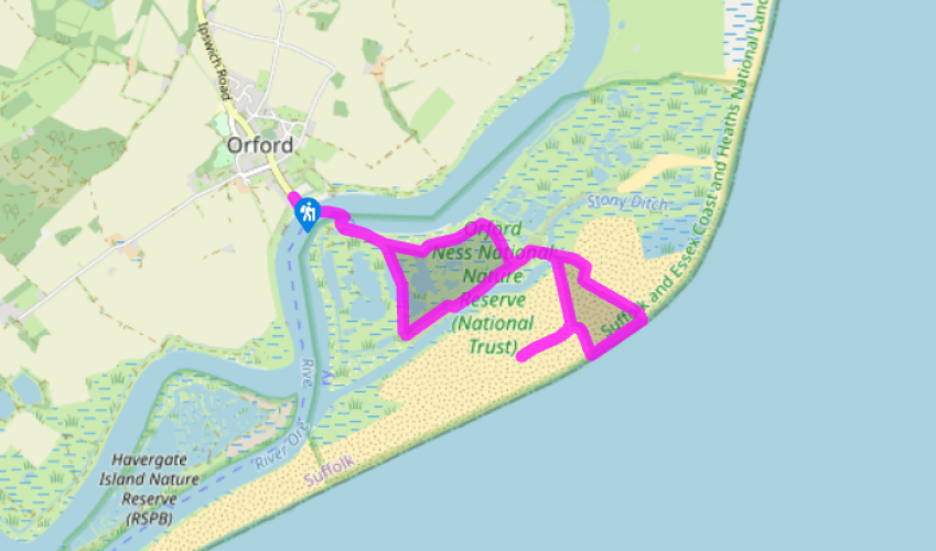
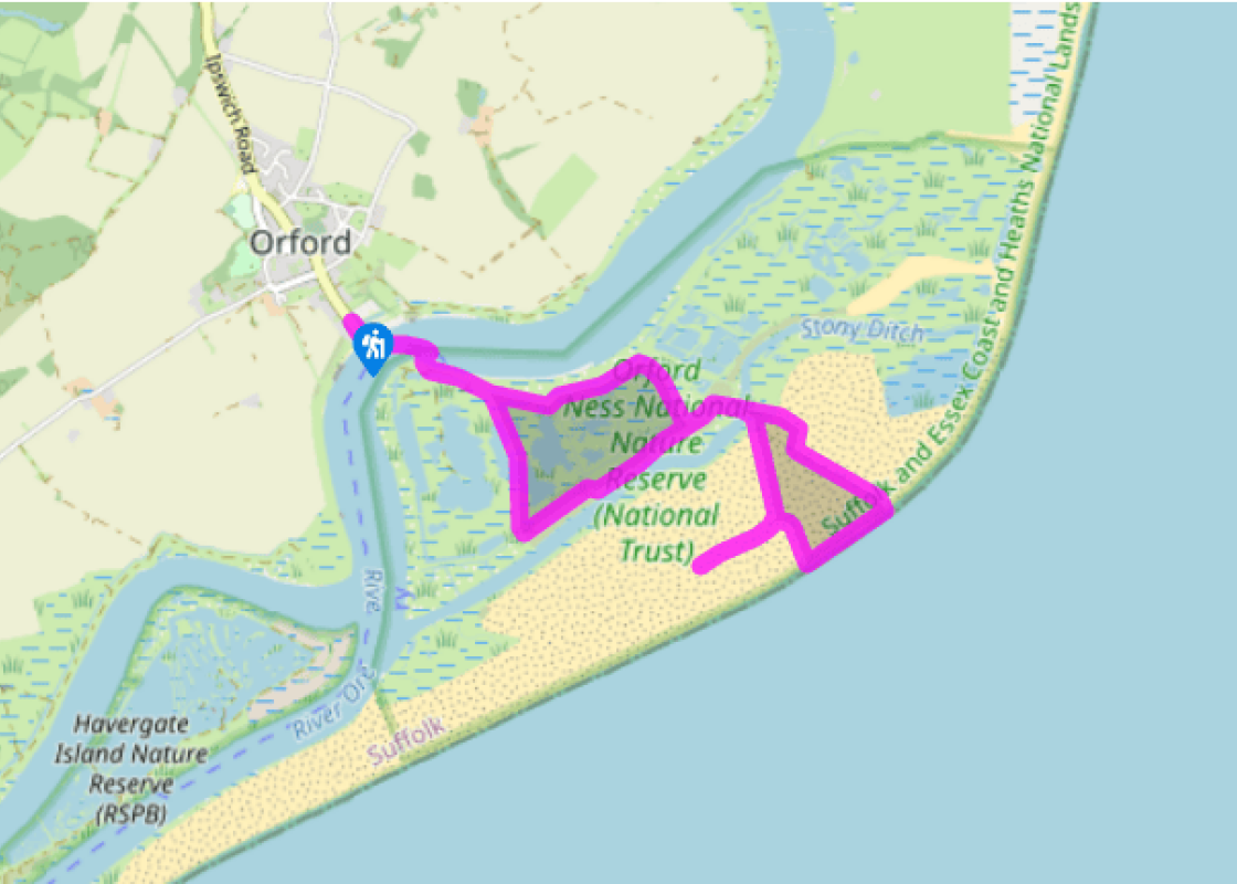
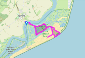
Arriving on Orford Ness, follow the red trail, which is waymarked with red arrows painted on to the road surface. It is essential to stick to the authorised route, not only to avoid disturbing wildlife, but also to keep out of the way of unexploded ordnance, which remains a potential danger. The trail begins by the wall of the River Ore, looking out over marshes where cattle graze on the site of a World War I airfield. In late summer, once the birds have finished nesting, you can continue along the river on the green trail through an area of marshes and lagoons. The main trail turns away from the river at this point and heads for an information building in the former telephone exchange. Look inside at the displays on the history of Orford Ness and the large aerial photograph of the shingle spit.
Follow the trail along the High Street and bear right over a Bailey bridge to cross Stony Ditch, with salt marsh to either side. Fork right here to head for the Black Beacon, a marine navigation beacon dating from 1928. The upper floors provide displays on birdlife and there is an elevated viewing area. The road to the right leads to the laboratories where Britain's early atomic weapons were tested, although it is claimed that no nuclear material was involved.
Return to the Black Beacon and head towards the beach, passing a police tower on the line of the old perimeter fence. Now turn left to walk along the shingle. The trail heads inland again when you come to a lighthouse and an old coastguard look-out that the National Trust plans to restore. Walk across the shingle to the Bomb Ballistics Building.
Walk back over the Bailey bridge and retrace your steps to the jetty.
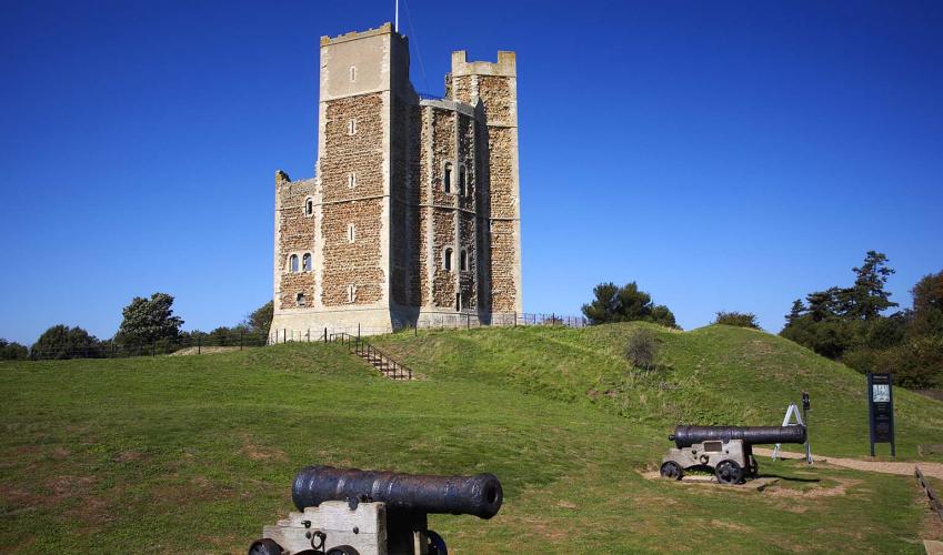
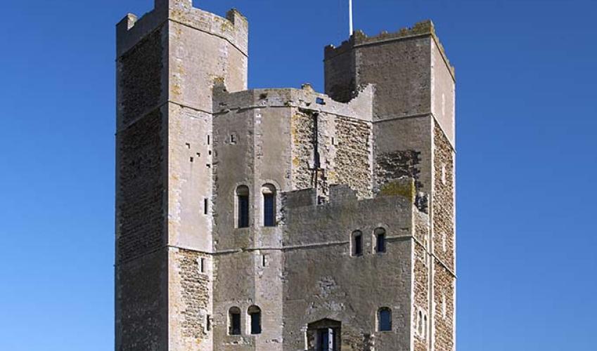
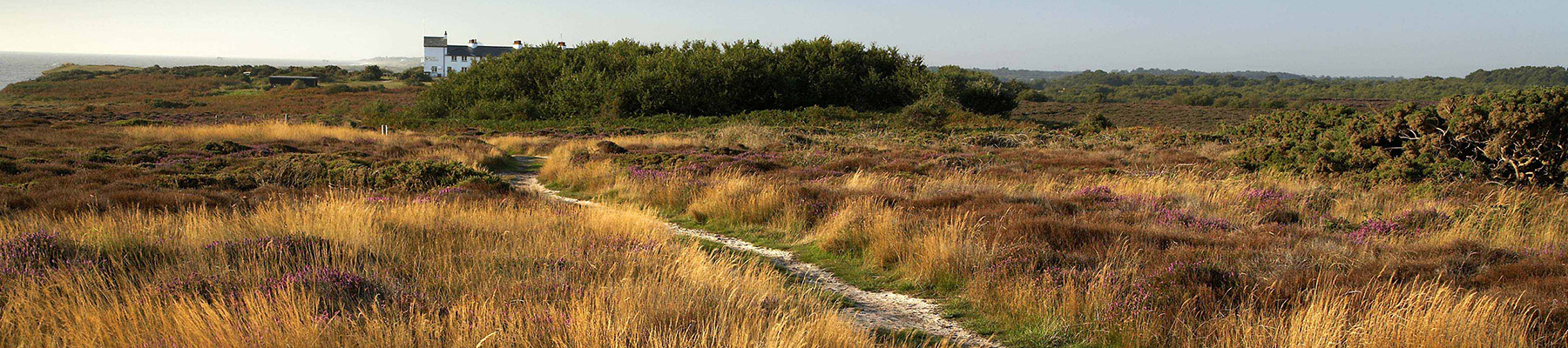
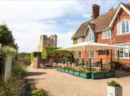
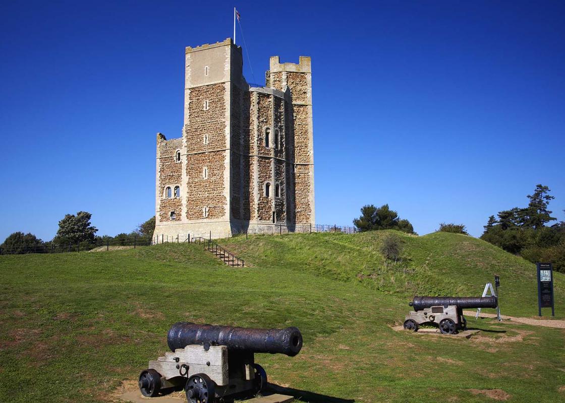
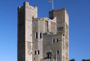
Of all the walks in this book, none can match the eerie appeal of this walk on Orford Ness. This is a hostile and lonely place, a shingle spit 10 miles (16.1km) long – a full 15 per cent of the entire globe’s ridged shingle can be found here – and growing at the rate of more than 15yds (14m) a... year. Its isolation made it a perfect site for military testing, and for much of the 20th century Orford Ness was a secret defence establishment where major advances were made in the fields of radar, military photography, bombs and atomic weapons. The army has gone but the buildings remain as permanent reminders of another age. Barn owls nest in the abandoned barracks. Little terns lay their eggs on the beach. The combination of wilderness and derelict buildings is strangely compelling and is what makes Orford Ness such a special place. Given the paranoia around national security nowadays it’s surprising just how much of the Ness is open to the public. Behind the information building, there is an observation platform with views over the Stony Ditch creek and the strange pagoda-type structures of the Atomic Weapons Research Establishment (AWRE), which operated here at the height of the Cold War. You can walk right inside Laboratory 1, where the first British atomic weapons tests took place in 1956 (though the rest of the AWRE is still out of bounds to visitors). Bomb Ballistics The Bomb Ballistics Building was built in 1933 as the nerve centre of Britain’s bomb-testing programme. You can climb on to the roof for views over the Ness, stretching north towards Sizewell, south towards Felixstowe and inland to Orford Castle. The large grey building to the north, known as Cobra Mist, was a top secret Anglo-American satellite research base alleged to have been involved in tracking UFOs (Unidentified Flying Objects) before its closure in 1973. It now houses transmitters which, with the tall radio masts beyond, broadcast the BBC World Service until recently. It’s difficult to underestimate the contribution (both for good and ill) that Orford Ness has made to 20th-century British history. It was here in the 1930s that Sir Robert Watson-Watt and a small team of scientists took the first steps in the development of the air defence system which came to be known as radar. Without the work carried out at Orford Ness, the outcome of the Battle of Britain might have been different and the course of World War II may have changed. Something to think about as you take the ferry back to Orford.
Suffolk is Constable country, where the county’s crumbling, time-ravaged coastline spreads itself under wide skies to convey a wonderful sense of remoteness and solitude. Highly evocative and atmospheric, this is where rivers wind lazily to the sea and notorious 18th-century smugglers hid from the excise men.
"An odd clash of human and natural landscapes on Europe's largest shingle spit."
Walk details
2hrs
Difficulty:
Medium
Gradient:
Flat
Distance:
5 miles (8kms)
Ascent:
0ft (0m)
Walk directions
Arriving on Orford Ness, follow the red trail, which is waymarked with red arrows painted on to the road surface. It is essential to stick to the authorised route, not only to avoid disturbing wildlife, but also to keep out of the way of unexploded ordnance, which remains a potential danger. The trail begins by the wall of the River Ore, looking out over marshes where cattle graze on the site of a World War I airfield. In late summer, once the birds have finished nesting, you can continue along the river on the green trail through an area of marshes and lagoons. The main trail turns away from the river at this point and heads for an information building in the former telephone exchange. Look inside at the displays on the history of Orford Ness and the large aerial photograph of the shingle spit.
1 of 4
Follow the trail along the High Street and bear right over a Bailey bridge to cross Stony Ditch, with salt marsh to either side. Fork right here to head for the Black Beacon, a marine navigation beacon dating from 1928. The upper floors provide displays on birdlife and there is an elevated viewing area. The road to the right leads to the laboratories where Britain's early atomic weapons were tested, although it is claimed that no nuclear material was involved.
2 of 4
Return to the Black Beacon and head towards the beach, passing a police tower on the line of the old perimeter fence. Now turn left to walk along the shingle. The trail heads inland again when you come to a lighthouse and an old coastguard look-out that the National Trust plans to restore. Walk across the shingle to the Bomb Ballistics Building.
3 of 4
Walk back over the Bailey bridge and retrace your steps to the jetty.
Of all the walks in this book, none can match the eerie appeal of this walk on Orford Ness. This is a hostile and lonely place, a shingle spit 10 miles (16.1km) long – a full 15 per cent of the entire globe’s ridged shingle can be found here – and growing at the rate of more than 15yds (14m) a... year. Its isolation made it a perfect site for military testing, and for much of the 20th century Orford Ness was a secret defence establishment where major advances were made in the fields of radar, military photography, bombs and atomic weapons. The army has gone but the buildings remain as permanent reminders of another age. Barn owls nest in the abandoned barracks. Little terns lay their eggs on the beach. The combination of wilderness and derelict buildings is strangely compelling and is what makes Orford Ness such a special place. Given the paranoia around national security nowadays it’s surprising just how much of the Ness is open to the public. Behind the information building, there is an observation platform with views over the Stony Ditch creek and the strange pagoda-type structures of the Atomic Weapons Research Establishment (AWRE), which operated here at the height of the Cold War. You can walk right inside Laboratory 1, where the first British atomic weapons tests took place in 1956 (though the rest of the AWRE is still out of bounds to visitors). Bomb Ballistics The Bomb Ballistics Building was built in 1933 as the nerve centre of Britain’s bomb-testing programme. You can climb on to the roof for views over the Ness, stretching north towards Sizewell, south towards Felixstowe and inland to Orford Castle. The large grey building to the north, known as Cobra Mist, was a top secret Anglo-American satellite research base alleged to have been involved in tracking UFOs (Unidentified Flying Objects) before its closure in 1973. It now houses transmitters which, with the tall radio masts beyond, broadcast the BBC World Service until recently. It’s difficult to underestimate the contribution (both for good and ill) that Orford Ness has made to 20th-century British history. It was here in the 1930s that Sir Robert Watson-Watt and a small team of scientists took the first steps in the development of the air defence system which came to be known as radar. Without the work carried out at Orford Ness, the outcome of the Battle of Britain might have been different and the course of World War II may have changed. Something to think about as you take the ferry back to Orford.
Suffolk is Constable country, where the county’s crumbling, time-ravaged coastline spreads itself under wide skies to convey a wonderful sense of remoteness and solitude. Highly evocative and atmospheric, this is where rivers wind lazily to the sea and notorious 18th-century smugglers hid from the excise men.