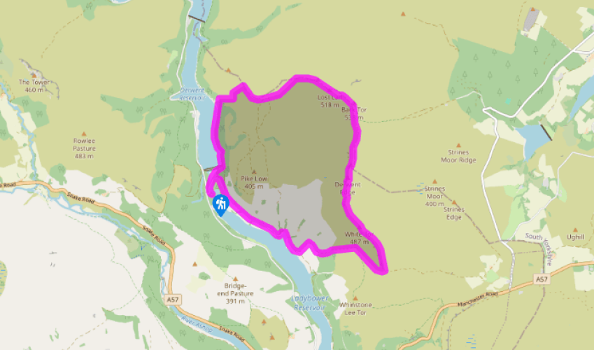
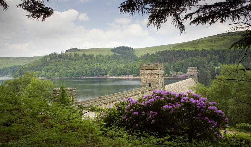
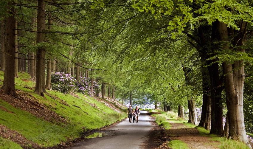
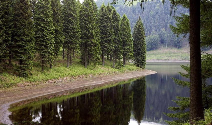
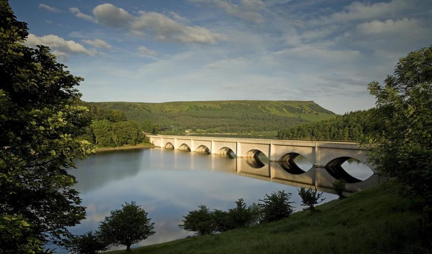
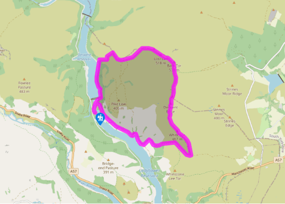
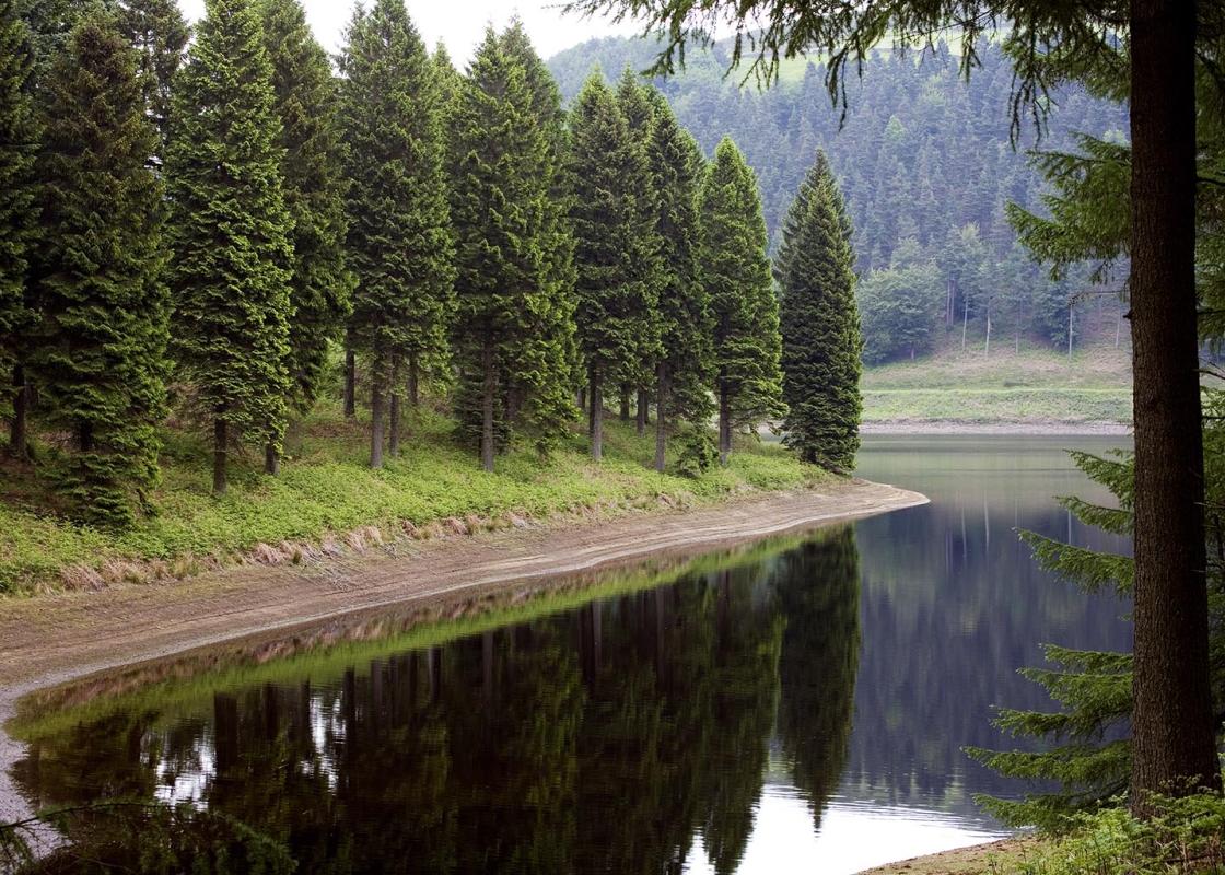
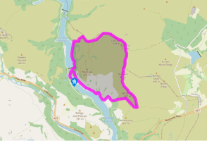
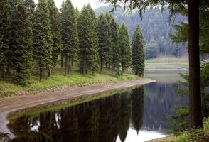
From the visitor centre at Fairholmes turn left and walk along the short, fenced path through the woods, with the river below to your right, then on along a lane with the dam away to the left. Follow the road as it bends right and continues on above the eastern shore of the reservoir.
After just over a mile (1.6km) you come to two gates. Go through the smaller one on the left for a paved path uphill signposted ‘Public footpath via Derwent Edge to Moscar’. Follow this past some stone barns (one of which is a walkers’ shelter) and then ford Grindle Clough’s stream. Continue alongside a conifer plantation until you reach the top of the moorland edge.
At the junction of routes turn left on to the popular path along the edge. Continue past a succession of large rocky outcrops – the Wheel Stones, Salt Cellar and Cakes of Bread – before reaching Back Tor with its prominent trig point on the highest boulder.
From here take the flagged path northwest to Lost Lad and on to the top of a broad spur of the hill. The route now swings westwards and descends a steep grassy slope. When the gradient eases you soon come to an easily missed junction of grassy tracks.
Fork left across Green Sitches and on through a tumbledown wall, ignoring the path to the left. Where the path forks go right to a clearly visible gate and stile. The waymarked path heads northwest down the rough grassy hillside before swinging left by an old wall. It descends to a path junction near the ruins of Bamford House. Go straight over for the steep winding path down to the reservoir.
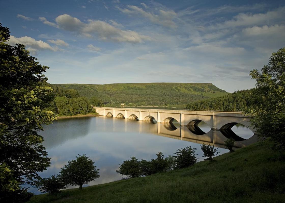
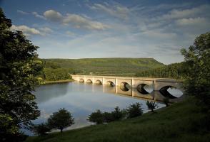
Turn left and follow the wide track above the shoreline until just before the dam. Here go right, through a kissing gate, then right again down steps (or the straight on along the ramped path to avoid the steps). Walk across the grass in front of the dam to return to the car park at Fairholmes.
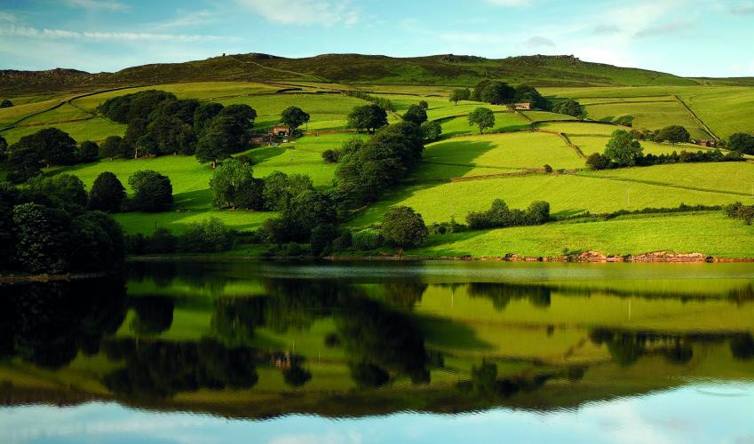
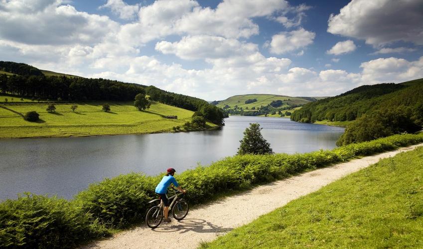
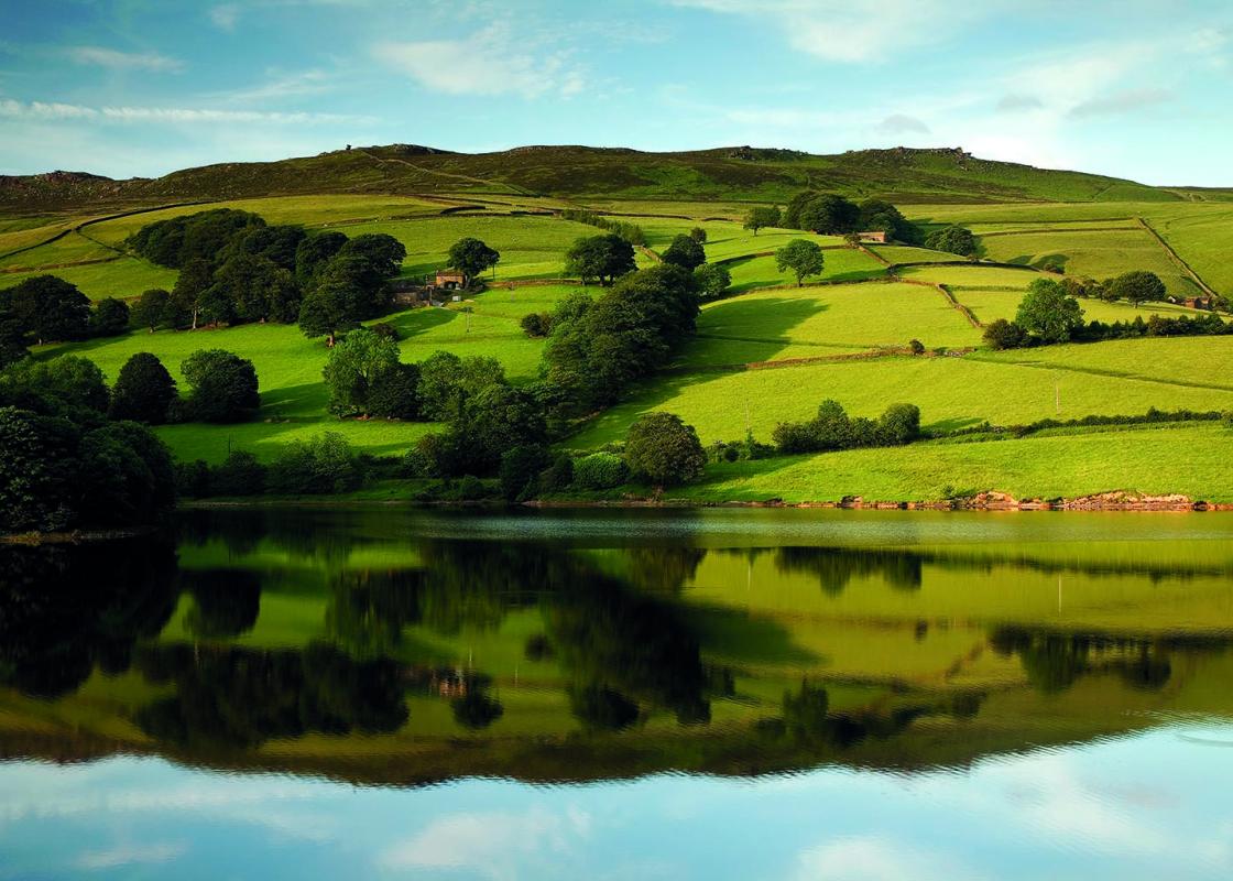
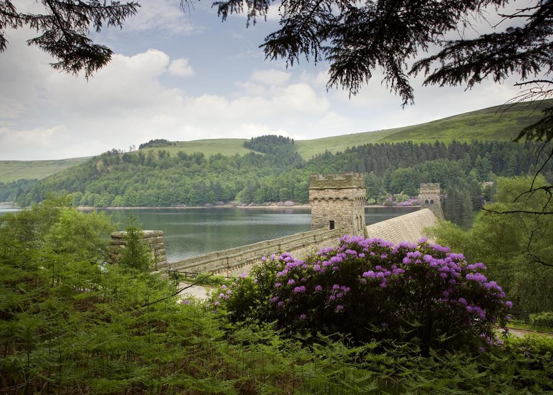
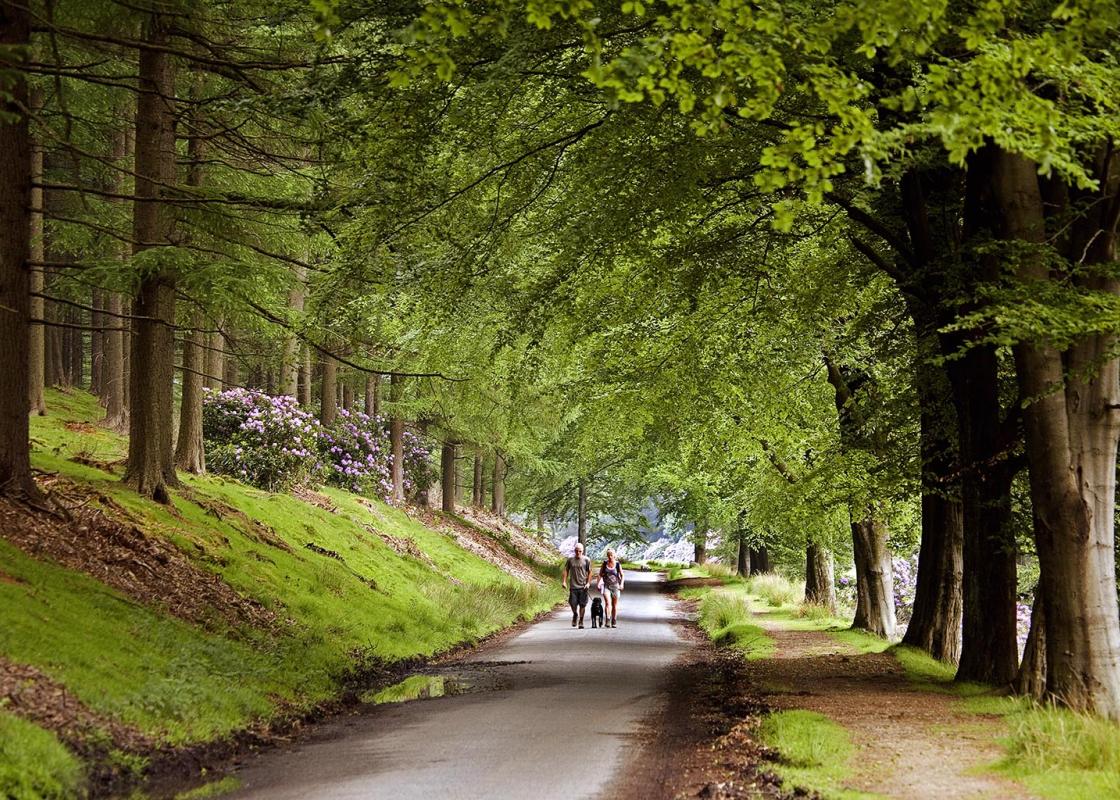
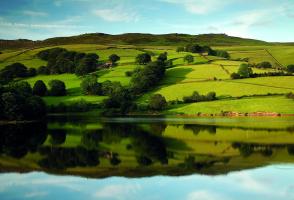
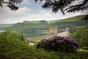
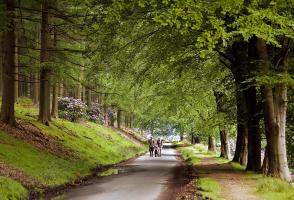
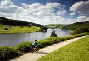
The woodland-fringed reservoirs of the Upper Derwent Valley are popular with walkers and sightseers alike, but when you get up on to the moors above the landscape feels altogether different. The steep-sided valley gives way to miles of bare and largely featureless moorland, save for occasional... weirdly shaped rocky outcrops. Striding across what for the most part are flat moorland paths there’s a sense of immense space and far horizons. It’s an altogether different walking experience than down in the confined valley, much of which is clothed in woodland, scrub and bracken. Weathered Over Time The walk to Back Tor begins with an easy stroll along the eastern shore of Ladybower Reservoir, but all the time you keep glancing up at the dark, rigid moorland edge high on your left. Soon you head up the bracken-covered hillside to reach the moorland top, after which it’s mostly a level ‘edge’ path all the way. At regular intervals there are extravagantly shaped rocky outcrops, where the gritstone has been weathered over many years to produce extraordinary formations. Their names often reflect what, to some at least, they resemble in shape or outline, including the Wheel Stones, Salt Cellar and Cakes of Bread. The Hurkling Stones can be found off the path at the southern end of the edge, hurkling meaning to crouch or bend. Some outcrops have less prosaic names but are no less striking, including Dovestone Tor and Back Tor itself, where the white trig point is attached to the highest of several giant boulders and necessitates a mild scramble to reach it. However, the views from the top are certainly worth it, taking in Kinder Scout and Bleaklow away to the west and the distant metropolis of Sheffield to the east, whilst immediately about you the moorland stretches for mile upon mile. A Sad Story Beyond Back Tor the path drops down to the lower point of Lost Lad, where the cairn marks the spot where a young shepherd boy perished. He lived in nearby Derwent village (itself since ‘drowned’ by the creation of Ladybower Reservoir) with his widowed mother, and one winter’s day he set out to find some missing sheep. But he got caught in a snowstorm and took shelter under a large rock, first scratching the words ‘lost lad’ on it. Sadly he succumbed to the blizzard, and later that spring some shepherds noticed the message on the rock and discovered his body. Since then, passing shepherds have placed a stone near the location in his memory, so that over time the stones have built up into the cairn you see today.
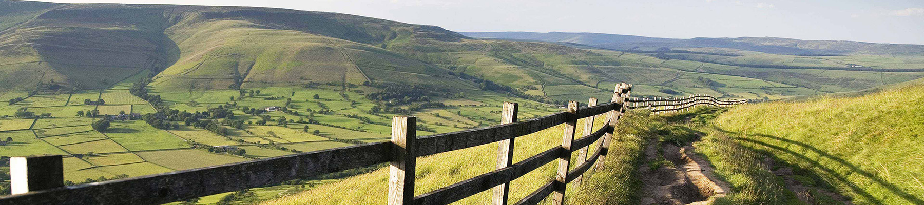
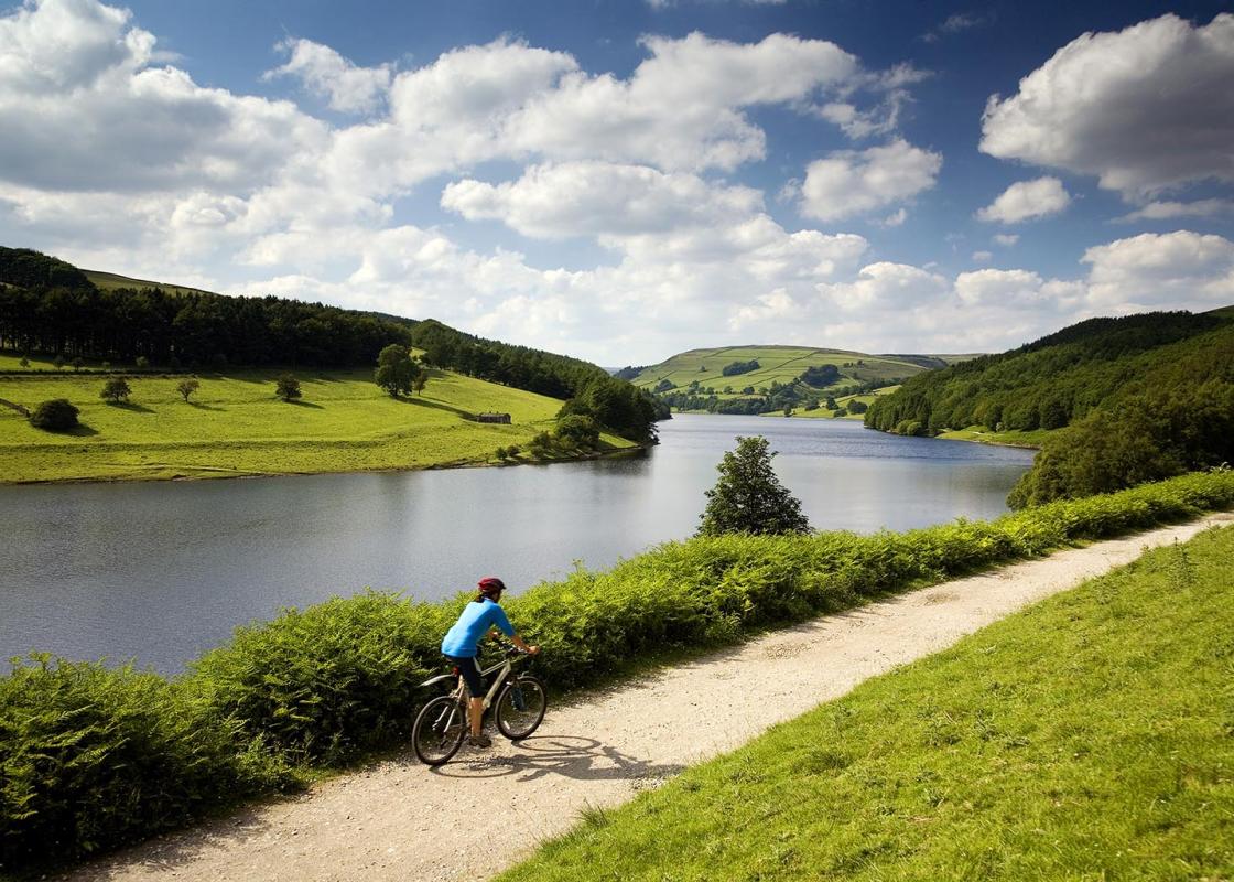
The natural features of this central English county range from the modest heights of the Peak District National Park, where Kinder Scout stands at 2,088 ft (636 m), to the depths of its remarkable underground caverns, floodlit to reveal exquisite Blue John stone. Walkers and cyclists will enjoy the High Peak Trail which extends from the Derwent Valley to the limestone plateau near Buxton, and for many, the spectacular scenery is what draws them to the area.
From the visitor centre at Fairholmes turn left and walk along the short, fenced path through the woods, with the river below to your right, then on along a lane with the dam away to the left. Follow the road as it bends right and continues on above the eastern shore of the reservoir.
1 of 6
After just over a mile (1.6km) you come to two gates. Go through the smaller one on the left for a paved path uphill signposted ‘Public footpath via Derwent Edge to Moscar’. Follow this past some stone barns (one of which is a walkers’ shelter) and then ford Grindle Clough’s stream. Continue alongside a conifer plantation until you reach the top of the moorland edge.
2 of 6
At the junction of routes turn left on to the popular path along the edge. Continue past a succession of large rocky outcrops – the Wheel Stones, Salt Cellar and Cakes of Bread – before reaching Back Tor with its prominent trig point on the highest boulder.
3 of 6
From here take the flagged path northwest to Lost Lad and on to the top of a broad spur of the hill. The route now swings westwards and descends a steep grassy slope. When the gradient eases you soon come to an easily missed junction of grassy tracks.
4 of 6
Fork left across Green Sitches and on through a tumbledown wall, ignoring the path to the left. Where the path forks go right to a clearly visible gate and stile. The waymarked path heads northwest down the rough grassy hillside before swinging left by an old wall. It descends to a path junction near the ruins of Bamford House. Go straight over for the steep winding path down to the reservoir.
5 of 6
Turn left and follow the wide track above the shoreline until just before the dam. Here go right, through a kissing gate, then right again down steps (or the straight on along the ramped path to avoid the steps). Walk across the grass in front of the dam to return to the car park at Fairholmes.
The woodland-fringed reservoirs of the Upper Derwent Valley are popular with walkers and sightseers alike, but when you get up on to the moors above the landscape feels altogether different. The steep-sided valley gives way to miles of bare and largely featureless moorland, save for occasional... weirdly shaped rocky outcrops. Striding across what for the most part are flat moorland paths there’s a sense of immense space and far horizons. It’s an altogether different walking experience than down in the confined valley, much of which is clothed in woodland, scrub and bracken. Weathered Over Time The walk to Back Tor begins with an easy stroll along the eastern shore of Ladybower Reservoir, but all the time you keep glancing up at the dark, rigid moorland edge high on your left. Soon you head up the bracken-covered hillside to reach the moorland top, after which it’s mostly a level ‘edge’ path all the way. At regular intervals there are extravagantly shaped rocky outcrops, where the gritstone has been weathered over many years to produce extraordinary formations. Their names often reflect what, to some at least, they resemble in shape or outline, including the Wheel Stones, Salt Cellar and Cakes of Bread. The Hurkling Stones can be found off the path at the southern end of the edge, hurkling meaning to crouch or bend. Some outcrops have less prosaic names but are no less striking, including Dovestone Tor and Back Tor itself, where the white trig point is attached to the highest of several giant boulders and necessitates a mild scramble to reach it. However, the views from the top are certainly worth it, taking in Kinder Scout and Bleaklow away to the west and the distant metropolis of Sheffield to the east, whilst immediately about you the moorland stretches for mile upon mile. A Sad Story Beyond Back Tor the path drops down to the lower point of Lost Lad, where the cairn marks the spot where a young shepherd boy perished. He lived in nearby Derwent village (itself since ‘drowned’ by the creation of Ladybower Reservoir) with his widowed mother, and one winter’s day he set out to find some missing sheep. But he got caught in a snowstorm and took shelter under a large rock, first scratching the words ‘lost lad’ on it. Sadly he succumbed to the blizzard, and later that spring some shepherds noticed the message on the rock and discovered his body. Since then, passing shepherds have placed a stone near the location in his memory, so that over time the stones have built up into the cairn you see today.
The natural features of this central English county range from the modest heights of the Peak District National Park, where Kinder Scout stands at 2,088 ft (636 m), to the depths of its remarkable underground caverns, floodlit to reveal exquisite Blue John stone. Walkers and cyclists will enjoy the High Peak Trail which extends from the Derwent Valley to the limestone plateau near Buxton, and for many, the spectacular scenery is what draws them to the area.