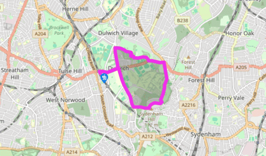
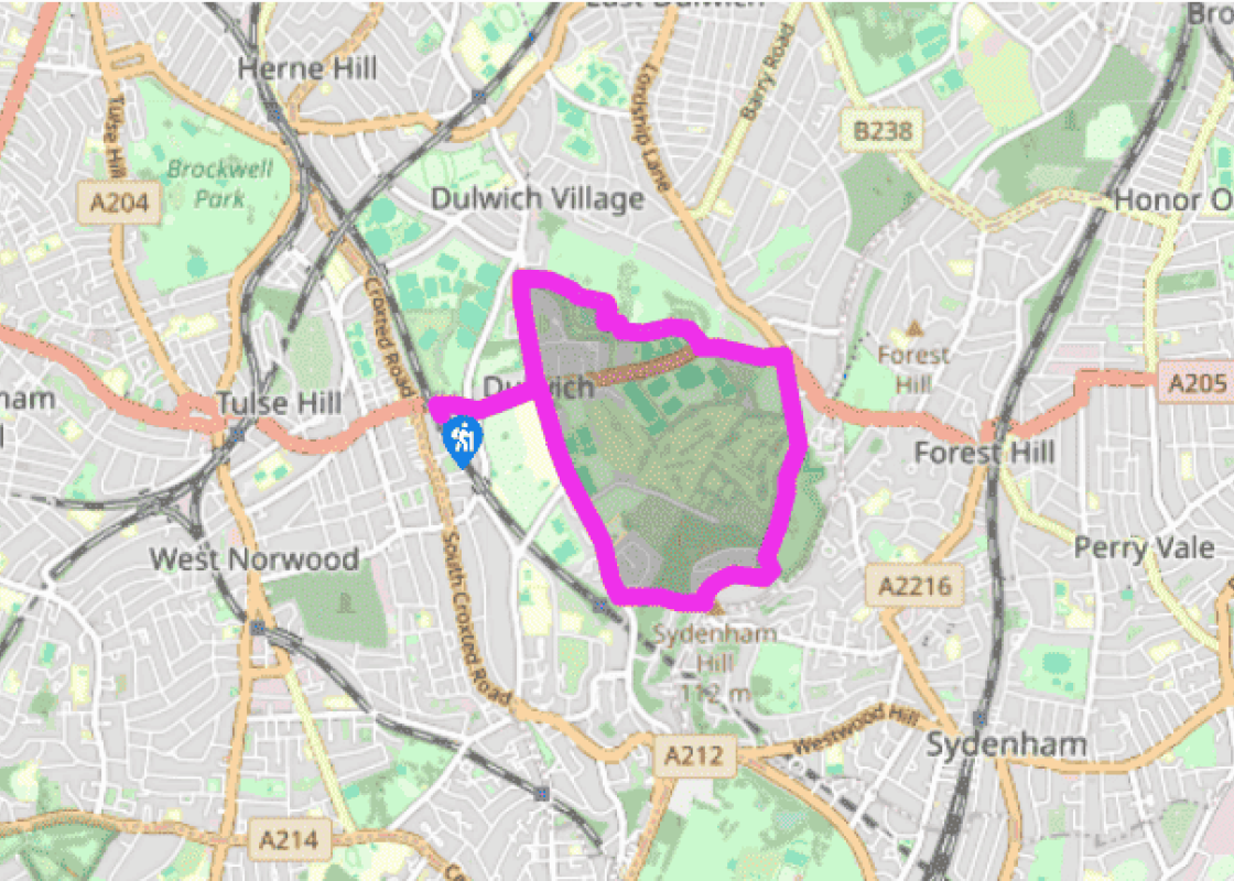
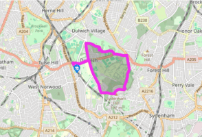
From West Dulwich station turn right along Thurlow Park Road, cross the road and turn right again, just after passing the playing fields, into College Road (marked ‘private road’). Follow the road past the toll gate, which dates from 1789. A board by the roadside, to the left, indicates that the pre-decimalisation amount payable for cars to pass here was 6d (2.5 new pence). You’ll have to pay more for that privilege now, though it’s free for pedestrians. This is the last toll gate in use in London. It was erected by a farmer who rented the surrounding fields from Dulwich College, and they continued the tradition after his death. After a further 550yds (503m) find a path on your left, practically opposite Sydenham Hill Station.
Walk through the kissing gate and into Low Cross Wood Lane (unmarked), which climbs steeply to reach another gate. Opposite this is an Italianate-style pub, Dulwich Wood House. Turn left into Crescent Wood Road and continue, opposite Countisbury House, through another kissing gate, set in a black railing fence, into Sydenham Woods, a nature reserve managed by the London Wildlife Trust.
Walk down the slope and turn right. Follow the track to the right, past a post marked with a No. 1. Continue on the path that descends quite quickly, and to the left of another post marked with a yellow No. 4 is a small set of ‘ruins’ (actually a Victorian folly). Bear left and, further on, you will pass a boggy pond. The short path to the left meets a long path that follows the trackbed of an old railway. If you’d like to see the remains of the railway tunnel, turn left and retrace your steps; otherwise turn right. Where the path ends by a bench and a white-topped post, go up steps on the left and bear right to follow a row of green wooden posts. In winter there are good views across London from here. Go through a kissing gate and continue ahead, ignoring the large bridge on your right, along Cox’s Walk, a wide path that passes the golf course.
At the end turn left, along Dulwich Common Road. After 440yds (402m) turn right into Dulwich Park. Take the wide tarmac path on the left. Just after the playground area (to your right) take the central path, then bear right, to follow the lake path. Cross the boardwalk over the lake.
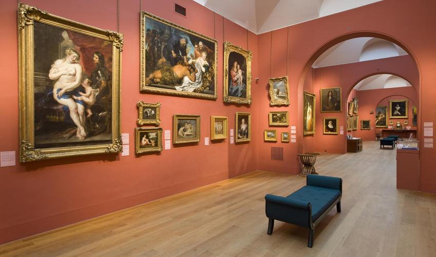
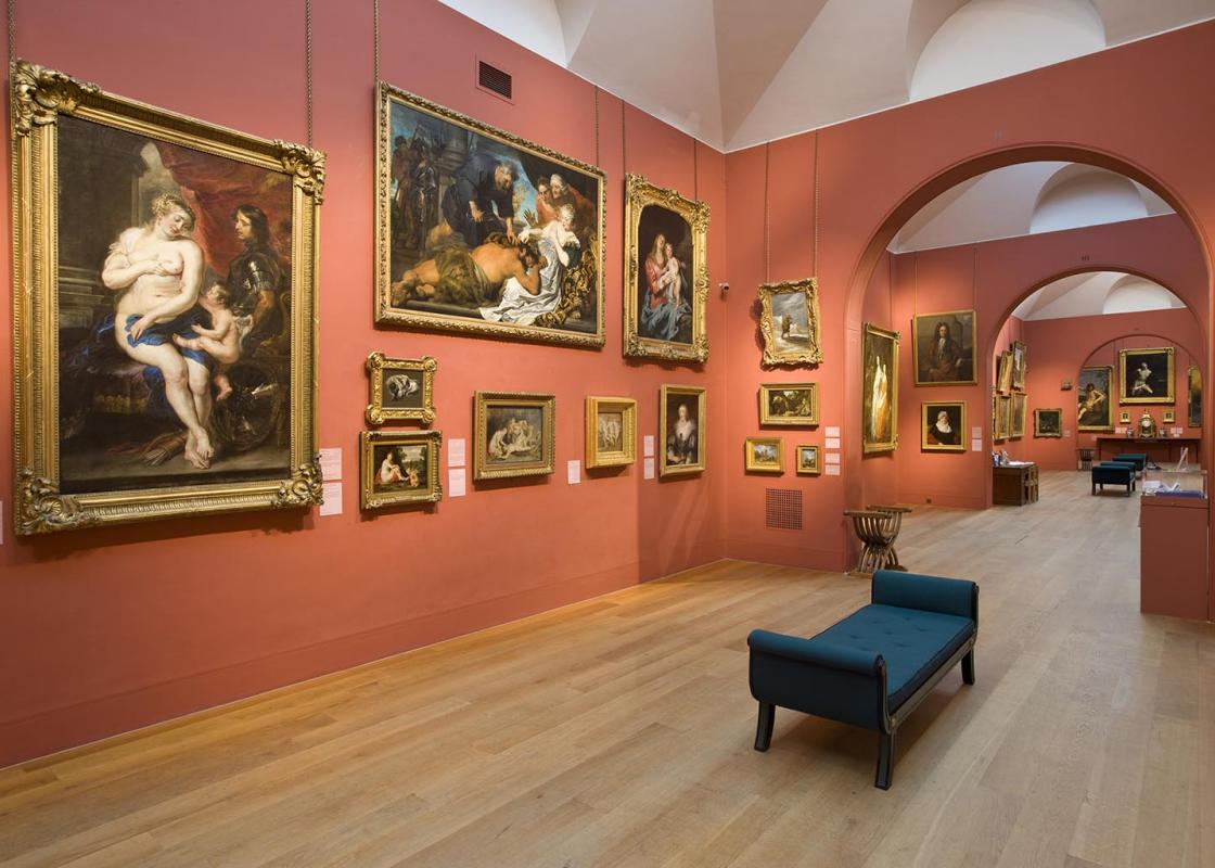
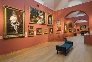
Bear left and walk beside the lake to take the path to the park gates, which leads after a few paces on to College Road. Turn left and continue along this road (Dulwich Picture Gallery is opposite). At Dulwich Common Road turn right to retrace your steps back to West Dulwich station.
Dulwich is one of London’s oldest recorded villages – it became a part of London when the city was expanded administratively. A few minutes from the South Circular, Dulwich is still a world apart from the capital. While the famed Dulwich College may be its centrepiece, this is only the tip of the... iceberg, for there are some quaint medieval lanes and woodlands too. Dulwich College was established in 1619 to educate poor local boys. The founder was Edward Alleyn, who had risen from humble beginnings as the son of a London publican to become an impresario and prominent Elizabethan actor, as well as owner of a Bankside playhouse. Even today, former pupils are known as ‘Old Alleynians’. The college was moved to its current site in the 1870s. The main buildings, made of a deep red-brick that resembles terracotta, were created by Charles Barry junior, the son of the famous Victorian architect who designed the Palace of Westminster. Antarctic adventure Ernest Shackleton (1874–1922) attended Dulwich College for three years when his family lived at Sydenham. He left, aged 16, to join the Merchant Navy. Ten years later he joined the 1901–04 British expedition to the South Pole, led by Captain Scott. At the age of 33, while leading his own gruelling expedition, he came within 97 miles (156km) of the South Pole. Despite this failure, it was Shackleton’s dogged and inspirational leadership that won him respect. Determined not to repeat Scott’s tragic mistakes, he led his team safely out of the Antarctic with no loss of life. Literary life Another famous old boy was the writer P G Wodehouse (1881–1975), creator of much-loved comic characters such as Bertie Wooster and his ‘gentleman’s gentleman’ Jeeves, and the eccentric Lord Emsworth with his favourite pig the Empress of Blandings. Wodehouse, who attended Dulwich College from 1894 until 1900, much enjoyed his time there, referring to it as: ‘six years of unbroken bliss’. Dulwich often appeared in his books as Valley Fields. In 1939 Wodehouse returned to the school and wrote a report of a cricket match for The Alleynian, the school magazine which is still being produced today. The year Wodehouse left Dulwich a new boy called Raymond Chandler (1888–1959) joined the school. He, of course, went on to create the fictional private eye Philip Marlowe.
Greater London is one of the world’s largest urban areas; 33 boroughs stretching north to Enfield, south to Croydon, east to Havering, west to Hillingdon and with central London at the heart of it all. Greater London contains a multitude of parks and green spaces, from the six Royal Parks to other huge open spaces like Hampstead Heath and Clapham Common.
From West Dulwich station turn right along Thurlow Park Road, cross the road and turn right again, just after passing the playing fields, into College Road (marked ‘private road’). Follow the road past the toll gate, which dates from 1789. A board by the roadside, to the left, indicates that the pre-decimalisation amount payable for cars to pass here was 6d (2.5 new pence). You’ll have to pay more for that privilege now, though it’s free for pedestrians. This is the last toll gate in use in London. It was erected by a farmer who rented the surrounding fields from Dulwich College, and they continued the tradition after his death. After a further 550yds (503m) find a path on your left, practically opposite Sydenham Hill Station.
1 of 5
Walk through the kissing gate and into Low Cross Wood Lane (unmarked), which climbs steeply to reach another gate. Opposite this is an Italianate-style pub, Dulwich Wood House. Turn left into Crescent Wood Road and continue, opposite Countisbury House, through another kissing gate, set in a black railing fence, into Sydenham Woods, a nature reserve managed by the London Wildlife Trust.
2 of 5
Walk down the slope and turn right. Follow the track to the right, past a post marked with a No. 1. Continue on the path that descends quite quickly, and to the left of another post marked with a yellow No. 4 is a small set of ‘ruins’ (actually a Victorian folly). Bear left and, further on, you will pass a boggy pond. The short path to the left meets a long path that follows the trackbed of an old railway. If you’d like to see the remains of the railway tunnel, turn left and retrace your steps; otherwise turn right. Where the path ends by a bench and a white-topped post, go up steps on the left and bear right to follow a row of green wooden posts. In winter there are good views across London from here. Go through a kissing gate and continue ahead, ignoring the large bridge on your right, along Cox’s Walk, a wide path that passes the golf course.
3 of 5
At the end turn left, along Dulwich Common Road. After 440yds (402m) turn right into Dulwich Park. Take the wide tarmac path on the left. Just after the playground area (to your right) take the central path, then bear right, to follow the lake path. Cross the boardwalk over the lake.
4 of 5
Bear left and walk beside the lake to take the path to the park gates, which leads after a few paces on to College Road. Turn left and continue along this road (Dulwich Picture Gallery is opposite). At Dulwich Common Road turn right to retrace your steps back to West Dulwich station.
Dulwich is one of London’s oldest recorded villages – it became a part of London when the city was expanded administratively. A few minutes from the South Circular, Dulwich is still a world apart from the capital. While the famed Dulwich College may be its centrepiece, this is only the tip of the... iceberg, for there are some quaint medieval lanes and woodlands too. Dulwich College was established in 1619 to educate poor local boys. The founder was Edward Alleyn, who had risen from humble beginnings as the son of a London publican to become an impresario and prominent Elizabethan actor, as well as owner of a Bankside playhouse. Even today, former pupils are known as ‘Old Alleynians’. The college was moved to its current site in the 1870s. The main buildings, made of a deep red-brick that resembles terracotta, were created by Charles Barry junior, the son of the famous Victorian architect who designed the Palace of Westminster. Antarctic adventure Ernest Shackleton (1874–1922) attended Dulwich College for three years when his family lived at Sydenham. He left, aged 16, to join the Merchant Navy. Ten years later he joined the 1901–04 British expedition to the South Pole, led by Captain Scott. At the age of 33, while leading his own gruelling expedition, he came within 97 miles (156km) of the South Pole. Despite this failure, it was Shackleton’s dogged and inspirational leadership that won him respect. Determined not to repeat Scott’s tragic mistakes, he led his team safely out of the Antarctic with no loss of life. Literary life Another famous old boy was the writer P G Wodehouse (1881–1975), creator of much-loved comic characters such as Bertie Wooster and his ‘gentleman’s gentleman’ Jeeves, and the eccentric Lord Emsworth with his favourite pig the Empress of Blandings. Wodehouse, who attended Dulwich College from 1894 until 1900, much enjoyed his time there, referring to it as: ‘six years of unbroken bliss’. Dulwich often appeared in his books as Valley Fields. In 1939 Wodehouse returned to the school and wrote a report of a cricket match for The Alleynian, the school magazine which is still being produced today. The year Wodehouse left Dulwich a new boy called Raymond Chandler (1888–1959) joined the school. He, of course, went on to create the fictional private eye Philip Marlowe.
Greater London is one of the world’s largest urban areas; 33 boroughs stretching north to Enfield, south to Croydon, east to Havering, west to Hillingdon and with central London at the heart of it all. Greater London contains a multitude of parks and green spaces, from the six Royal Parks to other huge open spaces like Hampstead Heath and Clapham Common.