"A demanding trek along the ridges of the southern end of the Vale of Ewyas"
Walk directions
Walk towards the bridge, but before you cross it, bear left up a narrow lane, signposted to The Grange Pony Trekking Centre. Follow this along the side of the stream and past a footpath on the left, marked by a stone archway. Continue to a drive on the left, again leading to the trekking centre, and follow this up to a cluster of barns.
Keep right here and continue uphill to a large house on the right, with a gate blocking your progress ahead. Bear around to the left and climb on a loose rocky track that leads up to another gate. Pass through this and follow a rough, eroded track as it zig-zags up on to easier ground. Cross the source of a small stream, and continue to the foot of a steep zig-zag track that climbs
steeply up the escarpment.
Follow this, bearing both right and left and then, as the gradient eases, continue ahead on a broad and often boggy track. Take this past a few small cairns to a large one, the Blacksmith’s Anvil, that sits on top of the ridge. Turn left here and continue to follow the track south over Chwarel y Fan.
Walk straight on, along the line of the ridge, to reach the summit of Bal-Mawr. Carrying on the same track, go down to the left and pass a good track on your left-hand side. Keep ahead to a cairn and then descend to the left. Drop to a fork where you keep right to follow the brook to a crossroads of paths. Maintain your direction (signposted ‘Cwm Bwchel’).
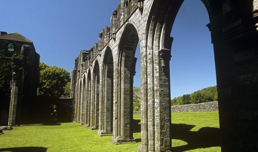
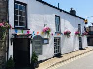
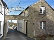
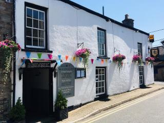
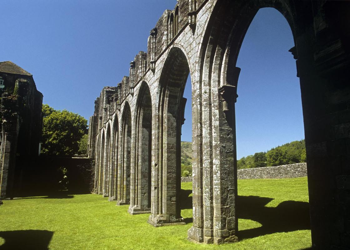
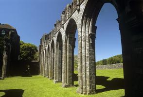
Cross a stile, down past a house, and over another stile. Ignore another stile on the right and continue down to another at the bottom of the field. Cross this and bear right to cross another and a footbridge. Keep walking straight ahead to another stile and then continue to a gate. Go immediately through a small metal gate and follow the stream down through another gate to another footbridge. Cross this and take the lane to the road. Turn left here, then turn right to visit the priory.
Go through a gate on the left, in front of the priory (signposted to Hatterrall Hill), and follow the main track to a stream, where you turn left to a gate. Continue through a succession of fields, over two stiles and a small copse. Follow the path up on to the ridge and continue to a T-junction; Offa’s Dyke is where you turn left.
Walk along Offa’s Dyke, pass the trig point and continue for another mile (1.6km) to a cairn and a marker stone at a crossroads of paths. Turn left and follow the path down around a sharp left-right zig-zag to a fence. Turn right here, then turn left over a stile. Walk down, over another stile to a hedge at the bottom of the next field, cross another stile and carry on down, before bearing right, crossing a stream and turning left to pass over a stile and onwards onto a tarmac lane. Turn right through a gate and follow this through a yard, where it becomes a rough track. Keep ahead to a sharp left-hand bend and keep straight ahead, up steps and over a stile. Continue straight ahead through more fields to join another lane and follow this down, past two chapels to the road. Turn left to return to your car.
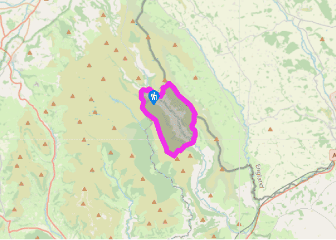
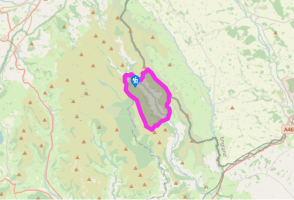
The sheer size of the Vale of Ewyas means that it’s best explored in two different walks. The northern reaches are crossed in Walk 28, while this one tracks south from Capel-y-ffin to loop around the tiny settlement of Llanthony. This circuit has the added advantage of passing the ruins of... Llanthony Priory and the opportunity of a great pub at the half-way stage. The down side is that the head of the valley is some way to the north so, in order to follow both ridges, you’ll have to drop into the foot of the valley and then climb out again. The early stages of both walks follow the same line as far as the crest of the Ffawyddog ridge. From here, this circuit will take you south, over the distinctive serrated skyline of Chwarel y Fan, the site of some disused quarries and, at 2,227ft (679m), the highest point of the day. The ridge then drops steadily down to Bal-Mawr, where you’ll follow the banks of the Bwchel brook, through Cwm Bwchel, to the hamlet of Llanthony. From the priory, it’s up again, easily at first as you cross the fields adjacent to the ruins, but then steeply to gain a blunt spur that leads on to the slim ridge of Hatterrall. Offa’s Dyke Path follows the crest of the ridge, as does the border. Another steep drop brings you back to the pastures above Capel-y-ffin, where you’ll pass two tiny, whitewashed chapels before you reach the road. In an attempt to keep the Welsh to the west, King Offa, the 8th-century ruler of Mercia (Central England), decided to mark out his borders using a deep ditch and an earth wall to strengthen any natural boundaries such as rivers or ridges. It ran from Prestatyn, on the north coast of Wales, to Chepstow, at the mouth of the River Wye. In places, it was over 20ft (6m) high and 60ft (18m) wide. Although the official border has changed a little in the ensuing years, it still follows a similar line to the original earthworks. Offa’s Dyke National Trail opened in 1971. It follows the north–south line of the dyke for 177 miles (285km) and showcases the incredible diversity of the Welsh countryside.
The largest unitary authority in Wales, Powys covers an area of approximately 2,000 square miles. Much of that is mountainous because it actually has the lowest population density of all the Welsh counties.
"A demanding trek along the ridges of the southern end of the Vale of Ewyas"
Walk details
5hrs 30mins
Difficulty:
Hard
Gradient:
Challenging
Distance:
9.5 miles (15.3kms)
Ascent:
2460ft (750m)
Walk directions
Walk towards the bridge, but before you cross it, bear left up a narrow lane, signposted to The Grange Pony Trekking Centre. Follow this along the side of the stream and past a footpath on the left, marked by a stone archway. Continue to a drive on the left, again leading to the trekking centre, and follow this up to a cluster of barns.
1 of 7
Keep right here and continue uphill to a large house on the right, with a gate blocking your progress ahead. Bear around to the left and climb on a loose rocky track that leads up to another gate. Pass through this and follow a rough, eroded track as it zig-zags up on to easier ground. Cross the source of a small stream, and continue to the foot of a steep zig-zag track that climbs
steeply up the escarpment.
2 of 7
Follow this, bearing both right and left and then, as the gradient eases, continue ahead on a broad and often boggy track. Take this past a few small cairns to a large one, the Blacksmith’s Anvil, that sits on top of the ridge. Turn left here and continue to follow the track south over Chwarel y Fan.
3 of 7
Walk straight on, along the line of the ridge, to reach the summit of Bal-Mawr. Carrying on the same track, go down to the left and pass a good track on your left-hand side. Keep ahead to a cairn and then descend to the left. Drop to a fork where you keep right to follow the brook to a crossroads of paths. Maintain your direction (signposted ‘Cwm Bwchel’).
4 of 7
Cross a stile, down past a house, and over another stile. Ignore another stile on the right and continue down to another at the bottom of the field. Cross this and bear right to cross another and a footbridge. Keep walking straight ahead to another stile and then continue to a gate. Go immediately through a small metal gate and follow the stream down through another gate to another footbridge. Cross this and take the lane to the road. Turn left here, then turn right to visit the priory.
5 of 7
Go through a gate on the left, in front of the priory (signposted to Hatterrall Hill), and follow the main track to a stream, where you turn left to a gate. Continue through a succession of fields, over two stiles and a small copse. Follow the path up on to the ridge and continue to a T-junction; Offa’s Dyke is where you turn left.
6 of 7
Walk along Offa’s Dyke, pass the trig point and continue for another mile (1.6km) to a cairn and a marker stone at a crossroads of paths. Turn left and follow the path down around a sharp left-right zig-zag to a fence. Turn right here, then turn left over a stile. Walk down, over another stile to a hedge at the bottom of the next field, cross another stile and carry on down, before bearing right, crossing a stream and turning left to pass over a stile and onwards onto a tarmac lane. Turn right through a gate and follow this through a yard, where it becomes a rough track. Keep ahead to a sharp left-hand bend and keep straight ahead, up steps and over a stile. Continue straight ahead through more fields to join another lane and follow this down, past two chapels to the road. Turn left to return to your car.
The sheer size of the Vale of Ewyas means that it’s best explored in two different walks. The northern reaches are crossed in Walk 28, while this one tracks south from Capel-y-ffin to loop around the tiny settlement of Llanthony. This circuit has the added advantage of passing the ruins of... Llanthony Priory and the opportunity of a great pub at the half-way stage. The down side is that the head of the valley is some way to the north so, in order to follow both ridges, you’ll have to drop into the foot of the valley and then climb out again. The early stages of both walks follow the same line as far as the crest of the Ffawyddog ridge. From here, this circuit will take you south, over the distinctive serrated skyline of Chwarel y Fan, the site of some disused quarries and, at 2,227ft (679m), the highest point of the day. The ridge then drops steadily down to Bal-Mawr, where you’ll follow the banks of the Bwchel brook, through Cwm Bwchel, to the hamlet of Llanthony. From the priory, it’s up again, easily at first as you cross the fields adjacent to the ruins, but then steeply to gain a blunt spur that leads on to the slim ridge of Hatterrall. Offa’s Dyke Path follows the crest of the ridge, as does the border. Another steep drop brings you back to the pastures above Capel-y-ffin, where you’ll pass two tiny, whitewashed chapels before you reach the road. In an attempt to keep the Welsh to the west, King Offa, the 8th-century ruler of Mercia (Central England), decided to mark out his borders using a deep ditch and an earth wall to strengthen any natural boundaries such as rivers or ridges. It ran from Prestatyn, on the north coast of Wales, to Chepstow, at the mouth of the River Wye. In places, it was over 20ft (6m) high and 60ft (18m) wide. Although the official border has changed a little in the ensuing years, it still follows a similar line to the original earthworks. Offa’s Dyke National Trail opened in 1971. It follows the north–south line of the dyke for 177 miles (285km) and showcases the incredible diversity of the Welsh countryside.
The largest unitary authority in Wales, Powys covers an area of approximately 2,000 square miles. Much of that is mountainous because it actually has the lowest population density of all the Welsh counties.