"A lesson in Suffolk architecture on a cross-country walk from a pretty village to a historic town."
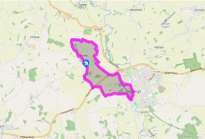
Walk directions
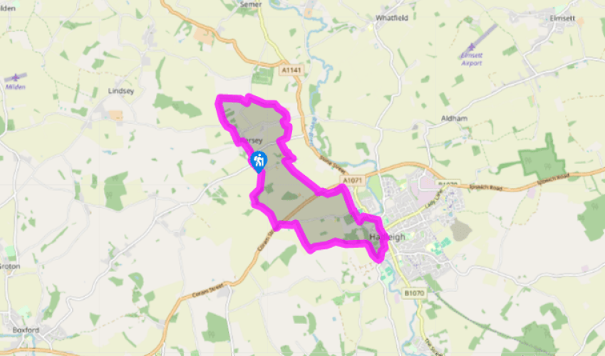
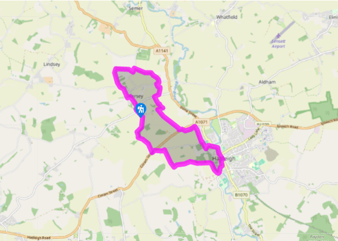
Walk down the main street and cross the Splash, the local name for the ford. After passing the first house, turn left along a track called Kedges Lane then right through the allotments and climb a field-edge path to a road. Walk left for 150yds (137m) then turn right on a fenced-off path. At the end of the meadow, turn right beside a ditch, crossing a footbridge and arriving at a road.
Turn left and in 75yds (69m) go right on a bridleway between the trees. The path bends right and descends towards a farm. Turn right along the farm track and briefly right along a road, then left by a shed to cross a field. Turn left alongside a stream and cross a footbridge, then climb steps and continue uphill towards a road.
Turn right for 100yds (91m) then left on to a farm drive marked 'Noakes'. Walk round to the left of the farm buildings and look for a narrow path alongside a hedge. When you reach a junction, turn right and go left just after a telegraph pole to cross the fields. Cross a footbridge and continue straight ahead before bearing half left and through a hedge to meet the A1071. This path may be diverted by crops so it is best to follow the obvious route rather than sticking to the right of way.
Cross the road, bear left across a field and turn left along a shady green lane. In a few paces bear half right across a field, keeping right at the field boundary, soon to follow the path left between gardens to a road. Turn right, cross Friars Hill and walk past the cricket ground with the cemetery wall to your right. Pass through a gate and turn half left across the recreation ground to arrive at riverside meadows. Cross the footbridge up ahead of you and walk through the car park on to Bridge Street.
Turn right and right again to walk along High Street. After 400yds (366m), turn right along Church Street to reach St Mary's Church. The Guildhall is on your left. Walk through the gate to the right of the Guildhall (if this is closed, walk around the building to the left). Continue straight ahead to reach a main road, then turn right to cross Toppesfield Bridge.
Ignore the signposted Riverside Walk and turn to the right on a field-edge track behind the riverside park. When the path divides, keep left to climb to Broom Hill nature reserve and continue up Constitution Hill, ignoring paths left and right. Turn right at a wide track and continue to a road, where you turn left.
Turn left at the A1071, then right in a few paces on to a waymarked track. At the corner of a field, keep to the right to drop down towards a cottage. Cross a footbridge and stile to the right of the cottage and turn right along the lane to return to Kersey. After the first house, follow the road left. Just after you pass a small green, follow the road round to the right and then turn left past the primary school to St Mary's Church. A steep footpath alongside the churchyard returns you to the main street.
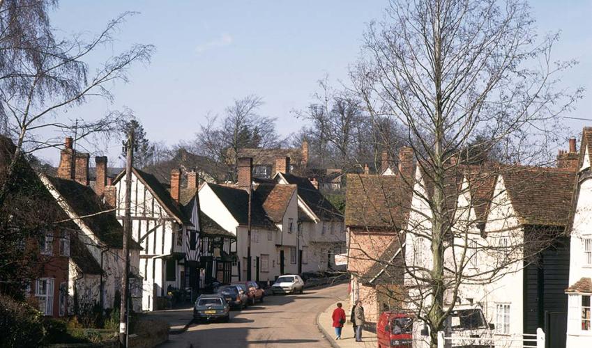
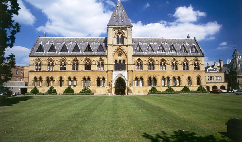
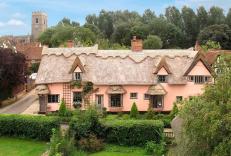
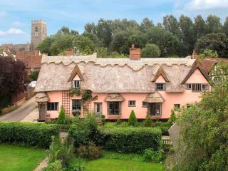
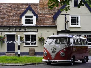
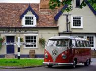
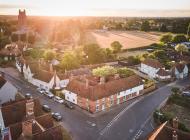
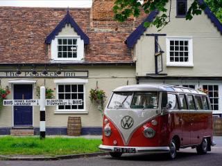
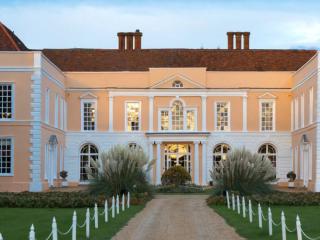
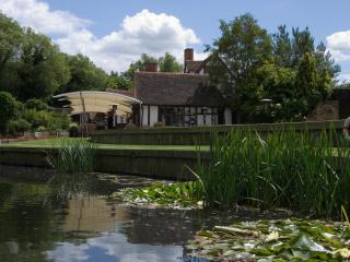
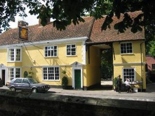
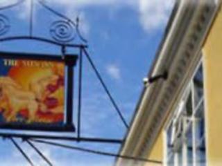
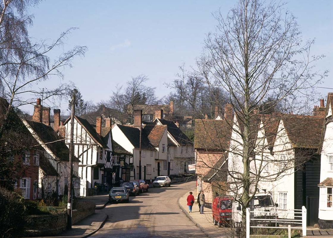
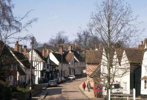
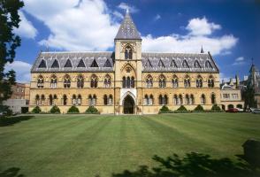
The village of Kersey, nestling deep in its own small vale, is one of those places that captures the essence of rural Suffolk. Medieval houses and cottages line the main street, climbing up steep slopes to either side of a ford. Children throw bread to the ducks. A thatcher works on a roof. Come... here on a summer day and it is such a perfect scene that it is easy to forget that most of the locals have gone off to work in Ipswich and that the people you see are tourists. Medieval houses This walk takes you across the fields from Kersey to Hadleigh, a historic market town full of interesting buildings. From the 14th to 16th centuries, Hadleigh was a centre of the wool trade, and many of the half-timbered merchants' houses along the High Street date from that time. Timberframing was common in East Anglia, using oak from coppiced woods, with large uprights used to build the main frame and the spaces between the timbers filled with 'wattle' (smaller sticks bundled together with twine) and 'daub' (a mixture of mud and straw) before being coated with whitewash or lime. Even those houses that appear to have Georgian brick façades are often timber-framed underneath. Ornamental plasterwork Another common feature of Suffolk architecture, both here and in the other wool towns, is pargeting. This involves decorating the façade of a house with ornamental plasterwork, often in the form of symbols. There are several fine examples along Hadleigh High Street. Although pargeting is generally associated with the 17th century, there has recently been a revival of interest in this East Anglian craft and it is starting to appear on houses once again. In the churchyard at Hadleigh are three contrasting buildings, each constructed from a different material. St Mary's Church, like most Suffolk churches, is built of flint, though unusually it has a spire rather than a tower. The 14th-century Guildhall is timber-framed and has been used as a market hall, workhouse, grammar school and corset factory before finding its present use as the town hall and council chamber. On summer afternoons you can enjoy a cream tea in the walled garden. The Oxford Movement The red-brick Deanery Tower of 1495, six storeys high and surmounted by turrets, was built for William Pykenham, Archdeacon of Suffolk and rector of Hadleigh, as the gateway for a planned manor house. In 1833 it was the setting for one of the first meetings of the Oxford Movement, that aimed to restore traditional Catholic values and ritual to the Church of England. The three buildings together form a surprisingly harmonious ensemble, and the same could be said of Kersey and Hadleigh as a whole.
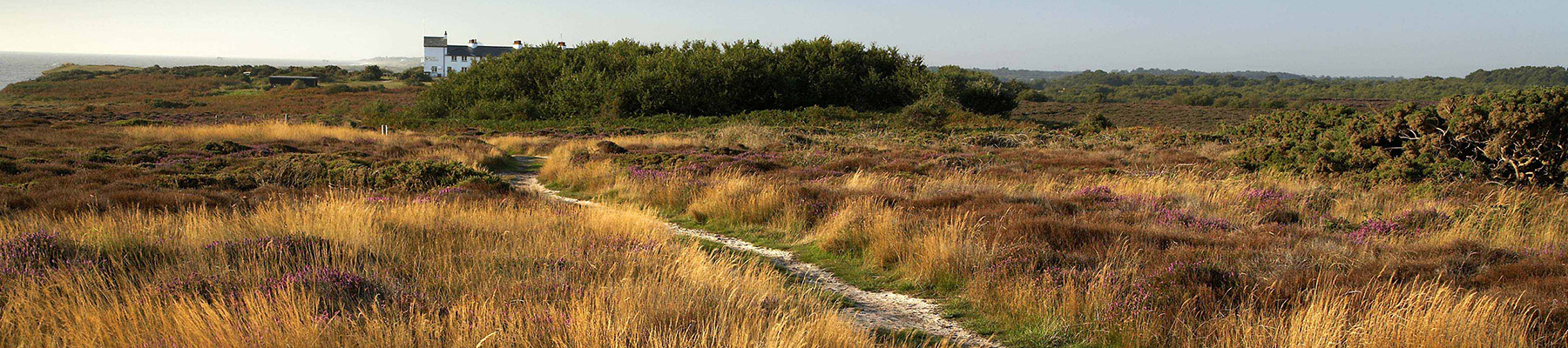
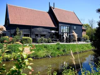
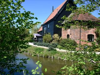
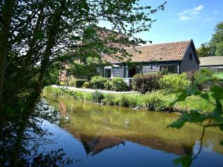
Suffolk is Constable country, where the county’s crumbling, time-ravaged coastline spreads itself under wide skies to convey a wonderful sense of remoteness and solitude. Highly evocative and atmospheric, this is where rivers wind lazily to the sea and notorious 18th-century smugglers hid from the excise men.
"A lesson in Suffolk architecture on a cross-country walk from a pretty village to a historic town."
Walk details
3hrs
Difficulty:
Hard
Gradient:
Challenging
Distance:
7 miles (11.3kms)
Ascent:
525ft (160m)
Walk directions
Walk down the main street and cross the Splash, the local name for the ford. After passing the first house, turn left along a track called Kedges Lane then right through the allotments and climb a field-edge path to a road. Walk left for 150yds (137m) then turn right on a fenced-off path. At the end of the meadow, turn right beside a ditch, crossing a footbridge and arriving at a road.
1 of 7
Turn left and in 75yds (69m) go right on a bridleway between the trees. The path bends right and descends towards a farm. Turn right along the farm track and briefly right along a road, then left by a shed to cross a field. Turn left alongside a stream and cross a footbridge, then climb steps and continue uphill towards a road.
2 of 7
Turn right for 100yds (91m) then left on to a farm drive marked 'Noakes'. Walk round to the left of the farm buildings and look for a narrow path alongside a hedge. When you reach a junction, turn right and go left just after a telegraph pole to cross the fields. Cross a footbridge and continue straight ahead before bearing half left and through a hedge to meet the A1071. This path may be diverted by crops so it is best to follow the obvious route rather than sticking to the right of way.
3 of 7
Cross the road, bear left across a field and turn left along a shady green lane. In a few paces bear half right across a field, keeping right at the field boundary, soon to follow the path left between gardens to a road. Turn right, cross Friars Hill and walk past the cricket ground with the cemetery wall to your right. Pass through a gate and turn half left across the recreation ground to arrive at riverside meadows. Cross the footbridge up ahead of you and walk through the car park on to Bridge Street.
4 of 7
Turn right and right again to walk along High Street. After 400yds (366m), turn right along Church Street to reach St Mary's Church. The Guildhall is on your left. Walk through the gate to the right of the Guildhall (if this is closed, walk around the building to the left). Continue straight ahead to reach a main road, then turn right to cross Toppesfield Bridge.
5 of 7
Ignore the signposted Riverside Walk and turn to the right on a field-edge track behind the riverside park. When the path divides, keep left to climb to Broom Hill nature reserve and continue up Constitution Hill, ignoring paths left and right. Turn right at a wide track and continue to a road, where you turn left.
6 of 7
Turn left at the A1071, then right in a few paces on to a waymarked track. At the corner of a field, keep to the right to drop down towards a cottage. Cross a footbridge and stile to the right of the cottage and turn right along the lane to return to Kersey. After the first house, follow the road left. Just after you pass a small green, follow the road round to the right and then turn left past the primary school to St Mary's Church. A steep footpath alongside the churchyard returns you to the main street.
The village of Kersey, nestling deep in its own small vale, is one of those places that captures the essence of rural Suffolk. Medieval houses and cottages line the main street, climbing up steep slopes to either side of a ford. Children throw bread to the ducks. A thatcher works on a roof. Come... here on a summer day and it is such a perfect scene that it is easy to forget that most of the locals have gone off to work in Ipswich and that the people you see are tourists. Medieval houses This walk takes you across the fields from Kersey to Hadleigh, a historic market town full of interesting buildings. From the 14th to 16th centuries, Hadleigh was a centre of the wool trade, and many of the half-timbered merchants' houses along the High Street date from that time. Timberframing was common in East Anglia, using oak from coppiced woods, with large uprights used to build the main frame and the spaces between the timbers filled with 'wattle' (smaller sticks bundled together with twine) and 'daub' (a mixture of mud and straw) before being coated with whitewash or lime. Even those houses that appear to have Georgian brick façades are often timber-framed underneath. Ornamental plasterwork Another common feature of Suffolk architecture, both here and in the other wool towns, is pargeting. This involves decorating the façade of a house with ornamental plasterwork, often in the form of symbols. There are several fine examples along Hadleigh High Street. Although pargeting is generally associated with the 17th century, there has recently been a revival of interest in this East Anglian craft and it is starting to appear on houses once again. In the churchyard at Hadleigh are three contrasting buildings, each constructed from a different material. St Mary's Church, like most Suffolk churches, is built of flint, though unusually it has a spire rather than a tower. The 14th-century Guildhall is timber-framed and has been used as a market hall, workhouse, grammar school and corset factory before finding its present use as the town hall and council chamber. On summer afternoons you can enjoy a cream tea in the walled garden. The Oxford Movement The red-brick Deanery Tower of 1495, six storeys high and surmounted by turrets, was built for William Pykenham, Archdeacon of Suffolk and rector of Hadleigh, as the gateway for a planned manor house. In 1833 it was the setting for one of the first meetings of the Oxford Movement, that aimed to restore traditional Catholic values and ritual to the Church of England. The three buildings together form a surprisingly harmonious ensemble, and the same could be said of Kersey and Hadleigh as a whole.
Suffolk is Constable country, where the county’s crumbling, time-ravaged coastline spreads itself under wide skies to convey a wonderful sense of remoteness and solitude. Highly evocative and atmospheric, this is where rivers wind lazily to the sea and notorious 18th-century smugglers hid from the excise men.