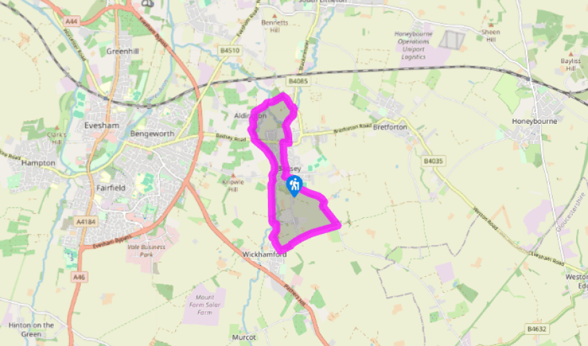
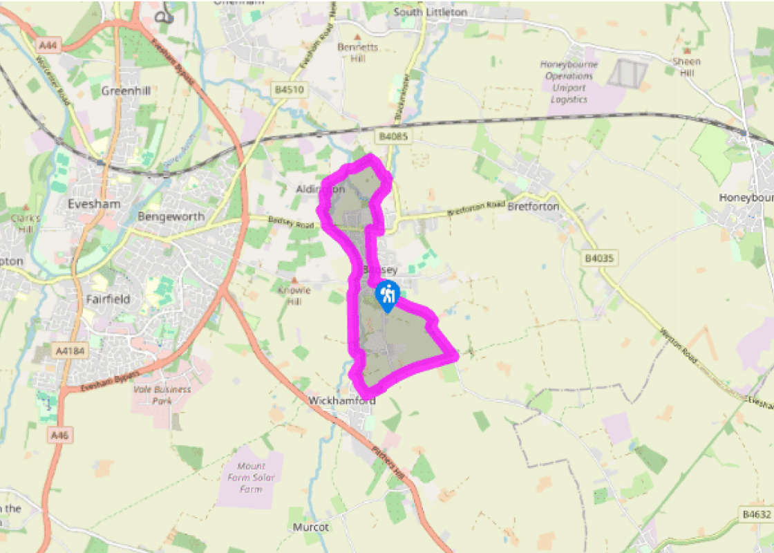
Walk south from St James’ Church, turn left, past the Wheatsheaf Inn and along School Lane, then turn right into Willersey Road. After 125yds (114m), turn left into Sands Lane. Walk for 500yds (457m), to take a waymarked path right, opposite wire fence paddocks. Cross a field to a footbridge. Cross the next (small) field diagonally left to find, behind trees, a muddy right-hand fieldedge. Follow this to a lane.
Turn right, signposted ‘Badsey’, and follow the lane for nearly 0.5 miles (800m). When this bends right, go straight ahead on a track. After 0.25 miles (400m), at the corner of the last field on the left before houses, find a stile in the hedgerow on the right then more meadow stiles lead to Wickhamford’s memorial hall.
Turn right at the road, passing striking black-and-white houses, some thatched. After 275yds (251m), at a right-hand bend, go left, passing the spectacular Wickhamford Manor, to pass in front of St John the Baptist church, of weathered sandstone with a squat tower. A footbridge crosses Badsey Brook; follow the left-hand field-edge.
Close to a black wooden shed, keep right to join a green-centred track to Badsey Lane. Cross to take a similar track to Badsey Road. Cross this fast road carefully, taking the road through Aldington to a junction in front of The Old Stables. Turn right then almost immediately left. Just after the last house along Chapel Lane, go half-right, to a footbridge. Over this, cross one field, then in a plantation is the walk’s only ascent, though hardly a taxing climb.
Continue to an intersection just before a large shed and nursery and turn right. At the B4085 go right for 40yds (37m). Turn right and down this tatty meadow, then swing right through a gap to a footbridge. Veer left a little to a metal kissing gate beside a shed with barbed wire gates. A track (green down the middle) leads to Bretforton Road. Turn right, then left at the sign for the village centre to view the Manor House on the right.
Continue along this street to the start at St James’ Church, where the Manor House’s POWs frequently attended services and had their own choir.
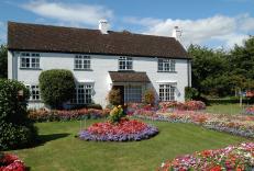
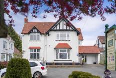
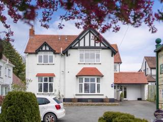
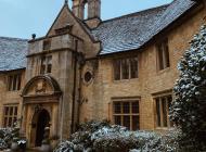
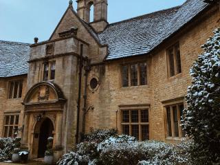
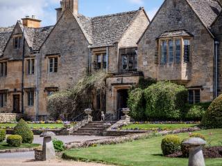
This is market-gardening country. During World War I at least 20 locations in Worcestershire were used to house prisoners of war (POWs), as part of the Government’s drive to plug the gap in the farming economy left by those who had been sent away to fight. Badsey’s POWs were mostly employed by... market gardeners – the most labour-intensive of agricultural activities – at a time of low mechanisation. The POWs received 1d of the 4d their employers had to pay the Government for their services. This became 5d after grumblings were made about these employers having access to preferential rates. Towards the end of World War I, the Manor House in Badsey, then a boys’ home, was requisitioned to accommodate POWs. Originally built to house monks from Evesham Abbey who fell sick, the striking black-and-white building is now a private residence. Parts of it date from about 1350, but it is mostly 16th century. Pockets of resentment existed in the local community towards the POWs. For example, the local paper gave a dressing-down to a farmer who gave cider to his workers, among whom were German POWs. Yet, despite the prevailing air of uncertainty, a growing bond of friendship began to develop between many of the prisoners and the market gardeners. One story suggests that a local employee lent a prisoner a bicycle to ride to one of the fields on the other side of the village, one employer sent his small child to escort a prisoner to work, and there is even a tale of a German prisoner carving toys out of wood to make Christmas presents for the children of a local farmer. In May 1918 three prisoners escaped while working at Langdon Hill. A search party was launched and a Badsey man stumbled on the three prisoners resting in a spinney near Wormington. Although some prisoners attempted to escape, such stories are rare. What was their incentive? Despite the mental strain of being a prisoner abroad, and living in what must have been cramped conditions – according to an edition of the Evesham Journal, about 100 men were held in the Manor House – to be captured, uninjured, and taken away from the front to do essentially familiar, physical work was a dream ticket when set alongside the hell of trench life.
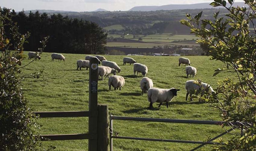
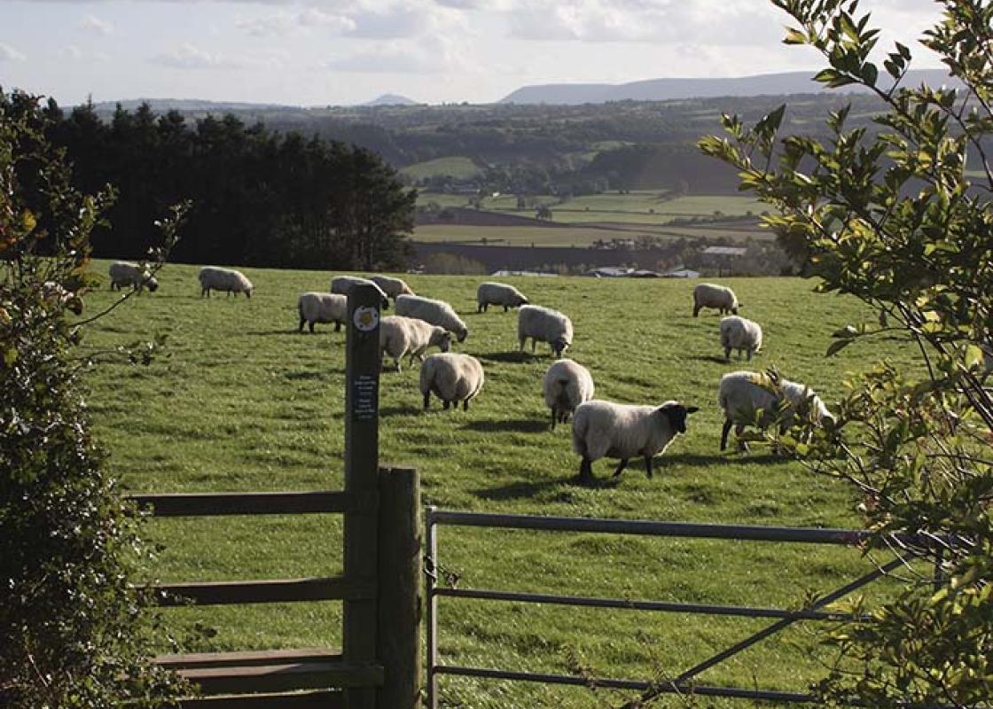
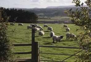
Worcestershire is a county of rolling hills, save for the flat Vale of Evesham in the east and the prominent spine of the Malverns in the west. Nearly all of the land is worked in some way; arable farming predominates – oilseed rape, cereals and potatoes – but there are concentrated areas of specific land uses, such as market gardening and plum growing.
Walk south from St James’ Church, turn left, past the Wheatsheaf Inn and along School Lane, then turn right into Willersey Road. After 125yds (114m), turn left into Sands Lane. Walk for 500yds (457m), to take a waymarked path right, opposite wire fence paddocks. Cross a field to a footbridge. Cross the next (small) field diagonally left to find, behind trees, a muddy right-hand fieldedge. Follow this to a lane.
1 of 6
Turn right, signposted ‘Badsey’, and follow the lane for nearly 0.5 miles (800m). When this bends right, go straight ahead on a track. After 0.25 miles (400m), at the corner of the last field on the left before houses, find a stile in the hedgerow on the right then more meadow stiles lead to Wickhamford’s memorial hall.
2 of 6
Turn right at the road, passing striking black-and-white houses, some thatched. After 275yds (251m), at a right-hand bend, go left, passing the spectacular Wickhamford Manor, to pass in front of St John the Baptist church, of weathered sandstone with a squat tower. A footbridge crosses Badsey Brook; follow the left-hand field-edge.
3 of 6
Close to a black wooden shed, keep right to join a green-centred track to Badsey Lane. Cross to take a similar track to Badsey Road. Cross this fast road carefully, taking the road through Aldington to a junction in front of The Old Stables. Turn right then almost immediately left. Just after the last house along Chapel Lane, go half-right, to a footbridge. Over this, cross one field, then in a plantation is the walk’s only ascent, though hardly a taxing climb.
4 of 6
Continue to an intersection just before a large shed and nursery and turn right. At the B4085 go right for 40yds (37m). Turn right and down this tatty meadow, then swing right through a gap to a footbridge. Veer left a little to a metal kissing gate beside a shed with barbed wire gates. A track (green down the middle) leads to Bretforton Road. Turn right, then left at the sign for the village centre to view the Manor House on the right.
5 of 6
Continue along this street to the start at St James’ Church, where the Manor House’s POWs frequently attended services and had their own choir.
This is market-gardening country. During World War I at least 20 locations in Worcestershire were used to house prisoners of war (POWs), as part of the Government’s drive to plug the gap in the farming economy left by those who had been sent away to fight. Badsey’s POWs were mostly employed by... market gardeners – the most labour-intensive of agricultural activities – at a time of low mechanisation. The POWs received 1d of the 4d their employers had to pay the Government for their services. This became 5d after grumblings were made about these employers having access to preferential rates. Towards the end of World War I, the Manor House in Badsey, then a boys’ home, was requisitioned to accommodate POWs. Originally built to house monks from Evesham Abbey who fell sick, the striking black-and-white building is now a private residence. Parts of it date from about 1350, but it is mostly 16th century. Pockets of resentment existed in the local community towards the POWs. For example, the local paper gave a dressing-down to a farmer who gave cider to his workers, among whom were German POWs. Yet, despite the prevailing air of uncertainty, a growing bond of friendship began to develop between many of the prisoners and the market gardeners. One story suggests that a local employee lent a prisoner a bicycle to ride to one of the fields on the other side of the village, one employer sent his small child to escort a prisoner to work, and there is even a tale of a German prisoner carving toys out of wood to make Christmas presents for the children of a local farmer. In May 1918 three prisoners escaped while working at Langdon Hill. A search party was launched and a Badsey man stumbled on the three prisoners resting in a spinney near Wormington. Although some prisoners attempted to escape, such stories are rare. What was their incentive? Despite the mental strain of being a prisoner abroad, and living in what must have been cramped conditions – according to an edition of the Evesham Journal, about 100 men were held in the Manor House – to be captured, uninjured, and taken away from the front to do essentially familiar, physical work was a dream ticket when set alongside the hell of trench life.
Worcestershire is a county of rolling hills, save for the flat Vale of Evesham in the east and the prominent spine of the Malverns in the west. Nearly all of the land is worked in some way; arable farming predominates – oilseed rape, cereals and potatoes – but there are concentrated areas of specific land uses, such as market gardening and plum growing.