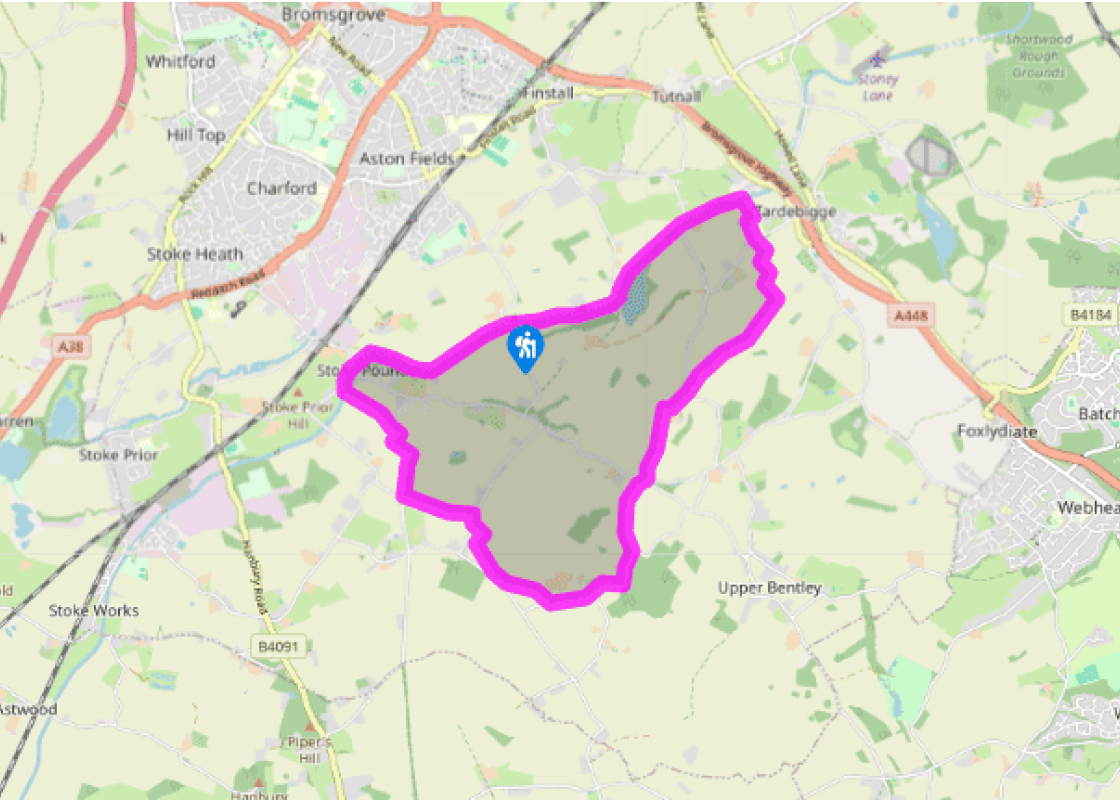
Cross bridge No. 51 and turn left, taking the towpath on the south side of the canal. Keep on the towpath for a little over 1.25 miles (2km). On your way, at a bend, the embankment of the Tardebigge Reservoir looms. Whenever a boat passes through a lock, heading either up or down, a lockful of water is shunted downstream by gravity. Although the locks are not built any wider or longer than is necessary, maintaining an adequate flow of water can be a problem at any time, not just when there is a dry summer. Hence the need for the reservoir, approached from its dammed end.
Beyond the topmost lock of the 30 is another striking feat of engineering – Tardebigge Tunnel. Turn right through a kissing gate just before the tunnel, but first descend steps to the tow path to see the light at the tunnel’s far portal, 580yds (530m) away. Doubtless some of the extra money went into the making of this tunnel, which was bored through solid rock.
Bear right, up the bank, with the distinctive, baroque needle spire of St Bartholomew’s ahead. The tower was completed in 1777. Cross the gravel car park then walk past the church it serves. Walk, with the primary school on your left, for just 30yds (27m). Turn left, beside the school and later its playing field, to reach a minor road.
Cross the road by a kissing gate and then a stile. Importantly, in the first field strike right of the fingerpost’s direction to reach a stile at the offset corner in 150yds (137m). Follow waymarks through two field gates. Turn right beyond the second, towards the wind turbine. At the corner gate bear right within your field on a hedge-side path to cross two stiles, the second followed by a flat bridge. Keep ahead to the stile visible 140yds (128m) beyond a remnant hedge. Cross this double stile and shadow the field boundary to a stile at the far end of the copse. There’s a field gate into a lane at the diagonally opposite corner. Bear left a few paces to the ‘No Through Road’; here take the gate, right, and walk to the decrepit oak at the far end of the barns here at Sheltwood Farm
Bear left. Within 110yds (100m) use the gate-side stile ahead. Drift right to use a stile through a wire fence, maintaining the same direction to cross a three-plank foot-bridge. Head half-right to use a corner stile near a pylon; turn left to a minor road junction. Turn right along the road to a waymarked stile, left, in 60yds (55m). Walk the left edge of two pastures, then climb the high stile and use the nearby handgate, swapping sides of the hedge. Continue hedge-side to a lane at a bend.
Turn right. Follow this for 0.5 miles (800m), taking ‘Woodgate’ at a junction, to Lower Bentley Farm’s driveway. Go 140yds (128m) further, to a fingerpost on the right 5yds (4m) up a farm track. Head a quarter-left to the field gate; then another to the right of the cottage at the field head. Continue to the farright corner of the long field, where two handgates bracket a plank bridge. Continue another 70yds (65m) to use a double stile, left. From here head a quarter right to a stile onto a lane.
Turn right, and in 75yds (69m) take a hand-railed, three-planked footbridge on the left. Pass through the kissing gate and walk ahead, to the right of the nearby offset field corner to find the first of a series of three in-line handgates across fields. At Orchard Farm’s garden, turn right to reach the top-left corner of the field and a handgate. Continue ahead to cross the double stile across a ditch. Look ahead-right to locate a fingerpost at twin metal kissing gates beneath trees. Once through, continue beside the hedge, use an awkward corner gate and then aim a quarter-left to a corner gate and handgate 50yds (46m) left of the field-head oak. A grassy track leads to a road.
Turn right. At the T-junction turn left. Join the canal towpath this side of the bridge (The Queen’s Head pub is opposite). Turn right beside the canal to return to Bridge 51, nearly 1 mile (1.6km) distant.
In some respects the British are a nation of slow learners: how often do we hear of a large construction project for which the final bill was vastly in excess of the original projected cost? The canal builders of the 19th century were often not much better. In 1791 an Act of Parliament gave the... go-ahead to build the Worcester and Birmingham Canal, setting aside £180,000. It was only in 1815 – 24 years later – that the route to Worcester was available to commercial traffic, and the sum that had been spent was a whopping £610,000. It seems that cost projections were invariably optimistic, rather than realistic. Even at that price, the project had been scaled down, literally, for the plan to take the larger barges that plied the Severn was abandoned. The Tardebigge Flight was just one of the challenges of constructing the Worcester and Birmingham Canal. The tally of locks along the 16-mile (25.7km) stretch between Tardebigge and Worcester is 56. Add to that five tunnels and several reservoirs, some of which the canal builders were obliged to provide for mill owners along rivers affected by the canal, and it is not only the locks that escalate! The Worcester and Birmingham Canal benefited from the discovery of salt at Stoke Prior in 1825 – the salt works were built around the canal shortly after. The works are now gone, replaced by housing, but the former brine reservoir remains at grid ref SO 947664. This was the works that John Corbett purchased in 1845. While Corbett must take the credit for the subsequent pre-eminence of his factory there, he must have been assisted by the competition between canal and railway. The Birmingham and Gloucester Railway had opened in 1841, and in 1851 another line followed: the Oxford, Worcester and Wolverhampton Railway. Back in 1771, long before the Worcester and Birmingham Canal was conceived, James Brindley had engineered the broad-beamed Droitwich Barge Canal, right into the town’s salt production centre. It ran for 5.75 miles (9.2km) to the River Severn, taking salt down and bringing coal up. Perhaps as a response to the railway threat, this ‘cul-de-sac’ was opened up in 1853 by cutting a mere 1.5-mile long (2.4km), narrow-beamed channel from the centre of Droitwich to Hanbury Wharf, joining the Droitwich Barge Canal with the Worcester and Birmingham Canal – the so-called Droitwich Junction Canal. Transportation of salt by canal ceased in 1914. Even if you are not a canal-boat lover, the Tardebigge Flight is a memorable spectacle – it just goes on and on. It has a total of 30 locks within 2 miles (3.2km).
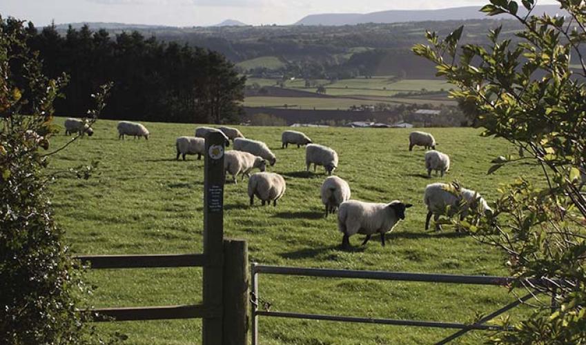
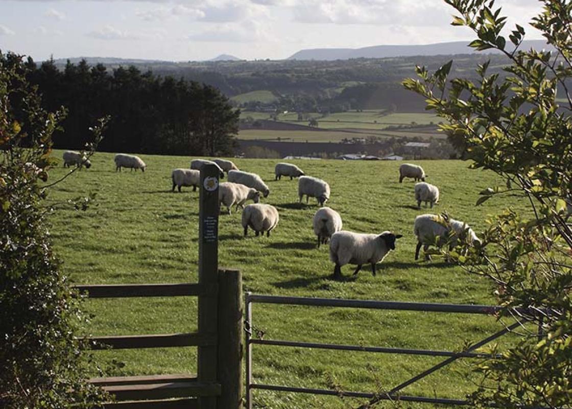
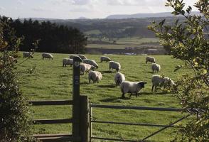
Worcestershire is a county of rolling hills, save for the flat Vale of Evesham in the east and the prominent spine of the Malverns in the west. Nearly all of the land is worked in some way; arable farming predominates – oilseed rape, cereals and potatoes – but there are concentrated areas of specific land uses, such as market gardening and plum growing.
Cross bridge No. 51 and turn left, taking the towpath on the south side of the canal. Keep on the towpath for a little over 1.25 miles (2km). On your way, at a bend, the embankment of the Tardebigge Reservoir looms. Whenever a boat passes through a lock, heading either up or down, a lockful of water is shunted downstream by gravity. Although the locks are not built any wider or longer than is necessary, maintaining an adequate flow of water can be a problem at any time, not just when there is a dry summer. Hence the need for the reservoir, approached from its dammed end.
1 of 8
Beyond the topmost lock of the 30 is another striking feat of engineering – Tardebigge Tunnel. Turn right through a kissing gate just before the tunnel, but first descend steps to the tow path to see the light at the tunnel’s far portal, 580yds (530m) away. Doubtless some of the extra money went into the making of this tunnel, which was bored through solid rock.
2 of 8
Bear right, up the bank, with the distinctive, baroque needle spire of St Bartholomew’s ahead. The tower was completed in 1777. Cross the gravel car park then walk past the church it serves. Walk, with the primary school on your left, for just 30yds (27m). Turn left, beside the school and later its playing field, to reach a minor road.
3 of 8
Cross the road by a kissing gate and then a stile. Importantly, in the first field strike right of the fingerpost’s direction to reach a stile at the offset corner in 150yds (137m). Follow waymarks through two field gates. Turn right beyond the second, towards the wind turbine. At the corner gate bear right within your field on a hedge-side path to cross two stiles, the second followed by a flat bridge. Keep ahead to the stile visible 140yds (128m) beyond a remnant hedge. Cross this double stile and shadow the field boundary to a stile at the far end of the copse. There’s a field gate into a lane at the diagonally opposite corner. Bear left a few paces to the ‘No Through Road’; here take the gate, right, and walk to the decrepit oak at the far end of the barns here at Sheltwood Farm
4 of 8
Bear left. Within 110yds (100m) use the gate-side stile ahead. Drift right to use a stile through a wire fence, maintaining the same direction to cross a three-plank foot-bridge. Head half-right to use a corner stile near a pylon; turn left to a minor road junction. Turn right along the road to a waymarked stile, left, in 60yds (55m). Walk the left edge of two pastures, then climb the high stile and use the nearby handgate, swapping sides of the hedge. Continue hedge-side to a lane at a bend.
5 of 8
Turn right. Follow this for 0.5 miles (800m), taking ‘Woodgate’ at a junction, to Lower Bentley Farm’s driveway. Go 140yds (128m) further, to a fingerpost on the right 5yds (4m) up a farm track. Head a quarter-left to the field gate; then another to the right of the cottage at the field head. Continue to the farright corner of the long field, where two handgates bracket a plank bridge. Continue another 70yds (65m) to use a double stile, left. From here head a quarter right to a stile onto a lane.
6 of 8
Turn right, and in 75yds (69m) take a hand-railed, three-planked footbridge on the left. Pass through the kissing gate and walk ahead, to the right of the nearby offset field corner to find the first of a series of three in-line handgates across fields. At Orchard Farm’s garden, turn right to reach the top-left corner of the field and a handgate. Continue ahead to cross the double stile across a ditch. Look ahead-right to locate a fingerpost at twin metal kissing gates beneath trees. Once through, continue beside the hedge, use an awkward corner gate and then aim a quarter-left to a corner gate and handgate 50yds (46m) left of the field-head oak. A grassy track leads to a road.
7 of 8
Turn right. At the T-junction turn left. Join the canal towpath this side of the bridge (The Queen’s Head pub is opposite). Turn right beside the canal to return to Bridge 51, nearly 1 mile (1.6km) distant.
In some respects the British are a nation of slow learners: how often do we hear of a large construction project for which the final bill was vastly in excess of the original projected cost? The canal builders of the 19th century were often not much better. In 1791 an Act of Parliament gave the... go-ahead to build the Worcester and Birmingham Canal, setting aside £180,000. It was only in 1815 – 24 years later – that the route to Worcester was available to commercial traffic, and the sum that had been spent was a whopping £610,000. It seems that cost projections were invariably optimistic, rather than realistic. Even at that price, the project had been scaled down, literally, for the plan to take the larger barges that plied the Severn was abandoned. The Tardebigge Flight was just one of the challenges of constructing the Worcester and Birmingham Canal. The tally of locks along the 16-mile (25.7km) stretch between Tardebigge and Worcester is 56. Add to that five tunnels and several reservoirs, some of which the canal builders were obliged to provide for mill owners along rivers affected by the canal, and it is not only the locks that escalate! The Worcester and Birmingham Canal benefited from the discovery of salt at Stoke Prior in 1825 – the salt works were built around the canal shortly after. The works are now gone, replaced by housing, but the former brine reservoir remains at grid ref SO 947664. This was the works that John Corbett purchased in 1845. While Corbett must take the credit for the subsequent pre-eminence of his factory there, he must have been assisted by the competition between canal and railway. The Birmingham and Gloucester Railway had opened in 1841, and in 1851 another line followed: the Oxford, Worcester and Wolverhampton Railway. Back in 1771, long before the Worcester and Birmingham Canal was conceived, James Brindley had engineered the broad-beamed Droitwich Barge Canal, right into the town’s salt production centre. It ran for 5.75 miles (9.2km) to the River Severn, taking salt down and bringing coal up. Perhaps as a response to the railway threat, this ‘cul-de-sac’ was opened up in 1853 by cutting a mere 1.5-mile long (2.4km), narrow-beamed channel from the centre of Droitwich to Hanbury Wharf, joining the Droitwich Barge Canal with the Worcester and Birmingham Canal – the so-called Droitwich Junction Canal. Transportation of salt by canal ceased in 1914. Even if you are not a canal-boat lover, the Tardebigge Flight is a memorable spectacle – it just goes on and on. It has a total of 30 locks within 2 miles (3.2km).
Worcestershire is a county of rolling hills, save for the flat Vale of Evesham in the east and the prominent spine of the Malverns in the west. Nearly all of the land is worked in some way; arable farming predominates – oilseed rape, cereals and potatoes – but there are concentrated areas of specific land uses, such as market gardening and plum growing.