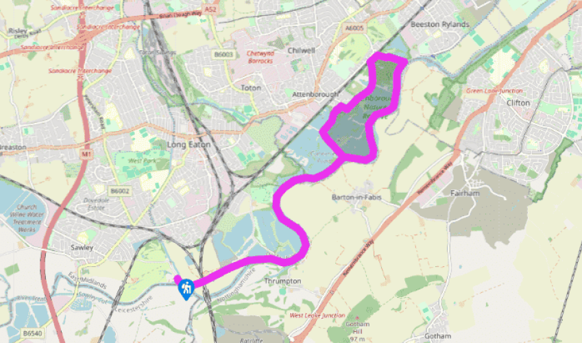
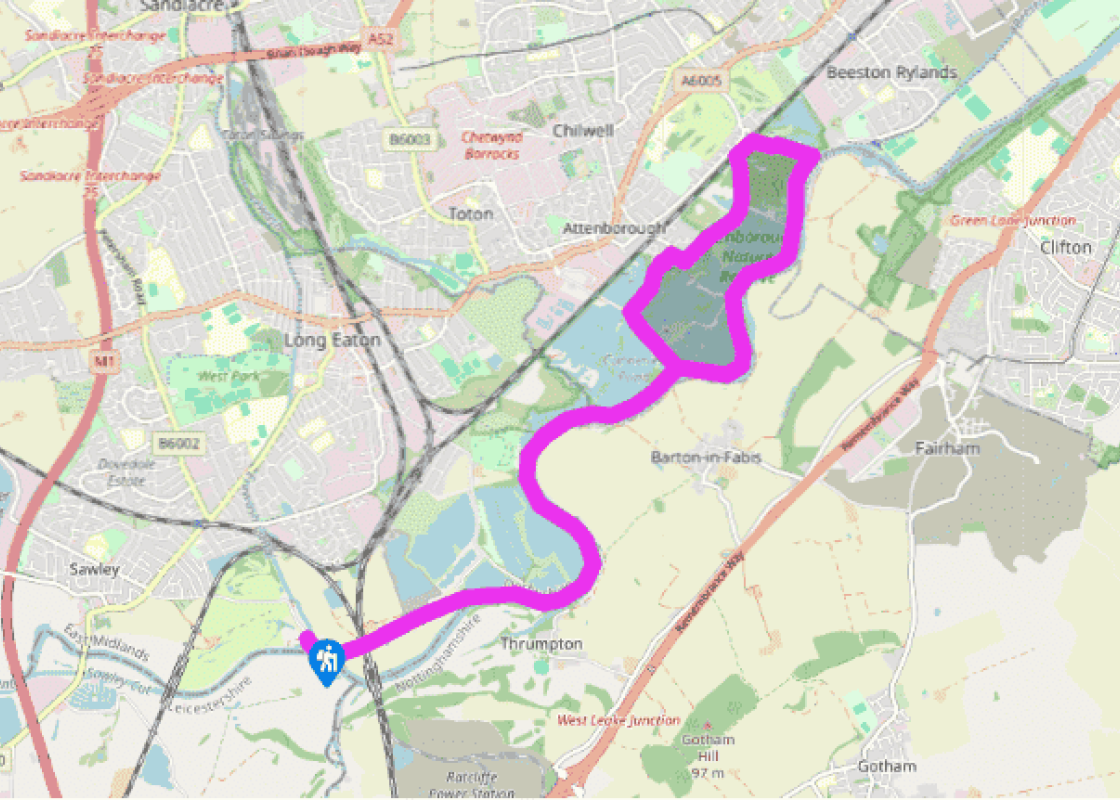
From the car park walk past the Trent Lock pub and its riverside garden to reach the River Trent. Turn left, along the bank, cross the footbridge over the Erewash Canal, then head right along the Cranfleet Cut towpath opposite the sailing club. Continue underneath twin railway bridges and rejoin the Trent at Cranfleet Lock.
The path now follows the flood bank barriers. Ignore circular walk waymarkers and all paths off left and stay on the riverside route. Past Thrumpton village on the far bank the river meanders left, beside the first of many large artificial lakes formed through the flooding of old gravel pits. Eventually, beyond a couple of secluded cottages, you cross a small stone bridge to enter Attenborough Nature Reserve and reach a path junction.
Turn right and continue the route along the north bank of the river, signposted ‘Riverside Path to Beeston Marina and Nottingham’. Ignore the next two turnings on the left and when the boats of Beeston Marina come into sight on the river bend ahead turn left for a path away from the river, signposted simply ‘Meadow Lane’.
The path goes between further flooded pits, an area of wet woodland and reedbed known as The Delta, before reaching the railway. Follow the path left, alongside the busy line for 250yds (229m), then veer left again through more patchy woodland. Fork right at a junction and beyond a humped bridge the path enters suburban Attenborough.
Take the lane past the cricket ground, follow it round to the right, then turn left down Church Lane. Go left on the signposted public bridleway through gates on the far side of the churchyard, beside Ireton House. This leads back into the nature reserve. Turn right at a junction and follow the path to the car park and Nature Centre.
Facing the boardwalk to the Nature Centre, turn left over the bridge for a wide and popular track to meet the outward route at a junction of paths. Turn right and follow the riverside path all the way back to Trent Lock.
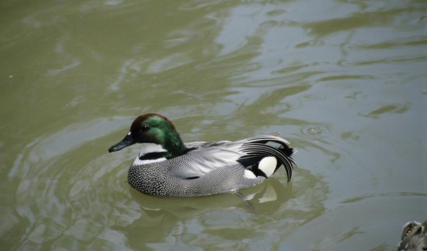
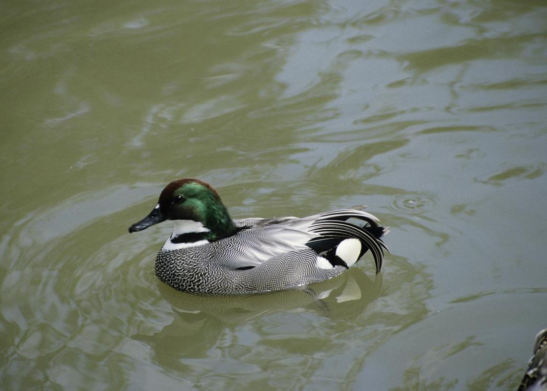
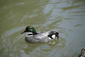
Trent Lock is situated where the River Soar flows into the Trent and where the Erewash Canal starts out on its way north towards the former coalfields. It’s a bright and colourful place where East Midlands people come to see the boats. Sailing dinghies race by, while colourful barges take a more... leisurely pace down the network of waterways. The Trent is a navigable hub here, with connections up the Soar to Leicester and beyond, west around the edge of the Pennines to the Mersey and east to the Humber and the North Sea. Trent Lock is also located on the border of three counties: Derbyshire, Leicestershire and Nottinghamshire. After crossing over the Erewash Canal, by its confluence with the River Trent, the early part of the walk from Trent Lock is along the Cranfleet Cut tow path. The Cut was built (or rather dug) in 1798 so that the heavy Trent barges could avoid the river’s Thrumpton Weir and in so doing allow the river to compete with newer rival canals. Busy with Birdlife Beyond two railway bridges carrying the busy Derby and Nottingham main lines, the Cut rejoins the Trent at Cranfleet Lock and the route now follows the river bank flood barriers. Before long you enter Attenborough Nature Reserve, a Site of Special Scientific Interest established in 1966. It extends across a series of disused gravel pits, which were excavated between 1929 and 1967. Now mostly flooded to form attractive lakes, the former pits show varying developments of natural vegetation. New plants colonise the reserve each year but you could well spot meadow saxifrage, flowering rush, ragged-robin and yellow rattle. Most eyes, however, will be focused on the abundant birdlife. This is an important wintering site for many wildfowl, including shoveler, wigeon, goldeneye and teal. In summer great crested grebe, shelduck and little ringed plover all come here to feed and breed, plus there are a variety of warblers and a large colony of common terns. Restoring Watery Habitats Attenborough Nature Reserve is managed by Nottinghamshire Wildlife Trust, since you’re now just across the county boundary. Over the last few years they’ve been developing a range of aquatic and waterside habitats to suit different species of birds, as well as benefit the various mammals and insects that also thrive here (including dragonflies and newts). Small islands have been cleared of vegetation to allow terns and lapwings to nest; a ‘wet meadow’ has been restored and extensive new reedbeds introduced – hopefully to attract rarities like the bittern. An artificial holt has also been built to encourage otters to make their home here. Around the reserve there are hides that, like all the walking routes, are open daily and free to use. Identification charts can be found in most hides, and there’s lots of useful further information at the Nature Centre.
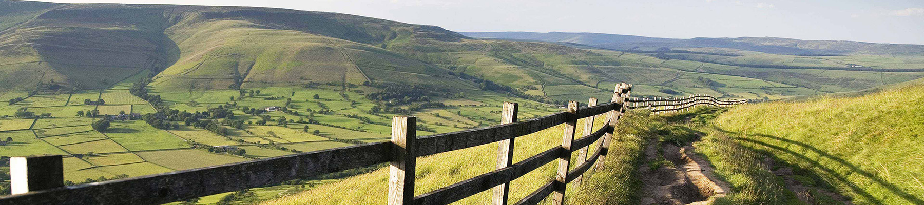
The natural features of this central English county range from the modest heights of the Peak District National Park, where Kinder Scout stands at 2,088 ft (636 m), to the depths of its remarkable underground caverns, floodlit to reveal exquisite Blue John stone. Walkers and cyclists will enjoy the High Peak Trail which extends from the Derwent Valley to the limestone plateau near Buxton, and for many, the spectacular scenery is what draws them to the area.
From the car park walk past the Trent Lock pub and its riverside garden to reach the River Trent. Turn left, along the bank, cross the footbridge over the Erewash Canal, then head right along the Cranfleet Cut towpath opposite the sailing club. Continue underneath twin railway bridges and rejoin the Trent at Cranfleet Lock.
1 of 6
The path now follows the flood bank barriers. Ignore circular walk waymarkers and all paths off left and stay on the riverside route. Past Thrumpton village on the far bank the river meanders left, beside the first of many large artificial lakes formed through the flooding of old gravel pits. Eventually, beyond a couple of secluded cottages, you cross a small stone bridge to enter Attenborough Nature Reserve and reach a path junction.
2 of 6
Turn right and continue the route along the north bank of the river, signposted ‘Riverside Path to Beeston Marina and Nottingham’. Ignore the next two turnings on the left and when the boats of Beeston Marina come into sight on the river bend ahead turn left for a path away from the river, signposted simply ‘Meadow Lane’.
3 of 6
The path goes between further flooded pits, an area of wet woodland and reedbed known as The Delta, before reaching the railway. Follow the path left, alongside the busy line for 250yds (229m), then veer left again through more patchy woodland. Fork right at a junction and beyond a humped bridge the path enters suburban Attenborough.
4 of 6
Take the lane past the cricket ground, follow it round to the right, then turn left down Church Lane. Go left on the signposted public bridleway through gates on the far side of the churchyard, beside Ireton House. This leads back into the nature reserve. Turn right at a junction and follow the path to the car park and Nature Centre.
5 of 6
Facing the boardwalk to the Nature Centre, turn left over the bridge for a wide and popular track to meet the outward route at a junction of paths. Turn right and follow the riverside path all the way back to Trent Lock.
Trent Lock is situated where the River Soar flows into the Trent and where the Erewash Canal starts out on its way north towards the former coalfields. It’s a bright and colourful place where East Midlands people come to see the boats. Sailing dinghies race by, while colourful barges take a more... leisurely pace down the network of waterways. The Trent is a navigable hub here, with connections up the Soar to Leicester and beyond, west around the edge of the Pennines to the Mersey and east to the Humber and the North Sea. Trent Lock is also located on the border of three counties: Derbyshire, Leicestershire and Nottinghamshire. After crossing over the Erewash Canal, by its confluence with the River Trent, the early part of the walk from Trent Lock is along the Cranfleet Cut tow path. The Cut was built (or rather dug) in 1798 so that the heavy Trent barges could avoid the river’s Thrumpton Weir and in so doing allow the river to compete with newer rival canals. Busy with Birdlife Beyond two railway bridges carrying the busy Derby and Nottingham main lines, the Cut rejoins the Trent at Cranfleet Lock and the route now follows the river bank flood barriers. Before long you enter Attenborough Nature Reserve, a Site of Special Scientific Interest established in 1966. It extends across a series of disused gravel pits, which were excavated between 1929 and 1967. Now mostly flooded to form attractive lakes, the former pits show varying developments of natural vegetation. New plants colonise the reserve each year but you could well spot meadow saxifrage, flowering rush, ragged-robin and yellow rattle. Most eyes, however, will be focused on the abundant birdlife. This is an important wintering site for many wildfowl, including shoveler, wigeon, goldeneye and teal. In summer great crested grebe, shelduck and little ringed plover all come here to feed and breed, plus there are a variety of warblers and a large colony of common terns. Restoring Watery Habitats Attenborough Nature Reserve is managed by Nottinghamshire Wildlife Trust, since you’re now just across the county boundary. Over the last few years they’ve been developing a range of aquatic and waterside habitats to suit different species of birds, as well as benefit the various mammals and insects that also thrive here (including dragonflies and newts). Small islands have been cleared of vegetation to allow terns and lapwings to nest; a ‘wet meadow’ has been restored and extensive new reedbeds introduced – hopefully to attract rarities like the bittern. An artificial holt has also been built to encourage otters to make their home here. Around the reserve there are hides that, like all the walking routes, are open daily and free to use. Identification charts can be found in most hides, and there’s lots of useful further information at the Nature Centre.
The natural features of this central English county range from the modest heights of the Peak District National Park, where Kinder Scout stands at 2,088 ft (636 m), to the depths of its remarkable underground caverns, floodlit to reveal exquisite Blue John stone. Walkers and cyclists will enjoy the High Peak Trail which extends from the Derwent Valley to the limestone plateau near Buxton, and for many, the spectacular scenery is what draws them to the area.