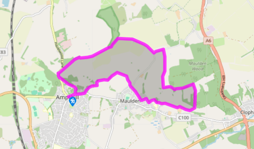
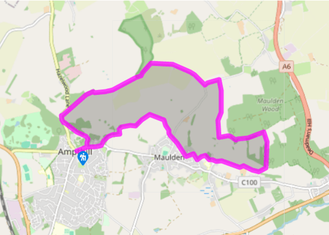
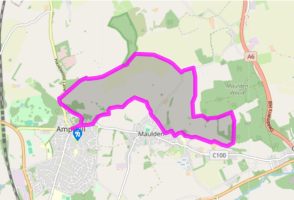
From the Market Square in the centre of Ampthill walk east along Church Street and left to reach the handsome Church of St Andrew. Go along Rectory Lane, to its left and, forking left at the end, go left through a gap by Rectory Cottage for the lovely Holly Walk. At the far end cross the road and turn right. Walk up the pavement and, at the top of the bend, cross back over to join a concrete lane opposite.
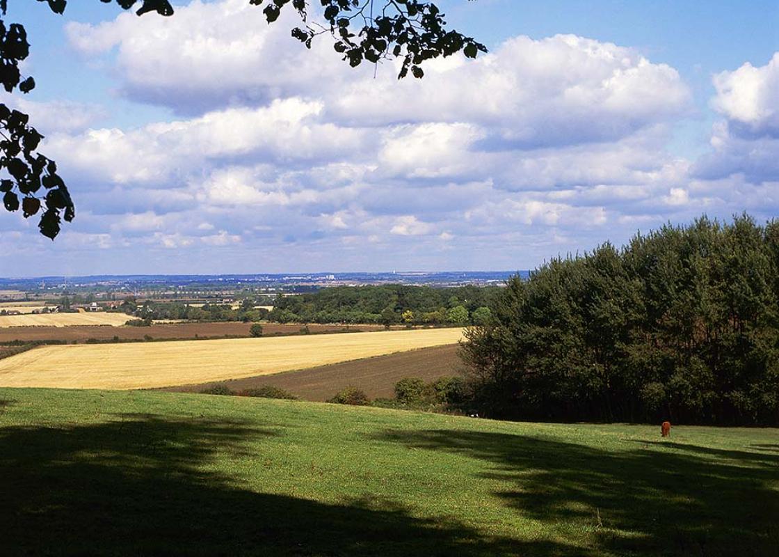
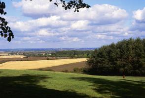
To visit the remains of Houghton House fork left by some houses, otherwise fork right to the reservoir gates where you switch to the farm track the other side of the hedge. Walk along this panoramic hilltop track to King's Wood, a locally run nature reserve. Go through the gate to the right and follow the path around the edge of the wood (or there is a parallel path through the trees if you prefer).
After 0.25 miles (400m) turn right for a wide track that crosses first open fields, then Brickhill Pastures farmyard, then follows its drive to the lane at the end. Go left and, just before the turning for South Limbersey House, turn right on a public footpath across the field just to the right of the buildings. Go through a gate, down the track between fields, and continue through another gate.
Beyond a third gate, if you want to shorten the route by 1.5 miles (2.4km) go straight on to reach Maulden church, otherwise turn left for a shady path to Maulden Wood. At the junction of tracks by its entrance turn first right for a clear bridleway that ends up skirting the southern edge of the woodland on an undulating fenced route.
At the eye-catching octagonal lodge (private) turn right and walk along the track all the way down to join the surfaced lane at the bottom by Green End Farm. After 220yds (201m) go up the steps in the grassy embankment on the right for a waymarked route around the right-hand side of Old Farm. Bear left beyond the farmhouse to continue through fields, cross the end of a drive and another short field to reach St Mary's Church at Maulden.
Follow the surfaced path out of the far side of the churchyard (the wide black gate beyond the mausoleum) and down to the road. Turn right to walk along the road through Maulden.
After 300yds (274m), just before Cobbitts Road, turn right along a narrow walkway between houses. Where it veers left, go straight on past the end of a house to reach the road, and cross over.
Continue through two fields, to the left of Kings Farm and, at the end of a narrow fenced enclosure, go along a short green lane. Turn left at the junction of routes at the end, and after following successive fieldedges bend left on a track and, just before a ruined barn, turn right for a path that eventually drops down to Gas House Lane. Go left, then right to follow the main road back into Ampthill.
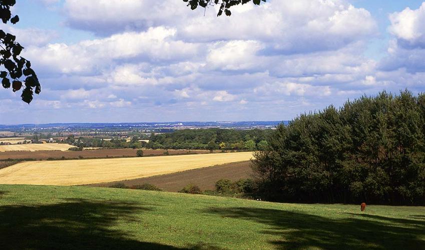
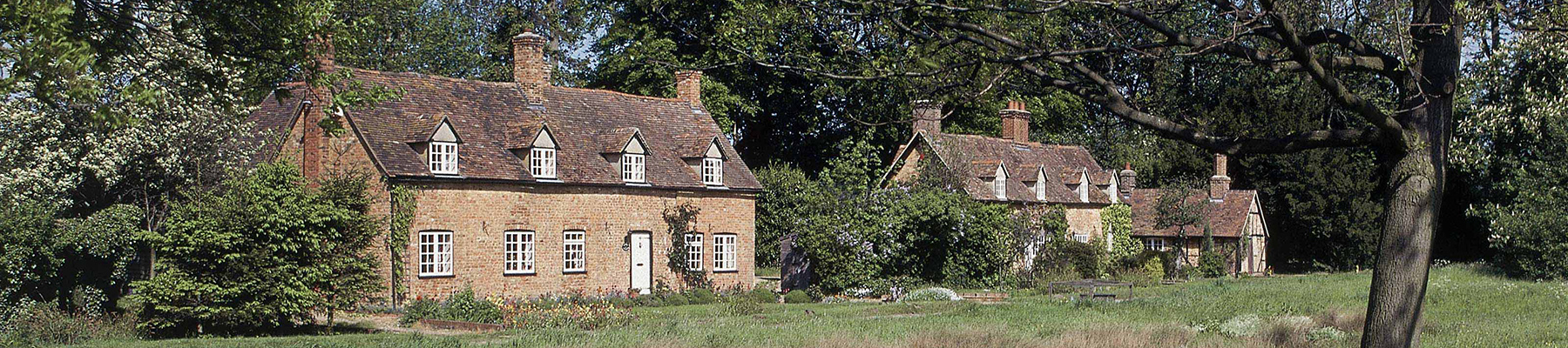
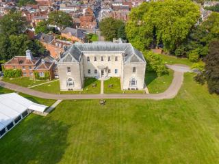
Ampthill gained its charter for a weekly market as far back as 1219, and its park was used by Henry VIII for hunting (Catherine of Aragon lived in a castle here during their divorce). However, most of the fine period buildings that surround the Market Place and line Church Street, in particular,... date from the late 18th and early 19th centuries. Ampthill's location on a prominent greensand ridge made it a popular stop-off for travellers on coaching routes, while today it's more notable for an inordinate number of antique shops. To the north, and just off the walk, is Houghton House, built in 1615 for the Countess of Pembroke and systematically dismantled and emptied 179 years later by the Duke of Bedford. The shell of what must have been a fine building is still worth inspecting, especially as the views across the county from its open hilltop location are first rate. Bunyan's spiritual purpose Houghton House was supposedly the inspiration for 'House Beautiful', and a nearby stretch of Bedford Road the 'Hill Difficulty', in John Bunyan's Pilgrim's Progress. This famous work of spiritual allegory, an ostensibly simple tale of a pilgrim's daily encounters as he wanders through the local countryside, was first published in 1678, since when it has been translated into more languages than any other book except the Bible (the John Bunyan Museum at Bedford has more than 170 translations). John Bunyan was born in 1628 at Elstow, near Bedford, the son of a tinker, and initially followed in his father's footsteps. But seeking deeper, more spiritual explanations about heaven and earth he turned to the newly formed independent religious congregations that were springing up around Bedford. When laws were passed in an attempt to thwart the dissenting congregations, Bunyan refused to comply and was jailed for continuing to deliver public sermons. He spent the next 12 years in prison, during which time he wrote a prolific amount of papers and books, including the Pilgrim's Progress, and on release spent the rest of his days preaching and public speaking.
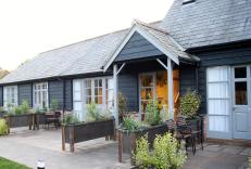
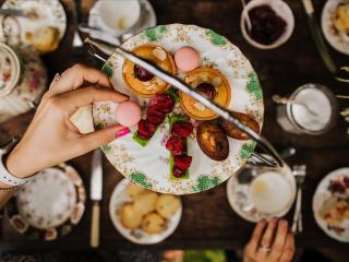
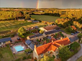
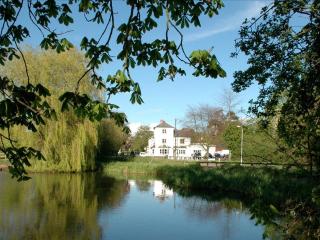
At its most southern point, Bedfordshire is only 35 miles from London Waterloo, so there’s a good reason for the UK’s fifth busiest airport to be called London Luton Airport. The county is one of England’s smaller in terms of area, but more than makes up for it in terms of business HQs and visitor attractions.
From the Market Square in the centre of Ampthill walk east along Church Street and left to reach the handsome Church of St Andrew. Go along Rectory Lane, to its left and, forking left at the end, go left through a gap by Rectory Cottage for the lovely Holly Walk. At the far end cross the road and turn right. Walk up the pavement and, at the top of the bend, cross back over to join a concrete lane opposite.
1 of 8
To visit the remains of Houghton House fork left by some houses, otherwise fork right to the reservoir gates where you switch to the farm track the other side of the hedge. Walk along this panoramic hilltop track to King's Wood, a locally run nature reserve. Go through the gate to the right and follow the path around the edge of the wood (or there is a parallel path through the trees if you prefer).
2 of 8
After 0.25 miles (400m) turn right for a wide track that crosses first open fields, then Brickhill Pastures farmyard, then follows its drive to the lane at the end. Go left and, just before the turning for South Limbersey House, turn right on a public footpath across the field just to the right of the buildings. Go through a gate, down the track between fields, and continue through another gate.
3 of 8
Beyond a third gate, if you want to shorten the route by 1.5 miles (2.4km) go straight on to reach Maulden church, otherwise turn left for a shady path to Maulden Wood. At the junction of tracks by its entrance turn first right for a clear bridleway that ends up skirting the southern edge of the woodland on an undulating fenced route.
4 of 8
At the eye-catching octagonal lodge (private) turn right and walk along the track all the way down to join the surfaced lane at the bottom by Green End Farm. After 220yds (201m) go up the steps in the grassy embankment on the right for a waymarked route around the right-hand side of Old Farm. Bear left beyond the farmhouse to continue through fields, cross the end of a drive and another short field to reach St Mary's Church at Maulden.
5 of 8
Follow the surfaced path out of the far side of the churchyard (the wide black gate beyond the mausoleum) and down to the road. Turn right to walk along the road through Maulden.
6 of 8
After 300yds (274m), just before Cobbitts Road, turn right along a narrow walkway between houses. Where it veers left, go straight on past the end of a house to reach the road, and cross over.
7 of 8
Continue through two fields, to the left of Kings Farm and, at the end of a narrow fenced enclosure, go along a short green lane. Turn left at the junction of routes at the end, and after following successive fieldedges bend left on a track and, just before a ruined barn, turn right for a path that eventually drops down to Gas House Lane. Go left, then right to follow the main road back into Ampthill.
Ampthill gained its charter for a weekly market as far back as 1219, and its park was used by Henry VIII for hunting (Catherine of Aragon lived in a castle here during their divorce). However, most of the fine period buildings that surround the Market Place and line Church Street, in particular,... date from the late 18th and early 19th centuries. Ampthill's location on a prominent greensand ridge made it a popular stop-off for travellers on coaching routes, while today it's more notable for an inordinate number of antique shops. To the north, and just off the walk, is Houghton House, built in 1615 for the Countess of Pembroke and systematically dismantled and emptied 179 years later by the Duke of Bedford. The shell of what must have been a fine building is still worth inspecting, especially as the views across the county from its open hilltop location are first rate. Bunyan's spiritual purpose Houghton House was supposedly the inspiration for 'House Beautiful', and a nearby stretch of Bedford Road the 'Hill Difficulty', in John Bunyan's Pilgrim's Progress. This famous work of spiritual allegory, an ostensibly simple tale of a pilgrim's daily encounters as he wanders through the local countryside, was first published in 1678, since when it has been translated into more languages than any other book except the Bible (the John Bunyan Museum at Bedford has more than 170 translations). John Bunyan was born in 1628 at Elstow, near Bedford, the son of a tinker, and initially followed in his father's footsteps. But seeking deeper, more spiritual explanations about heaven and earth he turned to the newly formed independent religious congregations that were springing up around Bedford. When laws were passed in an attempt to thwart the dissenting congregations, Bunyan refused to comply and was jailed for continuing to deliver public sermons. He spent the next 12 years in prison, during which time he wrote a prolific amount of papers and books, including the Pilgrim's Progress, and on release spent the rest of his days preaching and public speaking.
At its most southern point, Bedfordshire is only 35 miles from London Waterloo, so there’s a good reason for the UK’s fifth busiest airport to be called London Luton Airport. The county is one of England’s smaller in terms of area, but more than makes up for it in terms of business HQs and visitor attractions.