"A short but intense walk from enclosed valleys and forest to a stark peak."
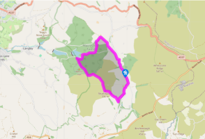
Walk directions
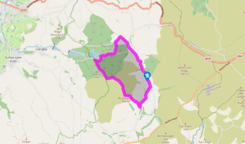
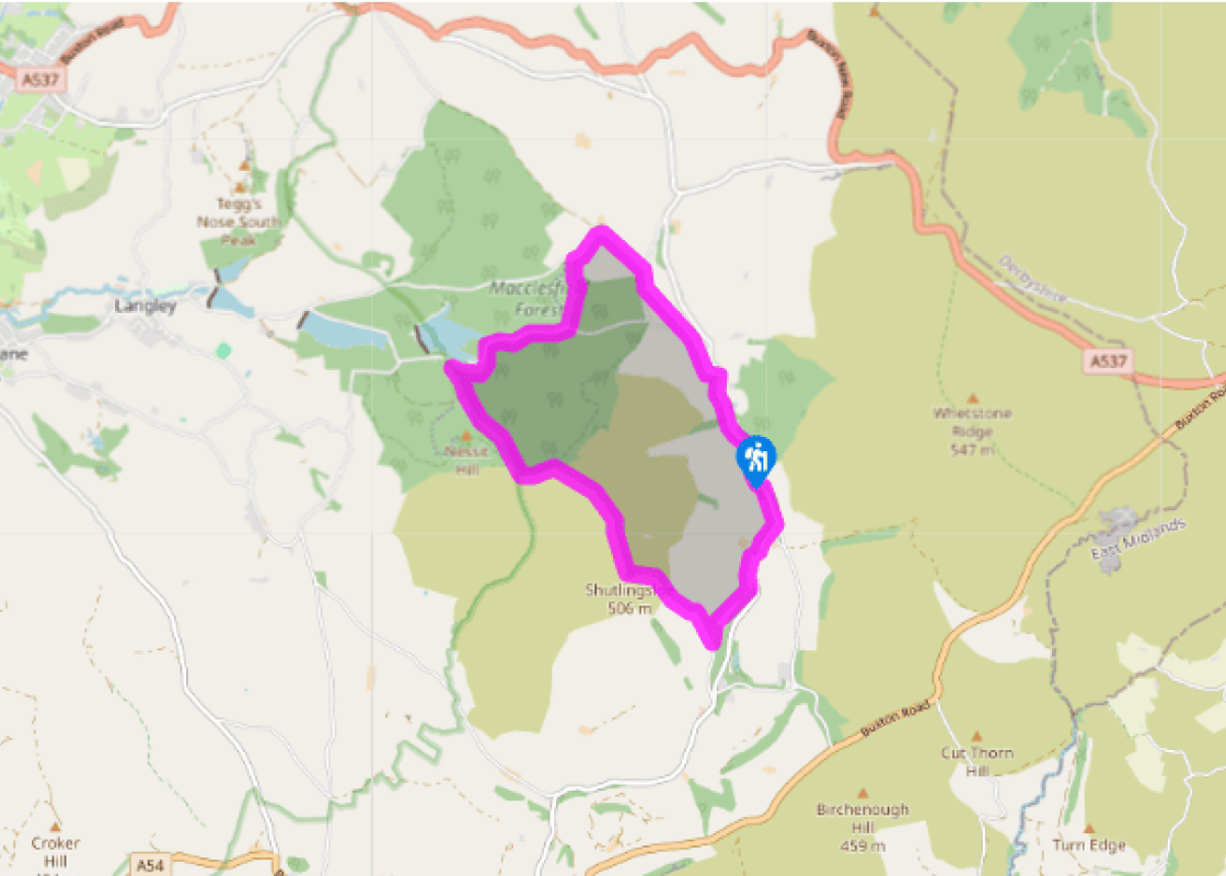
Follow the lane left from Vicarage Quarry car park. Just beyond Dingers Hollow Farm, leave left over a stile. Bear half right across a rising field. Over an intervening stile and stream, carry on, passing above a small barn to a lane. Walk left a few paces to another stile on the right and strike out half left, climbing across the slope of the hill. Aim right of trees on the skyline to find a stile in the top wall. Follow the lane right to a junction.
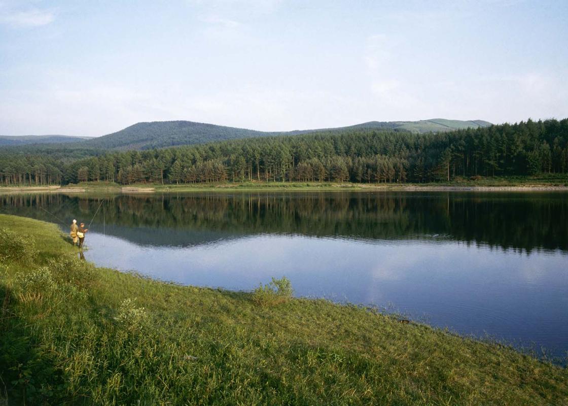
A sign to Forest Chapel points the way left, following the lane over a hill to a crossroads in the hamlet. The church is right, but the onward route lies downhill to the left. After 300yds (274m), at the corner of a plantation, leave left through a kissing gate. Descend a steep path at the edge of the forest into the base of the valley. Approaching a bridge by a small dam, turn off right on a path to Trentabank. Over a small bridge, swing left along the valley. In front of a gate, drop left across a stream to emerge onto a lane.
Take the path diagonally opposite, which runs right within the woods paralleling the lane. Reaching a squeeze gap back onto the lane, swing left into the trees. Ignore a duckboarded path later leaving left and continue for another 250yds (229m) to find a stepped path on the left. Go left again to climb steeply beside a wall up Nessit Hill. Keep going over a crossing track higher up, the way signed to Shutlingsloe. Eventually passing through a gate, join a track from the right. Walk on for a further 250yds (229m) to find the path to Shutlingsloe branching off right to a gate.
A flagged path heads away across the open moor, rising over a shoulder to a gate. Through that, go right beside the wall, later crossing a stile before the final stepped pull onto the summit.
The path off leaves directly opposite, initially an easy scramble down the rocks before running out across a steep grass slope. Continue down over a couple of stiles and a plank bridge to meet a track from Shutlingsloe Farm. Follow it right to a cattle grid and then double back left on another track past the cottage at Banktop. The path continues beyond, gently losing height to emerge onto a lane. Follow it left, keeping left at a junction just beyond the Clough House car park to return to the start.
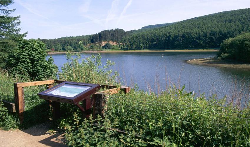
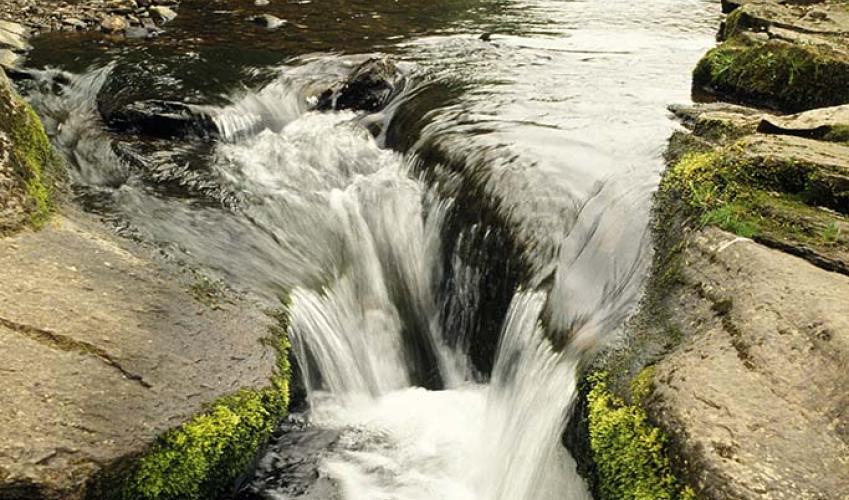
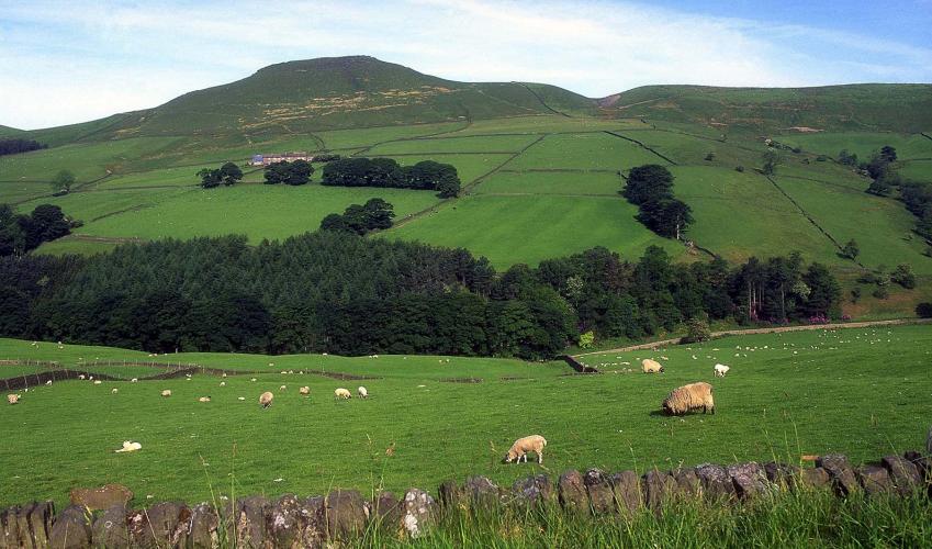
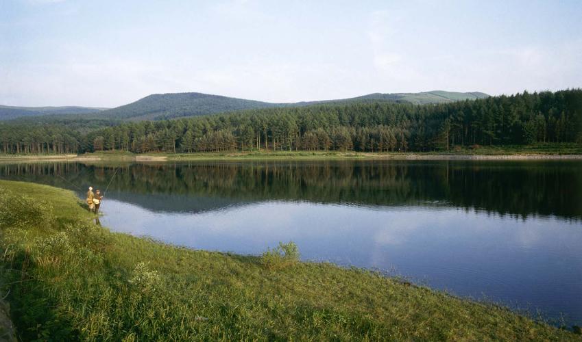
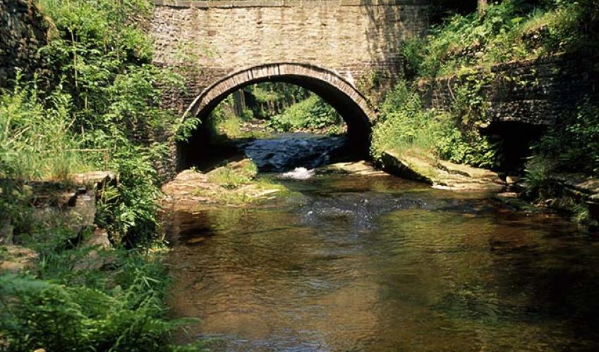
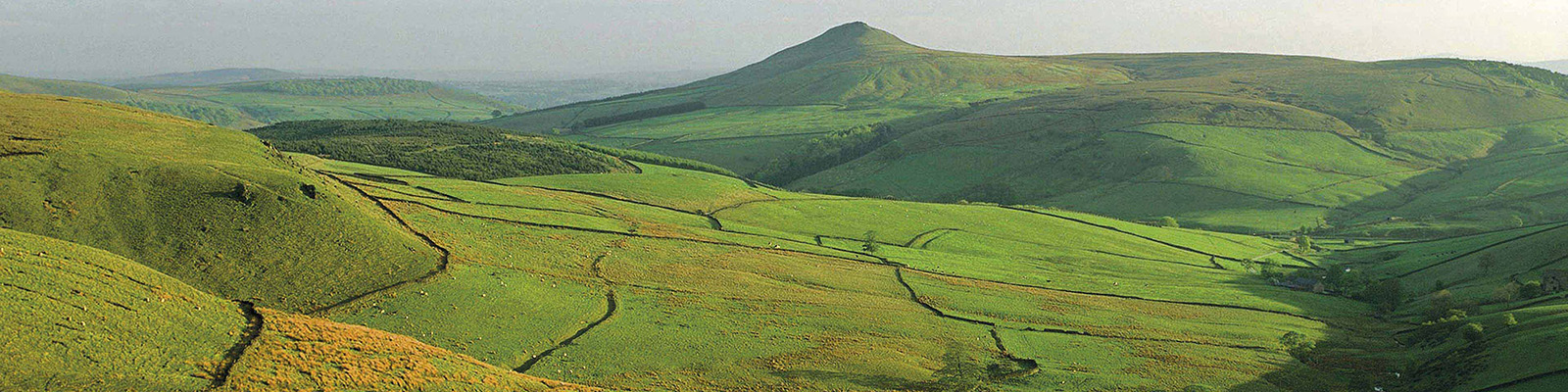
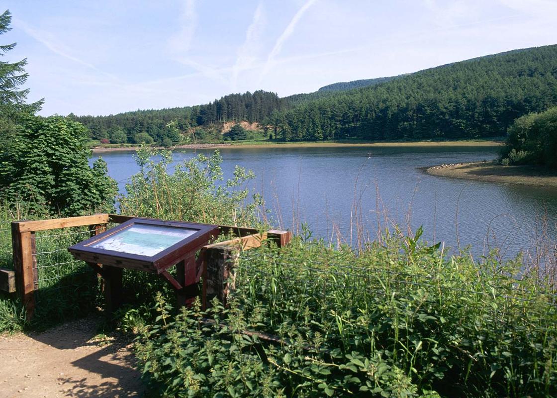
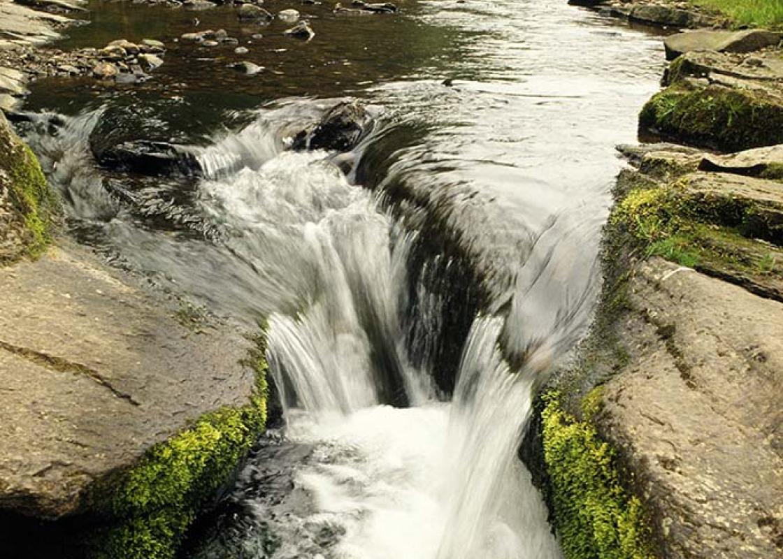
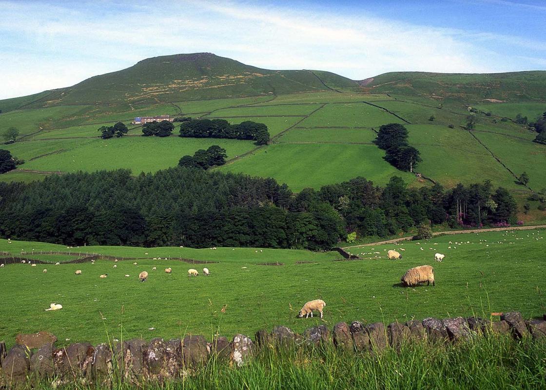
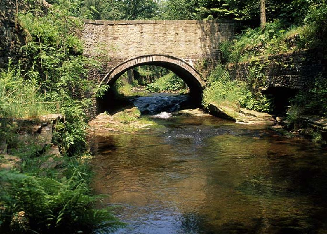
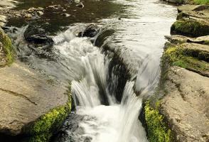
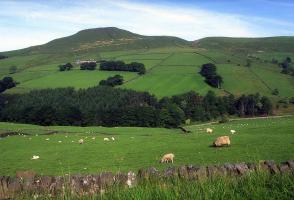
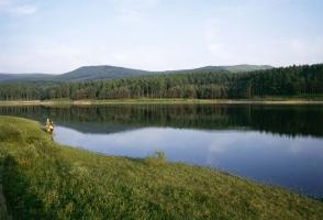
Shutlingsloe isn't the highest summit in this book, but at 1,660ft (506m) it is one of the highest points in Cheshire, only exceeded by the hills to its east. Of these Shining Tor, on the Derbyshire border, reaches 1,834ft (559m), but – despite its enticing name – it is a shapeless lump by... comparison. Shutlingsloe has a special place among Cheshire hills. A direct approach from Wildboarclough is both steep and short, and doesn't really satisfy. Shutlingsloe deserves better. Devious though it may seem, a loop round through Macclesfield Forest adds substance to the walk and, though still steep in parts, is less drastic than the direct approach. Macclesfield Forest is also the name of the hamlet that sits in a wrinkle of the hills. Its Forest Chapel dates from 1673 but owes its present appearance to Victorian rebuilding. It was originally a 'chapel of ease' for those who could not regularly make the trek to the parent church at Prestbury. It became an independent church in 1906 and St Saviour's, Wildboarclough, was in turn a subsidiary chapel. The chapel attracts large numbers to its annual rushbearing ceremony, conducted inside the church every August. Macclesfield Forest provides a source of timber, and the reservoirs provide Macclesfield with most of its water, but it's also important for leisure and wildlife. The dark forest floors under the spruce trees are relatively bare, but the trees themselves are a good place to look for the goldcrest. Although it's Britain's smallest bird, its active habits and bright orange cap make it relatively easy to spot. One of our largest birds, the grey heron, is also well represented, the colony on the shores of Trentabank reservoir being the largest in the Peak District. Stands of tall foxgloves are seen in recently cleared areas; they are among the first plants to colonise disturbed ground. The contrast between forest and moors is intense. The path across the moors is well-marked and, for much of its length, has been surfaced with large gritstone flags, and more recycled stone makes the final steep rise straightforward. There's a view indicator just left of the trig point. There's a steep start to the descent but then it gradually eases. The waters of Clough Brook once powered a mill, but most of this has now disappeared.
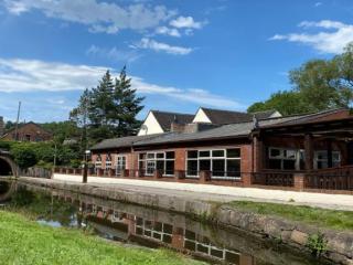
Nestled between the Welsh hills and Derbyshire Peaks, the Cheshire plains make an ideal location to take things slow and mess around in boats. Cheshire has more than 200 miles (302 km) of man-made waterways, more than any other county in England.
"A short but intense walk from enclosed valleys and forest to a stark peak."
Walk details
2hrs 30min
Difficulty:
Hard
Gradient:
Challenging
Distance:
5.25 miles (8.4kms)
Ascent:
1296ft (395m)
Walk directions
Follow the lane left from Vicarage Quarry car park. Just beyond Dingers Hollow Farm, leave left over a stile. Bear half right across a rising field. Over an intervening stile and stream, carry on, passing above a small barn to a lane. Walk left a few paces to another stile on the right and strike out half left, climbing across the slope of the hill. Aim right of trees on the skyline to find a stile in the top wall. Follow the lane right to a junction.
1 of 5
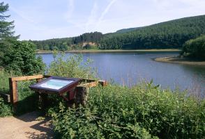
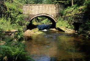
A sign to Forest Chapel points the way left, following the lane over a hill to a crossroads in the hamlet. The church is right, but the onward route lies downhill to the left. After 300yds (274m), at the corner of a plantation, leave left through a kissing gate. Descend a steep path at the edge of the forest into the base of the valley. Approaching a bridge by a small dam, turn off right on a path to Trentabank. Over a small bridge, swing left along the valley. In front of a gate, drop left across a stream to emerge onto a lane.
2 of 5
Take the path diagonally opposite, which runs right within the woods paralleling the lane. Reaching a squeeze gap back onto the lane, swing left into the trees. Ignore a duckboarded path later leaving left and continue for another 250yds (229m) to find a stepped path on the left. Go left again to climb steeply beside a wall up Nessit Hill. Keep going over a crossing track higher up, the way signed to Shutlingsloe. Eventually passing through a gate, join a track from the right. Walk on for a further 250yds (229m) to find the path to Shutlingsloe branching off right to a gate.
3 of 5
A flagged path heads away across the open moor, rising over a shoulder to a gate. Through that, go right beside the wall, later crossing a stile before the final stepped pull onto the summit.
4 of 5
The path off leaves directly opposite, initially an easy scramble down the rocks before running out across a steep grass slope. Continue down over a couple of stiles and a plank bridge to meet a track from Shutlingsloe Farm. Follow it right to a cattle grid and then double back left on another track past the cottage at Banktop. The path continues beyond, gently losing height to emerge onto a lane. Follow it left, keeping left at a junction just beyond the Clough House car park to return to the start.
Shutlingsloe isn't the highest summit in this book, but at 1,660ft (506m) it is one of the highest points in Cheshire, only exceeded by the hills to its east. Of these Shining Tor, on the Derbyshire border, reaches 1,834ft (559m), but – despite its enticing name – it is a shapeless lump by... comparison. Shutlingsloe has a special place among Cheshire hills. A direct approach from Wildboarclough is both steep and short, and doesn't really satisfy. Shutlingsloe deserves better. Devious though it may seem, a loop round through Macclesfield Forest adds substance to the walk and, though still steep in parts, is less drastic than the direct approach. Macclesfield Forest is also the name of the hamlet that sits in a wrinkle of the hills. Its Forest Chapel dates from 1673 but owes its present appearance to Victorian rebuilding. It was originally a 'chapel of ease' for those who could not regularly make the trek to the parent church at Prestbury. It became an independent church in 1906 and St Saviour's, Wildboarclough, was in turn a subsidiary chapel. The chapel attracts large numbers to its annual rushbearing ceremony, conducted inside the church every August. Macclesfield Forest provides a source of timber, and the reservoirs provide Macclesfield with most of its water, but it's also important for leisure and wildlife. The dark forest floors under the spruce trees are relatively bare, but the trees themselves are a good place to look for the goldcrest. Although it's Britain's smallest bird, its active habits and bright orange cap make it relatively easy to spot. One of our largest birds, the grey heron, is also well represented, the colony on the shores of Trentabank reservoir being the largest in the Peak District. Stands of tall foxgloves are seen in recently cleared areas; they are among the first plants to colonise disturbed ground. The contrast between forest and moors is intense. The path across the moors is well-marked and, for much of its length, has been surfaced with large gritstone flags, and more recycled stone makes the final steep rise straightforward. There's a view indicator just left of the trig point. There's a steep start to the descent but then it gradually eases. The waters of Clough Brook once powered a mill, but most of this has now disappeared.
Nestled between the Welsh hills and Derbyshire Peaks, the Cheshire plains make an ideal location to take things slow and mess around in boats. Cheshire has more than 200 miles (302 km) of man-made waterways, more than any other county in England.