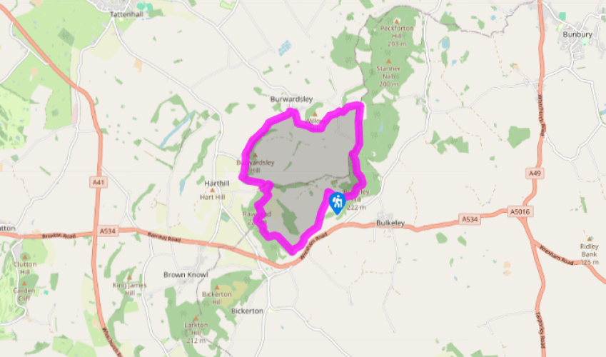
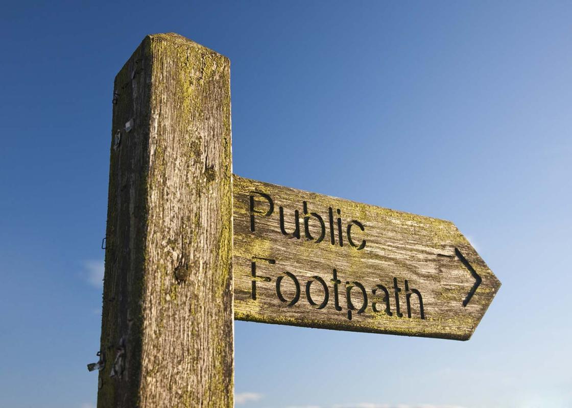
"A loop walk on the most accessible section of a prominent sandstone ridge."
Walk directions
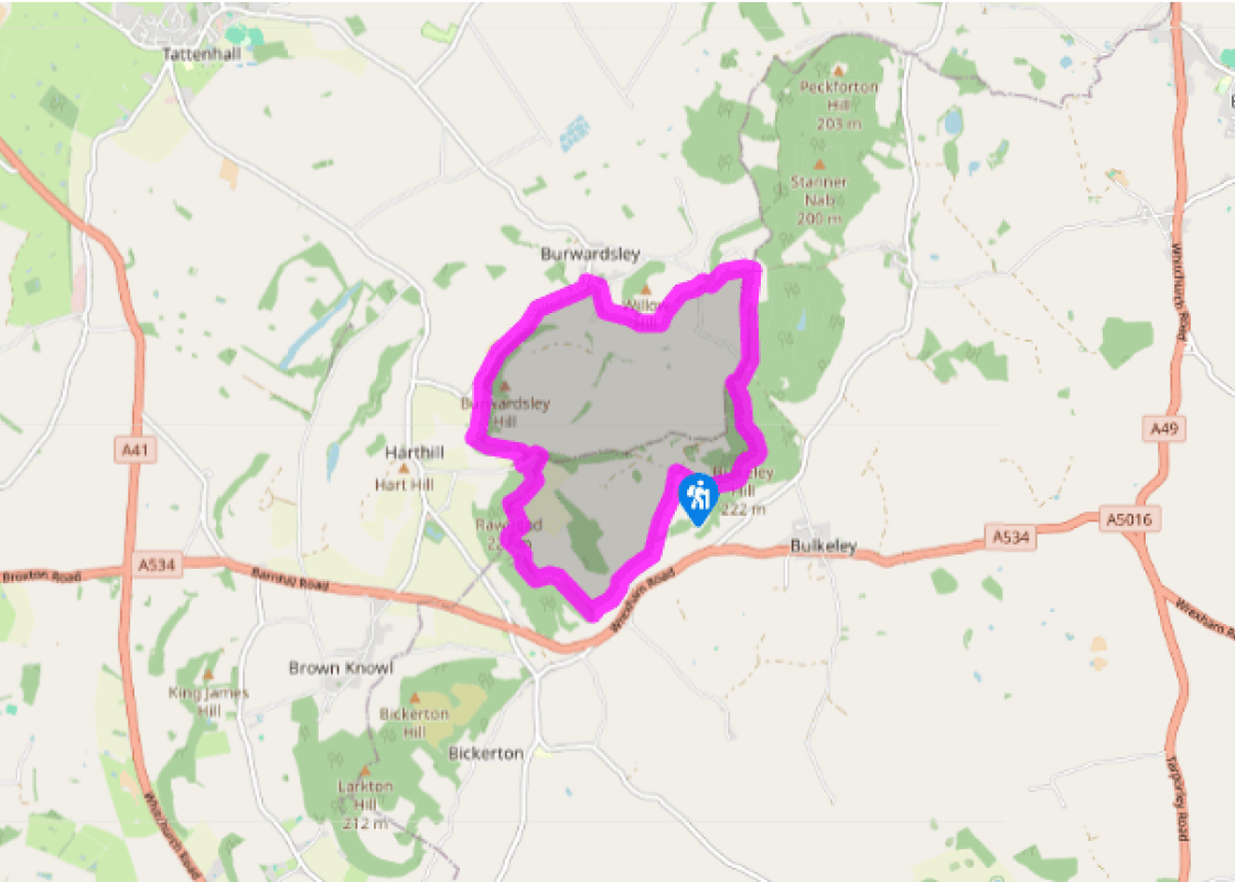
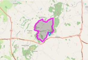
Walk back down Coppermines Lane towards the main road. At the last bend, leave over a stile beside a rock shelter. Follow the fence away; the copper works chimney out to the left. Dip across a stream and climb away at the edge of woodland. Carry on beside a subsequent field to another wood. Go right with the Sandstone Trail to a track and keep ahead towards Raw Head and Burwardsley.
Climb past Chiflik Farm, continuing on a path beside woodland, shortly moving within its fringe. Wind above Coombe Dale and Musket's Hole before climbing to the trig point on Raw Head.
Turn right with the onward trail, shortly reaching a waypost, from which a stepped path drops away. Lower down swing right to descend across the hill. At the bottom, follow a metalled track left for 150yds (137m). Opposite a track, turn right on a permissive path dropping to a lower track. Go right towards Bodnook Cottage. Just before, cross a stile on the left and swing right above pasture below the cottage. Over a stile, continue into wood.
Emerging beyond, cross a stile on the right into a field corner. Strike out on a diagonal, aiming for a tree partway along the far boundary. Over a stile, carry on by the right fence, exiting in the far corner onto a lane opposite The Teddy Bear Tea Room. Follow the road right, eventually reaching cottages at the edge of Burwardsley.
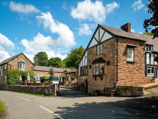
Turn right along Church Road, then go right again along Sarra Lane. Keep left where it forks and continue for 0.5 miles (800m), passing the Cheshire Workshops to a junction at Higher Burwardsley.
Branch right to a crossing and keep ahead up Rock Lane. Bear right at the next fork, climbing to the top of the rise.
Turn off right through a gate by the canted stone of a county boundary marker. Walk away at the field-edge towards Bulkeley Hill and Raw Head, continuing along a contained path past a house and on beside another field to a lane.
Go left and almost immediately right opposite a lodge that resembles a medieval gatehouse. Through a gap in the left wall, follow a path into Bulkeley Hill Wood. Keep left at a fork, rising above the eastern scarp. Curve below the summit, leaving through a gap at the National Trust boundary. Descend ahead to exit the wood beside an iron gate. Turn half right on a field trod towards Raw Head, which returns you to Coppermines Lane.
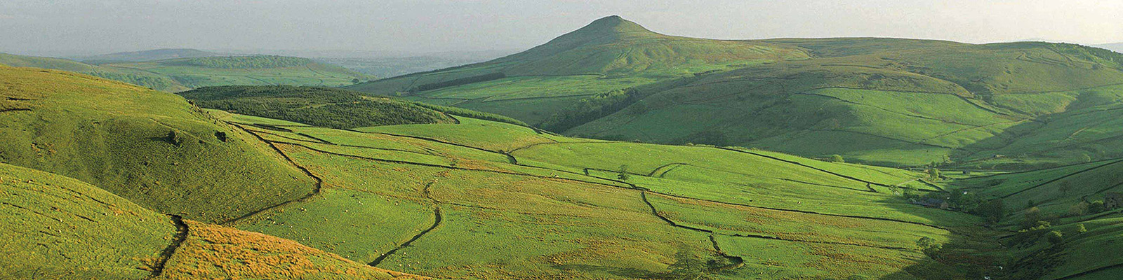
Beeston Castle, which is visible from afar, was built in the 13th century, its strategic hilltop site looking towards the turbulent Welsh border. It saw no real battles until the English Civil War around 400 years later. After changing hands several times, it was largely demolished in 1646 on the... orders of Parliament. Nearby Peckforton Castle is a 19th-century imitation of a medieval fortress. Layers of history Distant views of these grand castle-crowned ridges might lead you to anticipate airy ridge walking. In fact there is little of that to be found here, though Raw Head hill does provide its own brand of unique moments of drama. Generally, however, this walk delivers something different but equally pleasurable for walkers. The castles proclaim the long history of the area, but there are other layers of history to be found. The name of Coppermines Lane, where the walk starts, is a reminder of an industrial element. Where the walk first leaves the tarmac, a chimney glimpsed below marks the site of the old copper works. Just above, the map still marks the site of a mine, though there's little to be seen of it now. Sandstone trail From here your route climbs to Raw Head hill, then continues above a steep slope which breaks into startling crags at Musket's Hole. The summit, at 745ft (227m), is the highest point on the Sandstone Trail, a 34-mile (55km) route from Frodsham to Whitchurch. However, a screen of trees means it is far from the best viewpoint. The walk does serve up some great views, but never an all-round panorama: more a series of tasty morsels than a grand main course. But there is plenty of charm in their sudden and often fleeting appearance. High point After Raw Head hill the walk winds down through woods, fields and along a quiet lane to Burwardsley village followed by an even quieter one up to Higher Burwardsley. Then it climbs again to the National Trust-owned Bulkeley Hill Wood. The high point, literally and metaphorically, is a wonderful grove of sweet chestnut trees on a broad shelf rimmed by low sandstone crags. With virtually no undergrowth, you can fully appreciate the gnarled, multi-stemmed trees, which seem hunched with age. From here it is an enjoyable and easy stroll down through a plantation and then across a field back to Coppermines Lane.
Nestled between the Welsh hills and Derbyshire Peaks, the Cheshire plains make an ideal location to take things slow and mess around in boats. Cheshire has more than 200 miles (302 km) of man-made waterways, more than any other county in England.
"A loop walk on the most accessible section of a prominent sandstone ridge."
Walk details
2hrs 15min
Difficulty:
Medium
Gradient:
Moderate
Distance:
5.5 miles (8.8kms)
Ascent:
984ft (300m)
Walk directions
Walk back down Coppermines Lane towards the main road. At the last bend, leave over a stile beside a rock shelter. Follow the fence away; the copper works chimney out to the left. Dip across a stream and climb away at the edge of woodland. Carry on beside a subsequent field to another wood. Go right with the Sandstone Trail to a track and keep ahead towards Raw Head and Burwardsley.
1 of 8
Climb past Chiflik Farm, continuing on a path beside woodland, shortly moving within its fringe. Wind above Coombe Dale and Musket's Hole before climbing to the trig point on Raw Head.
2 of 8
Turn right with the onward trail, shortly reaching a waypost, from which a stepped path drops away. Lower down swing right to descend across the hill. At the bottom, follow a metalled track left for 150yds (137m). Opposite a track, turn right on a permissive path dropping to a lower track. Go right towards Bodnook Cottage. Just before, cross a stile on the left and swing right above pasture below the cottage. Over a stile, continue into wood.
3 of 8
Emerging beyond, cross a stile on the right into a field corner. Strike out on a diagonal, aiming for a tree partway along the far boundary. Over a stile, carry on by the right fence, exiting in the far corner onto a lane opposite The Teddy Bear Tea Room. Follow the road right, eventually reaching cottages at the edge of Burwardsley.
4 of 8
Turn right along Church Road, then go right again along Sarra Lane. Keep left where it forks and continue for 0.5 miles (800m), passing the Cheshire Workshops to a junction at Higher Burwardsley.
5 of 8
Branch right to a crossing and keep ahead up Rock Lane. Bear right at the next fork, climbing to the top of the rise.
6 of 8
Turn off right through a gate by the canted stone of a county boundary marker. Walk away at the field-edge towards Bulkeley Hill and Raw Head, continuing along a contained path past a house and on beside another field to a lane.
7 of 8
Go left and almost immediately right opposite a lodge that resembles a medieval gatehouse. Through a gap in the left wall, follow a path into Bulkeley Hill Wood. Keep left at a fork, rising above the eastern scarp. Curve below the summit, leaving through a gap at the National Trust boundary. Descend ahead to exit the wood beside an iron gate. Turn half right on a field trod towards Raw Head, which returns you to Coppermines Lane.
Beeston Castle, which is visible from afar, was built in the 13th century, its strategic hilltop site looking towards the turbulent Welsh border. It saw no real battles until the English Civil War around 400 years later. After changing hands several times, it was largely demolished in 1646 on the... orders of Parliament. Nearby Peckforton Castle is a 19th-century imitation of a medieval fortress. Layers of history Distant views of these grand castle-crowned ridges might lead you to anticipate airy ridge walking. In fact there is little of that to be found here, though Raw Head hill does provide its own brand of unique moments of drama. Generally, however, this walk delivers something different but equally pleasurable for walkers. The castles proclaim the long history of the area, but there are other layers of history to be found. The name of Coppermines Lane, where the walk starts, is a reminder of an industrial element. Where the walk first leaves the tarmac, a chimney glimpsed below marks the site of the old copper works. Just above, the map still marks the site of a mine, though there's little to be seen of it now. Sandstone trail From here your route climbs to Raw Head hill, then continues above a steep slope which breaks into startling crags at Musket's Hole. The summit, at 745ft (227m), is the highest point on the Sandstone Trail, a 34-mile (55km) route from Frodsham to Whitchurch. However, a screen of trees means it is far from the best viewpoint. The walk does serve up some great views, but never an all-round panorama: more a series of tasty morsels than a grand main course. But there is plenty of charm in their sudden and often fleeting appearance. High point After Raw Head hill the walk winds down through woods, fields and along a quiet lane to Burwardsley village followed by an even quieter one up to Higher Burwardsley. Then it climbs again to the National Trust-owned Bulkeley Hill Wood. The high point, literally and metaphorically, is a wonderful grove of sweet chestnut trees on a broad shelf rimmed by low sandstone crags. With virtually no undergrowth, you can fully appreciate the gnarled, multi-stemmed trees, which seem hunched with age. From here it is an enjoyable and easy stroll down through a plantation and then across a field back to Coppermines Lane.
Nestled between the Welsh hills and Derbyshire Peaks, the Cheshire plains make an ideal location to take things slow and mess around in boats. Cheshire has more than 200 miles (302 km) of man-made waterways, more than any other county in England.