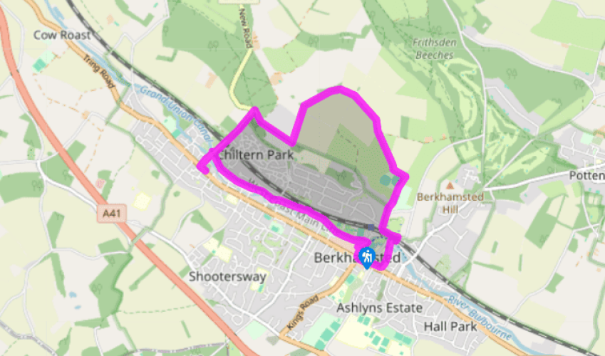
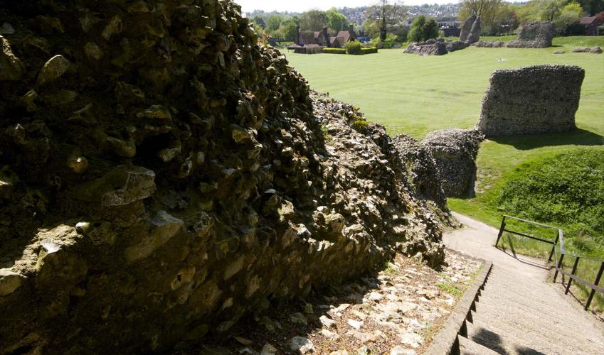
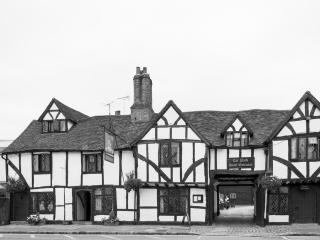
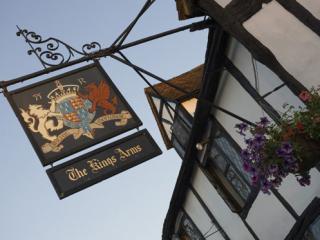
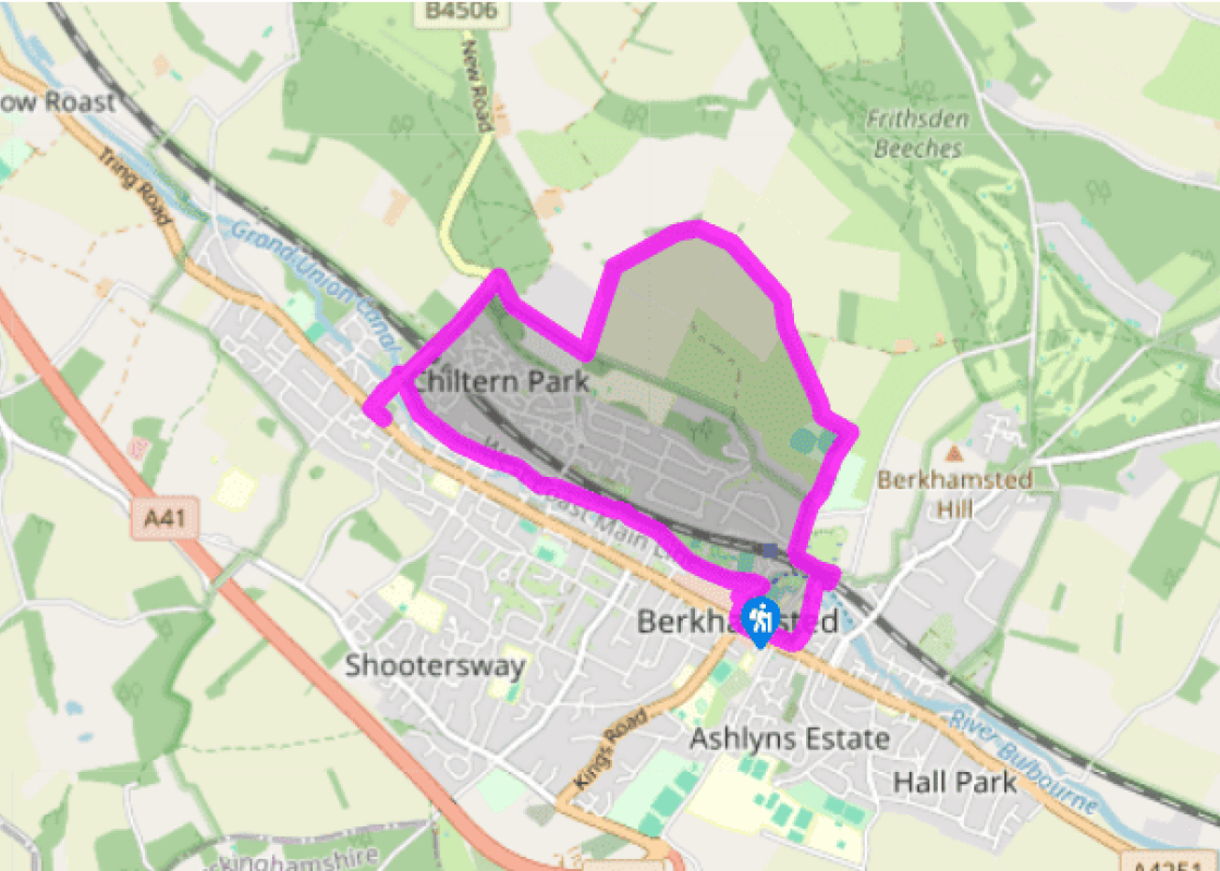
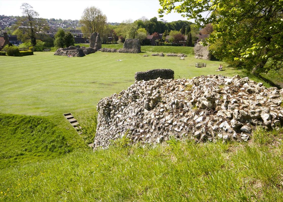
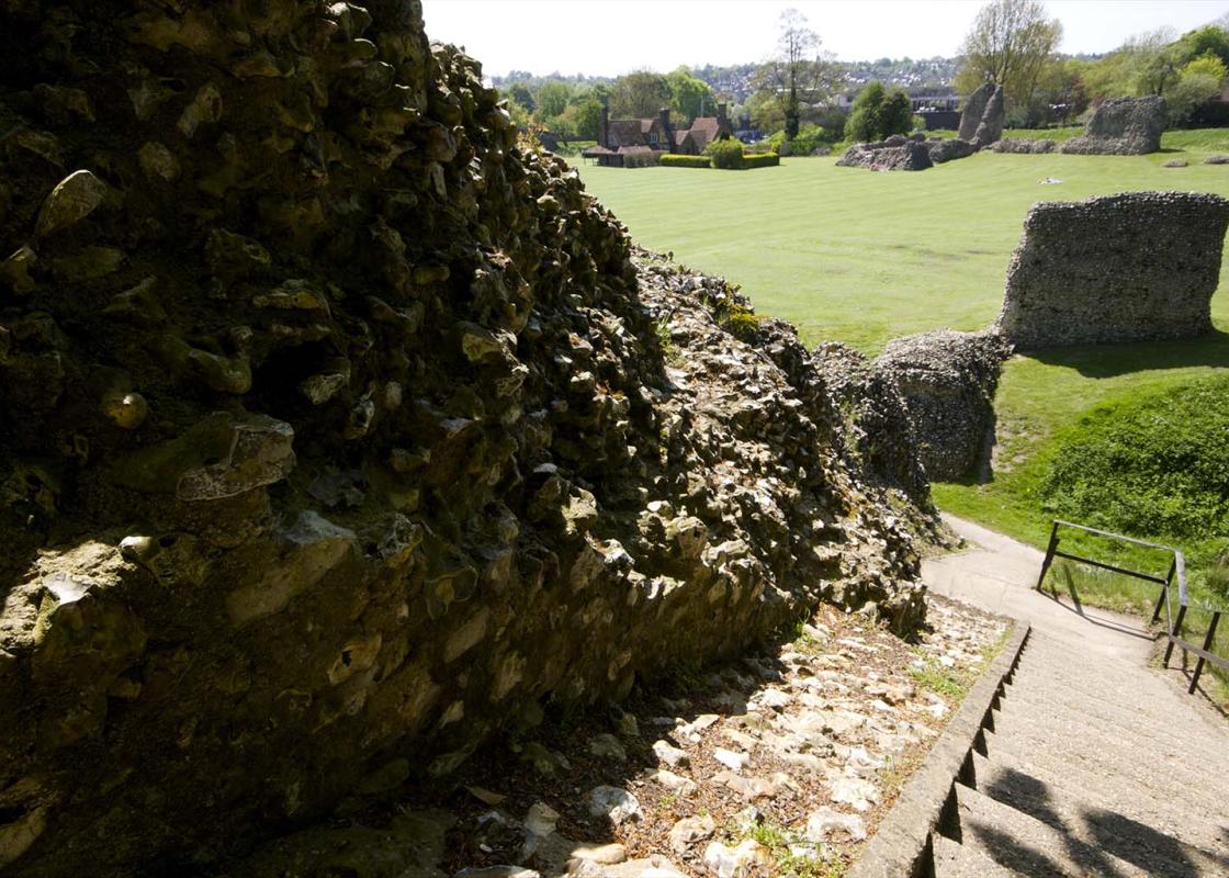
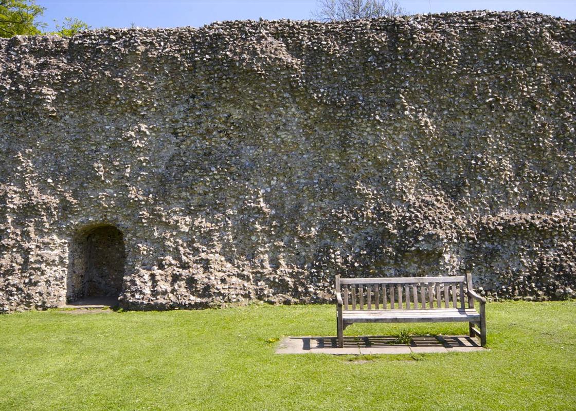
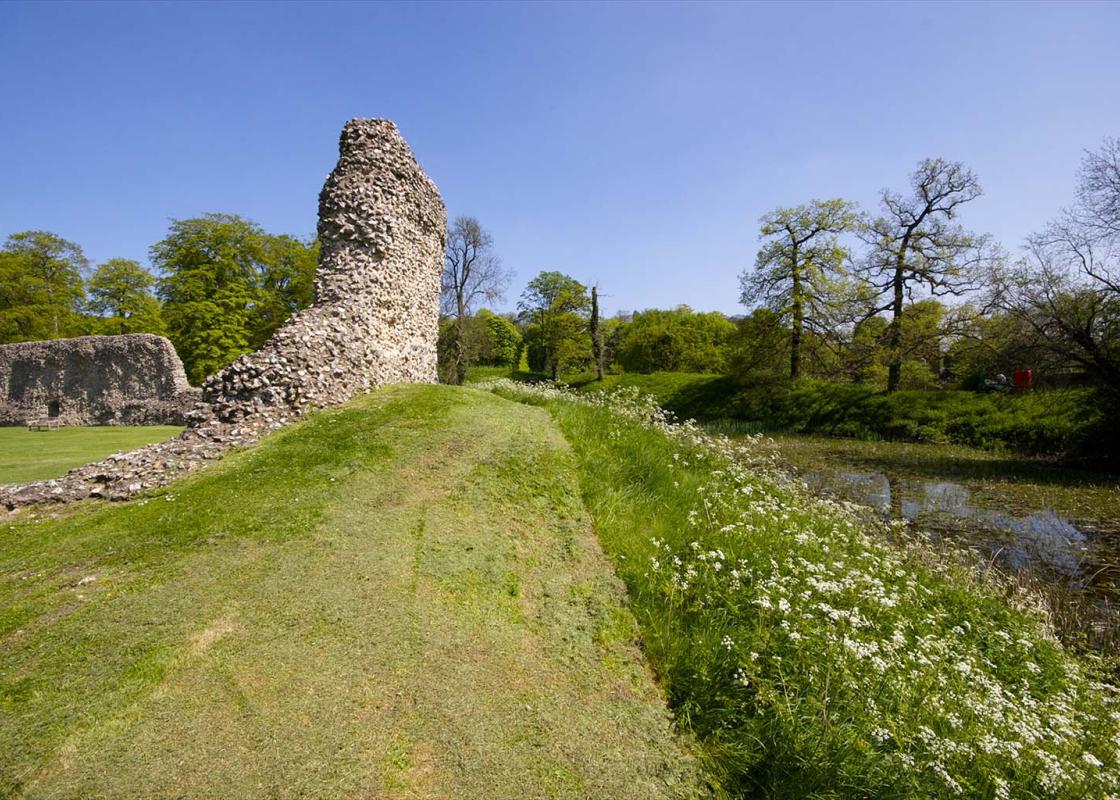
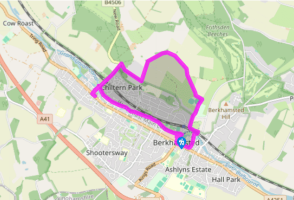
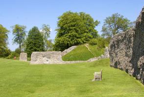
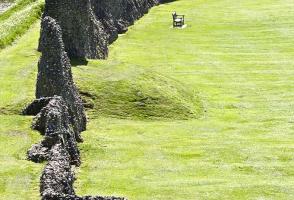
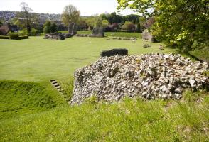
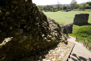
From the car park turn right then left into the High Street, passing the former Town Hall of 1859, now Carluccio’s. At Market Square the road divides – go down the left-hand, cobbled alley to the church and the 16th-century timber-framed Court House by the churchyard gates. Turn left into Castle Street and pass Berkhamsted School. Once across the canal turn right into Station Road, then left opposite The Crystal Palace pub, under the railway bridge and left again to skirt the castle.
From the castle head towards the station and turn right on to Brownlow Road. Where the road bears right carry straight on into Castle Hill, then straight on over a stile to the right of Berkhamsted Cricket, Sports and Social Club’s access road. Through a car park you pass tennis courts and a cricket pavilion, the route becoming a track. Cross a stile and continue to a footpath sign just past an electricity pole and go through a kissing gate.
Turn left at another kissing gate to follow a hedge alongside an arable field, climbing steeply out of the dry valley. Go through a hedge gap, with the path still along the right side of the hedge, the ascent now more gentle. The track bears left to another hedge gap and you continue, now on the chalk plateau, to a further wide gap and a footpath crossroads. Continue ahead and at the tree belt turn left and follow it to a kissing gate.
Turn right on to a metalled track, with paddocks to your left and houses to your right. Carry straight on through woods to emerge at the north edge of Northchurch Common. Continue ahead and turn left to descend the B4506 road into Northchurch, crossing the canal to the main road. Turn left on to the A4251, which follows the course of Roman Akeman Street through the Bulbourne valley. Pass the school to reach St Mary’s Church, with a fine cluster of 16th-century cottages beyond.
Retrace your steps back to New Road to the canal, joining the tow path on the southwest side of the bridge beside lock No. 49, Northchurch Lock. Turn right and follow the canal tow path to Berkhamsted, leaving it at an iron bridge, No. 140c, to walk up some steps. Turn right on to Lower Kings Road and walk back into the town centre.
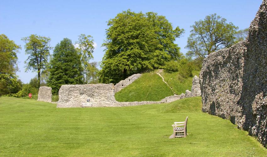
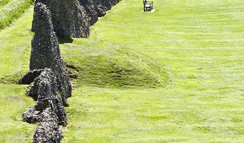
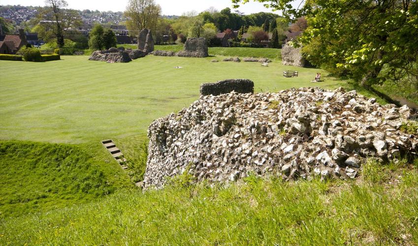
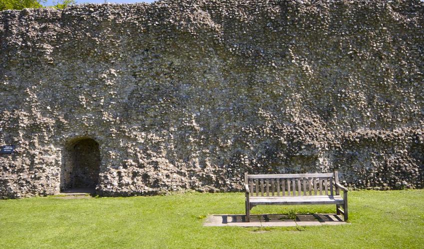
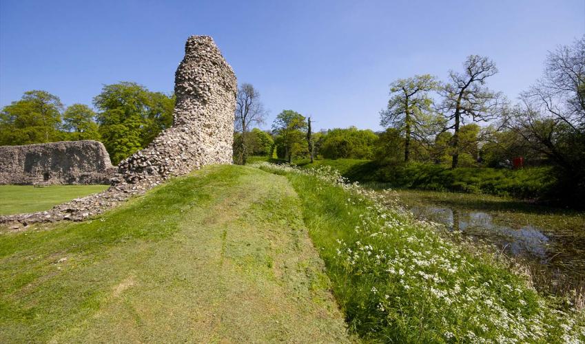
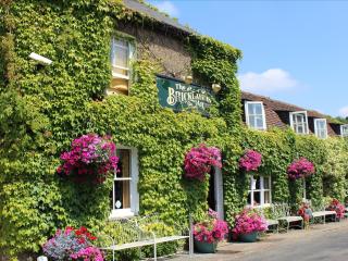
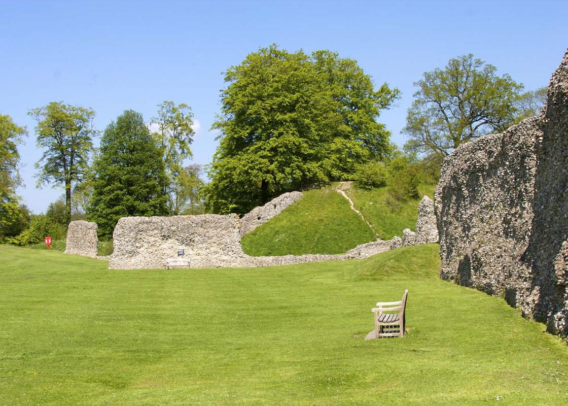
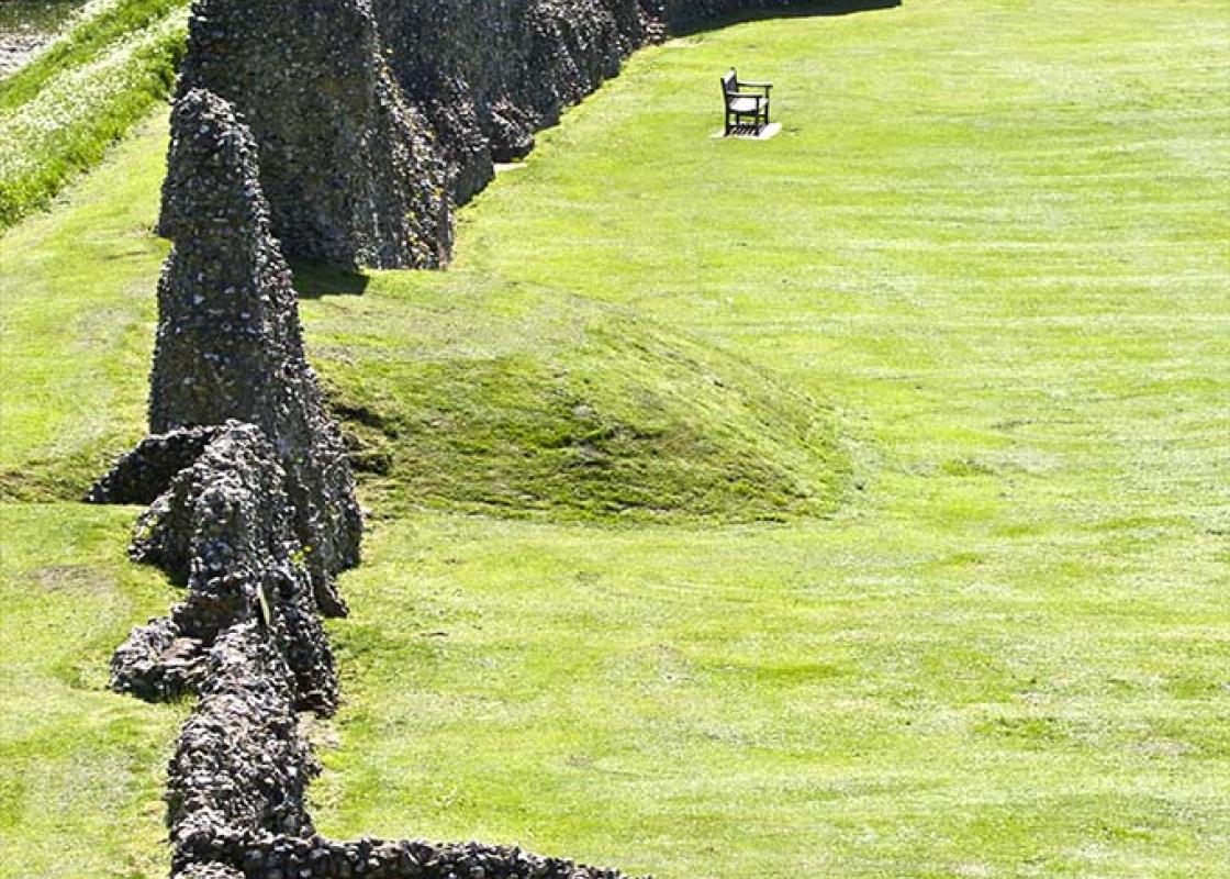
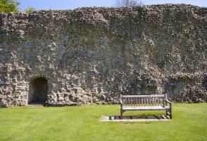
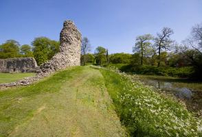
Berkhamsted was an important medieval town, its castle guarding the strategic gap in the Chiltern Hills cut by the River Bulbourne. A Roman road, known to the Anglo Saxons who later settled here as Akeman Street, passes through this important cutting. The Grand Junction Canal followed it in the... 1790s (later renamed the Grand Union Canal), linking the Thames Basin to the industrial powerhouses of Birmingham and the north. Railway builders arrived in the 1830s and in the later 20th century motor traffic choked the old Roman road and the town, until the bypass arrived. In the centre of the town a cobbled alley leads to the 16th-century timber-framed Court House by the churchyard gates. The parish church of St Peter is a large one and mostly 13th century with an unusually long nave for a parish church. Cruciform, its crossing is surmounted by a tower of 1536. Inside is a good collection of late medieval brasses, some medieval stained glass and some fine monuments, including one to a John Sayer of 1682 who was chief cook to King Charles II. To the north of the church is Berkhamsted School, whose core was the grammar school founded in 1541 by John Incent, Dean of St Paul’s Cathedral in London. In brick with stone dressings it was built about 1544, though enlarged in Victorian times. Today the school has grown to occupy most of the west side of Castle Street. Berkhamsted besieged The siege of Berkhamsted Castle in 1216 followed the civil war between King John and his barons after the signing of Magna Carta at Runnymede, an island in the Thames, in 1215. The barons had unwisely called on King Philip Augustus of France to help them. He sent his son, Louis le Dauphin, and a French army. They ravaged Hertfordshire, capturing both Berkhamsted and Hertford castles and occupying St Albans before being ousted in 1217. Lord Brownlow’s compensation Opposite the town, beyond the Grand Union Canal, lies Berkhamsted Park, which is on land that Lord Brownlow of Ashridge gave to the town as ‘compensation’ for his attempted Enclosure of Berkhamsted Common in 1863. He had 5ft (1.5m) metal fences erected around the vast common but locals, aided by a train load of London toughs, all organised by the MP Augustus Smith, tore them down. Perhaps wisely, Lord Brownlow gave in after what was known as the ‘Battle of Berkhamsted’.
As Hertfordshire is so close to London, many of its towns have become commuter havens. St Albans, less than 19 miles (30km) from the capital, has retained its distinctive character, along with many historic remains.
From the car park turn right then left into the High Street, passing the former Town Hall of 1859, now Carluccio’s. At Market Square the road divides – go down the left-hand, cobbled alley to the church and the 16th-century timber-framed Court House by the churchyard gates. Turn left into Castle Street and pass Berkhamsted School. Once across the canal turn right into Station Road, then left opposite The Crystal Palace pub, under the railway bridge and left again to skirt the castle.
1 of 5
From the castle head towards the station and turn right on to Brownlow Road. Where the road bears right carry straight on into Castle Hill, then straight on over a stile to the right of Berkhamsted Cricket, Sports and Social Club’s access road. Through a car park you pass tennis courts and a cricket pavilion, the route becoming a track. Cross a stile and continue to a footpath sign just past an electricity pole and go through a kissing gate.
2 of 5
Turn left at another kissing gate to follow a hedge alongside an arable field, climbing steeply out of the dry valley. Go through a hedge gap, with the path still along the right side of the hedge, the ascent now more gentle. The track bears left to another hedge gap and you continue, now on the chalk plateau, to a further wide gap and a footpath crossroads. Continue ahead and at the tree belt turn left and follow it to a kissing gate.
3 of 5
Turn right on to a metalled track, with paddocks to your left and houses to your right. Carry straight on through woods to emerge at the north edge of Northchurch Common. Continue ahead and turn left to descend the B4506 road into Northchurch, crossing the canal to the main road. Turn left on to the A4251, which follows the course of Roman Akeman Street through the Bulbourne valley. Pass the school to reach St Mary’s Church, with a fine cluster of 16th-century cottages beyond.
4 of 5
Retrace your steps back to New Road to the canal, joining the tow path on the southwest side of the bridge beside lock No. 49, Northchurch Lock. Turn right and follow the canal tow path to Berkhamsted, leaving it at an iron bridge, No. 140c, to walk up some steps. Turn right on to Lower Kings Road and walk back into the town centre.
Berkhamsted was an important medieval town, its castle guarding the strategic gap in the Chiltern Hills cut by the River Bulbourne. A Roman road, known to the Anglo Saxons who later settled here as Akeman Street, passes through this important cutting. The Grand Junction Canal followed it in the... 1790s (later renamed the Grand Union Canal), linking the Thames Basin to the industrial powerhouses of Birmingham and the north. Railway builders arrived in the 1830s and in the later 20th century motor traffic choked the old Roman road and the town, until the bypass arrived. In the centre of the town a cobbled alley leads to the 16th-century timber-framed Court House by the churchyard gates. The parish church of St Peter is a large one and mostly 13th century with an unusually long nave for a parish church. Cruciform, its crossing is surmounted by a tower of 1536. Inside is a good collection of late medieval brasses, some medieval stained glass and some fine monuments, including one to a John Sayer of 1682 who was chief cook to King Charles II. To the north of the church is Berkhamsted School, whose core was the grammar school founded in 1541 by John Incent, Dean of St Paul’s Cathedral in London. In brick with stone dressings it was built about 1544, though enlarged in Victorian times. Today the school has grown to occupy most of the west side of Castle Street. Berkhamsted besieged The siege of Berkhamsted Castle in 1216 followed the civil war between King John and his barons after the signing of Magna Carta at Runnymede, an island in the Thames, in 1215. The barons had unwisely called on King Philip Augustus of France to help them. He sent his son, Louis le Dauphin, and a French army. They ravaged Hertfordshire, capturing both Berkhamsted and Hertford castles and occupying St Albans before being ousted in 1217. Lord Brownlow’s compensation Opposite the town, beyond the Grand Union Canal, lies Berkhamsted Park, which is on land that Lord Brownlow of Ashridge gave to the town as ‘compensation’ for his attempted Enclosure of Berkhamsted Common in 1863. He had 5ft (1.5m) metal fences erected around the vast common but locals, aided by a train load of London toughs, all organised by the MP Augustus Smith, tore them down. Perhaps wisely, Lord Brownlow gave in after what was known as the ‘Battle of Berkhamsted’.
As Hertfordshire is so close to London, many of its towns have become commuter havens. St Albans, less than 19 miles (30km) from the capital, has retained its distinctive character, along with many historic remains.