Around Wharram Percy

Recommended by
Our view
"Exploring a deserted medieval village via some expansive Wolds scenery."
Walk directions

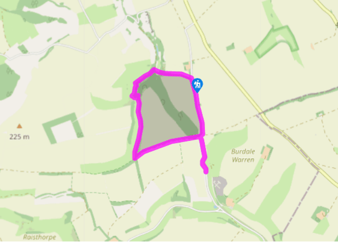
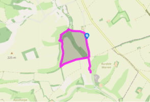
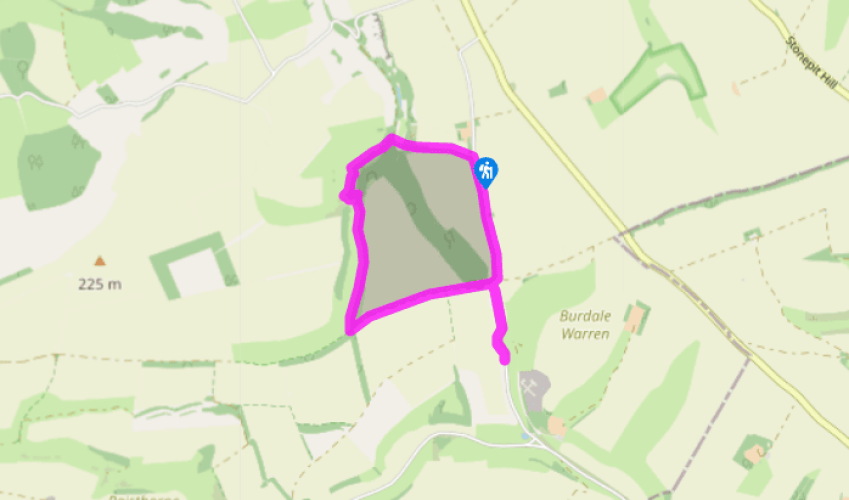
Walk downhill from the car park on a clear path signposted to the deserted medieval village. After a kissing gate the path becomes a sunken hollow way for a while. Go through another gate and bear right, aiming not for the obvious metal gate but for a kissing gate 30yds (27m) to its right. Go down steps then cross both a small footbridge and a track (the former railway line).

Go up steps to another kissing gate. Bear left up the obvious track following the Wolds Way sign. Where the track forks, go straight on up the slope to the level area just above, to look at the main site of the deserted medieval village. Then descend a lesser track down left to a house with a ‘Wharram’ sign.

View all directions
Location
Additional information
  Terrain  - Stony at first, then green tracks, and finally a quiet lane. No stiles
  Landscape  - Typical Wolds mix of tight green valley and broad open ridges
  Dog friendliness  - There are usually some chances for dogs to run free, but beware grazing livestock
  Parking  - Small car park for Wharram Percy, signed off B1248
  Toilets en route  - None on route
About the walk
Archaeologists have recognised the locations of more than 3,000 deserted medieval villages across England. Many were identified quite recently, often from aerial photographs, which can reveal features invisible to surface observers. Wharram Percy is one of the most important and intensively studied...
Read more
Been on this walk placeholder

Been on this walk?

Send us photos or a comment about this route. Or recommend a route of your own.

Walking in Safety placeholder

Walking in Safety

Read our tips to look after yourself and the environment when following this walk.

Get an AA guide placeholder

Get an AA guide

Explore our range of ‘50 Walks in’ guides - they’re the ideal companion for a ramble.

About the area
North Yorkshire, with its two National Parks and two designated Areas of Outstanding Natural Beauty, is England’s largest county and one of the most rural. This is prime walking country, from the heather-clad heights of the North York Moors to the limestone country that is so typical of the Yorkshire Dales – a place of contrasts and discoveries, of history and legend.
Area image

Around Wharram Percy

Recommended by
Our view
"Exploring a deserted medieval village via some expansive Wolds scenery."
Dog friendly
Location
Nearest postcode:
Additional information
  Terrain - Stony at first, then green tracks, and finally a quiet lane. No stiles
  Landscape - Typical Wolds mix of tight green valley and broad open ridges
  Dog friendliness - There are usually some chances for dogs to run free, but beware grazing livestock
  Parking - Small car park for Wharram Percy, signed off B1248
  Toilets en route - None on route
About the walk
Archaeologists have recognised the locations of more than 3,000 deserted medieval villages across England. Many were identified quite recently, often from aerial photographs, which can reveal features invisible to surface observers. Wharram Percy is one of the most important and intensively studied...
Read more
Been on this walk placeholder

Been on this walk?

Send us photos or a comment about this route. Or recommend a route of your own.

Walking in Safety placeholder

Walking in Safety

Read our tips to look after yourself and the environment when following this walk.

Get an AA guide placeholder

Get an AA guide

Explore our range of ‘50 Walks in’ guides - they’re the ideal companion for a ramble.

About the area
Area image
North Yorkshire
North Yorkshire, with its two National Parks and two designated Areas of Outstanding Natural Beauty, is England’s largest county and one of the most rural. This is prime walking country, from the heather-clad heights of the North York Moors to the limestone country that is so typical of the Yorkshire Dales – a place of contrasts and discoveries, of history and legend.