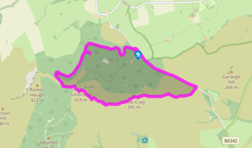
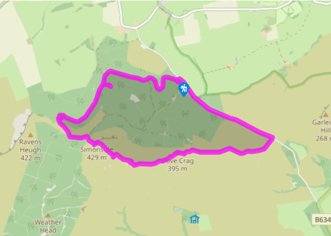
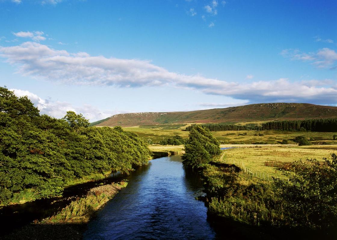
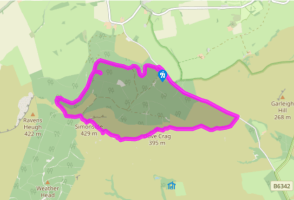
From the notice board near the car park entrance, leave past a barrier along a broad forest road. Continue uphill, ignoring a left turn and eventually reaching a fork by a communication mast. Take the right branch and head gently downhill for a little over 0.25 miles (400m) to another junction. Bear left on a lesser trail, climbing to the crest of the rise, where an unmarked path leaves on the left to Little Church Rock.
Returning to the main trail, continue along it to the left, shortly reaching a marker stone by a diagonally crossing path. Keep ahead along a grass path, later passing beneath massive boulders and eventually reaching a cairn.
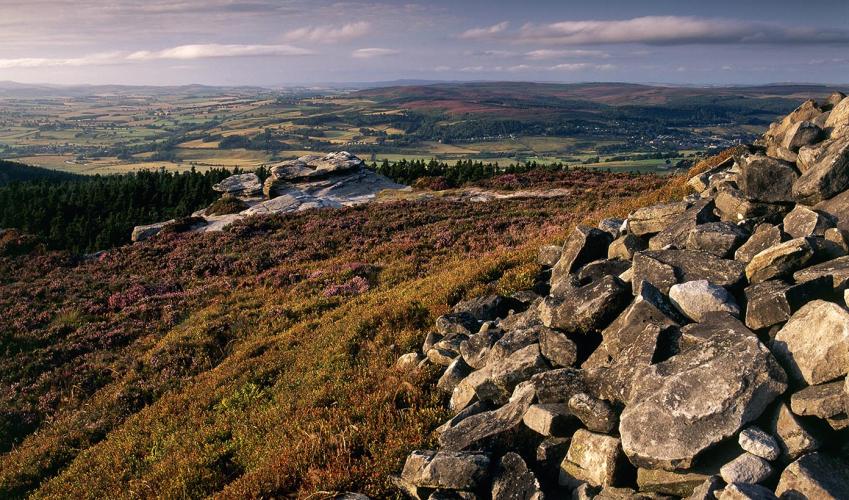
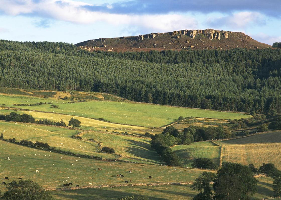
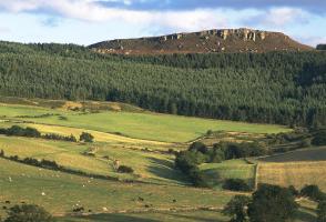
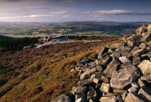
Swing sharp left, winding up a shallow gully before breaking from the trees onto open heather moor. Keep ahead, joining another path and then a forest road to a junction by an information board at the foot of Simonside. A rugged and intermittently stepped path picks its way up the crag; a steep climb, but rewarded by a view across Coquetdale to the Cheviot Hills.
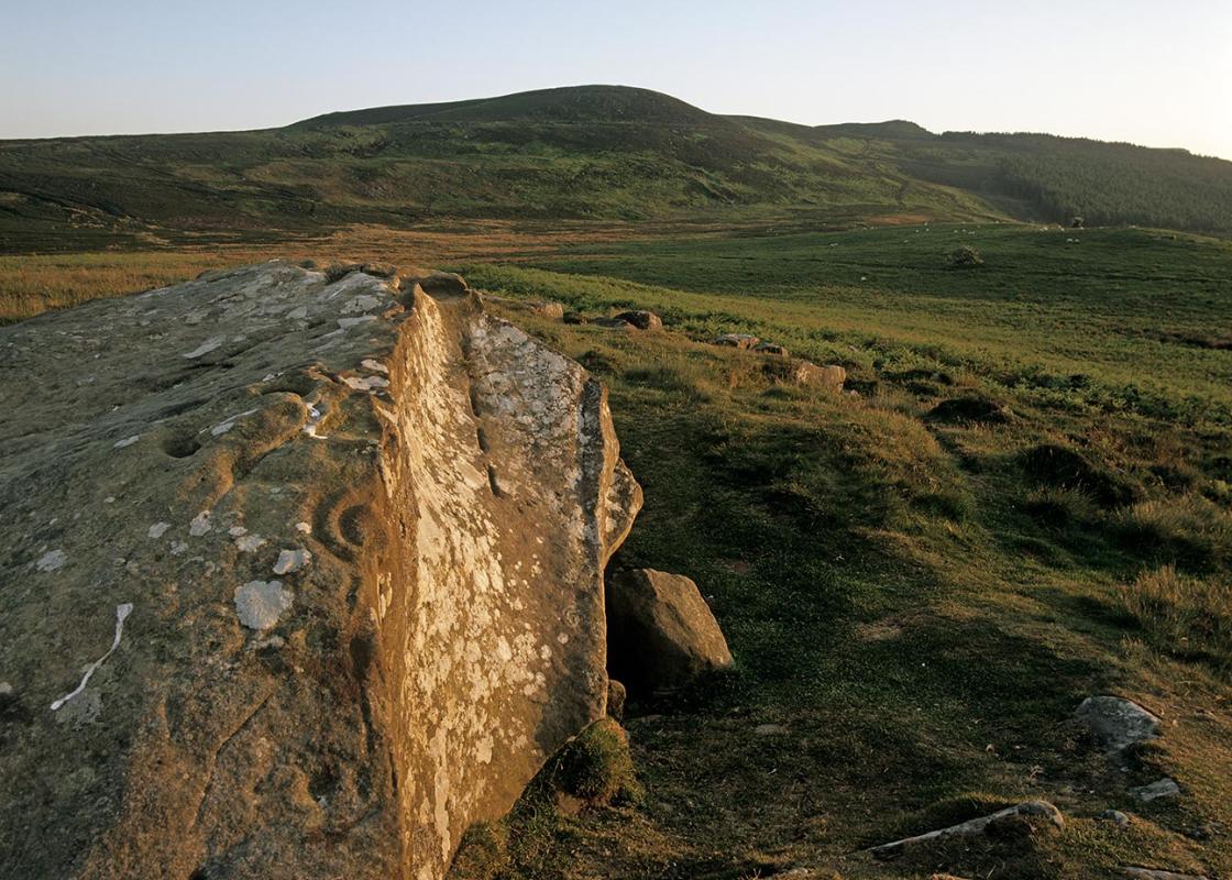
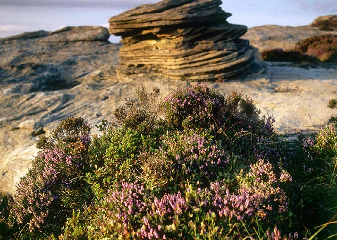
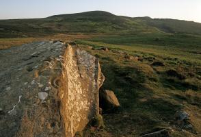
To the left, a flagged path leads away past a large Bronze Age burial cairn, heading across the moorland top to an impressive weather-sculpted tor. Pass around the rocks then swing right by another cairn towards the next outcrop, Old Stell Crag. Again the path winds past the rocks, descending above a gully before resuming the trek across the moor to a final outcrop at the edge of the plateau, Dove Crag. It too is the site of a cairn.
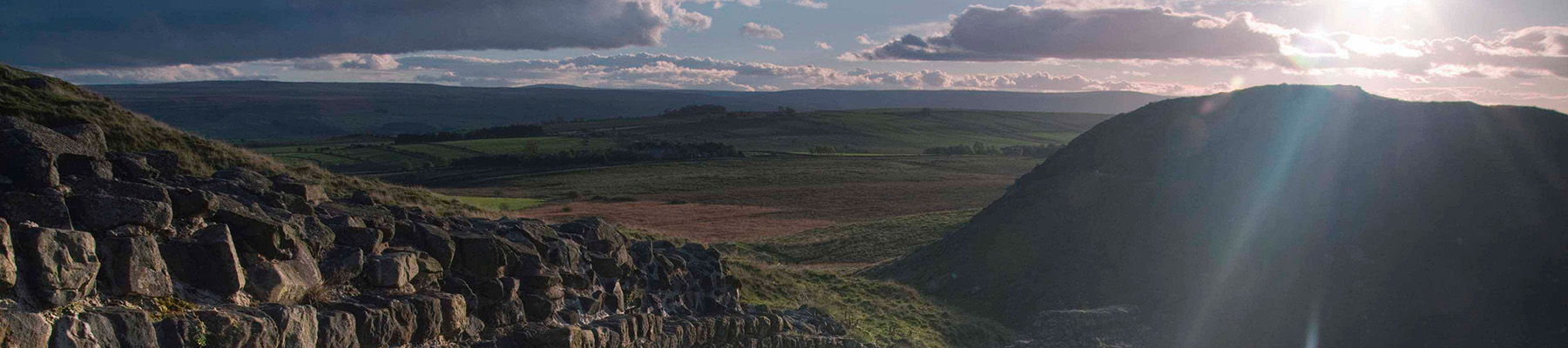
The onward route drops steeply from the hill. Ignore a waymarked path off left and continue down to a gate at the bottom. Beyond, the trail runs on over the gentle rise of The Beacon, passing two more cairns before descending its eastern snout. Ahead, the impressive defensive embankments and ditches of the Lordenshaw Iron Age settlement are clearly visible; a place to explore if you have the time, for there are several boulders bearing intriguing cup-and-ring marks scattered around its flanks. Joining St Oswald's Way lower down, walk out to a lane opposite a car park.
Turn left and follow the road for a mile (1.6km) back to the forest picnic area at the start of the walk.
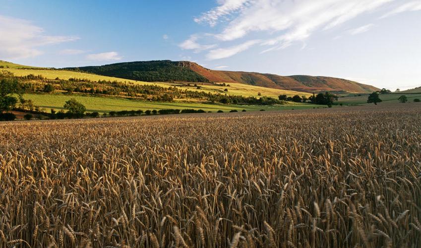
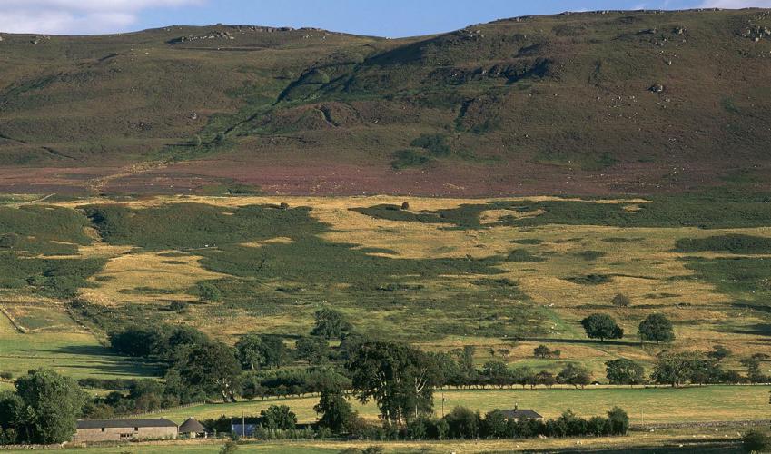
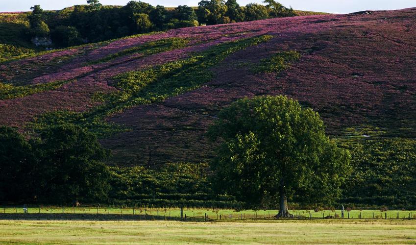
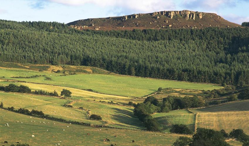
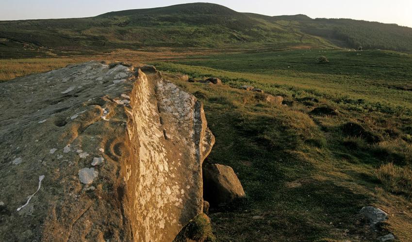
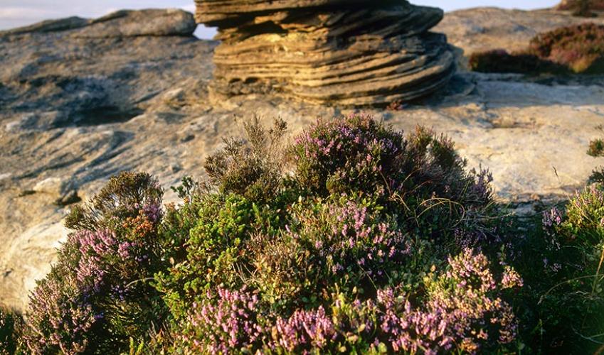
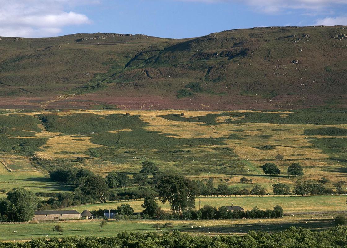
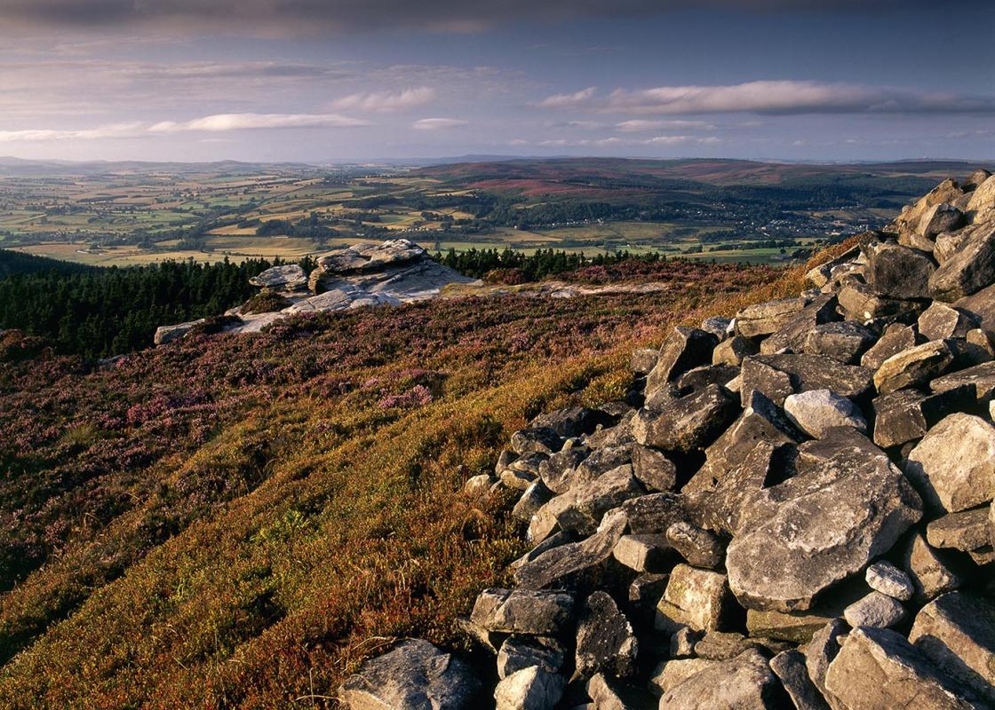
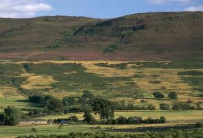
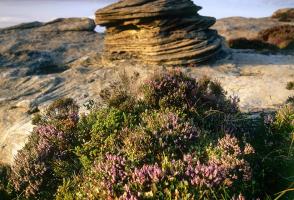
While the Simonside Hills are not the highest in Northumberland, they are the most distinctive. The taller Cheviots and hills of the North Pennines present a rounded, soft face to the visitor, so that it is often difficult from a distance to distinguish one from another. In contrast, the summit... plateau of Simonside, with its chopped-off, craggy edges, is recognisable from as far south as Newcastle and parts of County Durham. Fell sandstones and craggy summits The rocks that give these hills their appearance are geologically among the youngest in the county. They consist of fell sandstones, deposited as river sediments on top of the older shale, limestone and volcanic layers that form the bedrock. Although they are exposed elsewhere in Northumberland, nowhere are they as impressive as they are on Simonside. The cragbound summits, wrapped in a sombre, almost watchful atmosphere, have influenced people for as long as the surrounding land has been inhabited. The sandstones have proved soft enough for early settlers to leave their mark, yet hard enough for these marks to survive relentless weathering for 5,000 years. Throughout this time, agriculture was carried out in the valleys and across the lower slopes, but not on Simonside itself, suggesting that to generations of peoples it may have held some spiritual significance. Ancient sites At many sites, most notably Lordenshaw, where the Simonside ridge tails off to the roadside, a record of human activity for the whole of this period has been preserved. Many of the rocks show cup-and-ring carvings dating from Neolithic times. The Bronze Age is represented by 4,000-year-old cairns and burial mounds, while the top of the hill is dominated by an Iron Age earthwork built around 350 BC. More recent remains dating back only a few centuries include walls, old tracks and the spoil heaps of 19th-century lead prospecting. Scaling the heights Conifer forests now cover the lower reaches of these hills, but the summit crags remain clear, and are used for an activity that many of its devotees regard as a modern spiritual pursuit. As a sport, rock climbing began in Northumberland in the late 19th century, very soon after its birth in the Lake District and Snowdonia. The early pioneers included Sir Charles Trevelyan and the historian, G M Trevelyan from nearby Wallington Hall. The crags of Simonside were among the first to be developed and are still used extensively. The forest has rendered some rock faces temporarily invisible and others less accessible than before, but the crags of the northern rim of Simonside are among the most popular in the county.
If it’s history you’re after, there’s heaps of it in Northumberland. On Hadrian’s Wall you can imagine scarlet-cloaked Roman legionaries keeping watch for painted Pictish warriors while cursing the English weather and dreaming of home.
From the notice board near the car park entrance, leave past a barrier along a broad forest road. Continue uphill, ignoring a left turn and eventually reaching a fork by a communication mast. Take the right branch and head gently downhill for a little over 0.25 miles (400m) to another junction. Bear left on a lesser trail, climbing to the crest of the rise, where an unmarked path leaves on the left to Little Church Rock.
1 of 6
Returning to the main trail, continue along it to the left, shortly reaching a marker stone by a diagonally crossing path. Keep ahead along a grass path, later passing beneath massive boulders and eventually reaching a cairn.
2 of 6
Swing sharp left, winding up a shallow gully before breaking from the trees onto open heather moor. Keep ahead, joining another path and then a forest road to a junction by an information board at the foot of Simonside. A rugged and intermittently stepped path picks its way up the crag; a steep climb, but rewarded by a view across Coquetdale to the Cheviot Hills.
3 of 6
To the left, a flagged path leads away past a large Bronze Age burial cairn, heading across the moorland top to an impressive weather-sculpted tor. Pass around the rocks then swing right by another cairn towards the next outcrop, Old Stell Crag. Again the path winds past the rocks, descending above a gully before resuming the trek across the moor to a final outcrop at the edge of the plateau, Dove Crag. It too is the site of a cairn.
4 of 6
The onward route drops steeply from the hill. Ignore a waymarked path off left and continue down to a gate at the bottom. Beyond, the trail runs on over the gentle rise of The Beacon, passing two more cairns before descending its eastern snout. Ahead, the impressive defensive embankments and ditches of the Lordenshaw Iron Age settlement are clearly visible; a place to explore if you have the time, for there are several boulders bearing intriguing cup-and-ring marks scattered around its flanks. Joining St Oswald's Way lower down, walk out to a lane opposite a car park.
5 of 6
Turn left and follow the road for a mile (1.6km) back to the forest picnic area at the start of the walk.
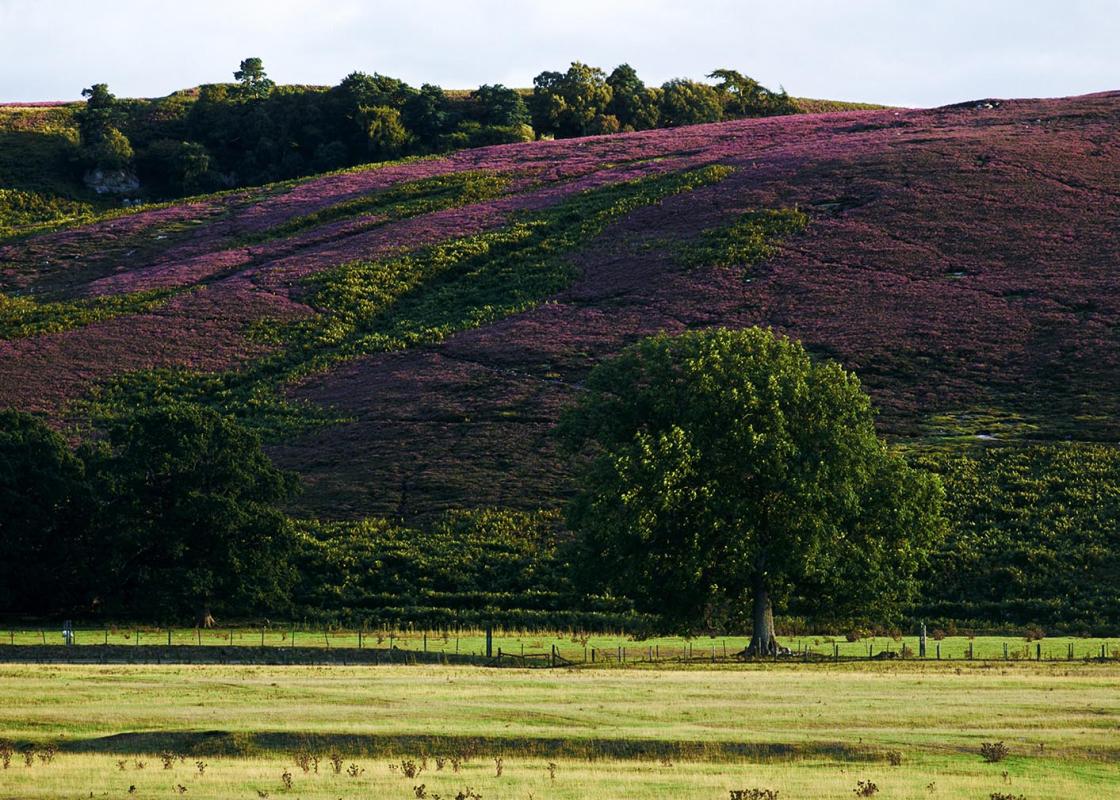
While the Simonside Hills are not the highest in Northumberland, they are the most distinctive. The taller Cheviots and hills of the North Pennines present a rounded, soft face to the visitor, so that it is often difficult from a distance to distinguish one from another. In contrast, the summit... plateau of Simonside, with its chopped-off, craggy edges, is recognisable from as far south as Newcastle and parts of County Durham. Fell sandstones and craggy summits The rocks that give these hills their appearance are geologically among the youngest in the county. They consist of fell sandstones, deposited as river sediments on top of the older shale, limestone and volcanic layers that form the bedrock. Although they are exposed elsewhere in Northumberland, nowhere are they as impressive as they are on Simonside. The cragbound summits, wrapped in a sombre, almost watchful atmosphere, have influenced people for as long as the surrounding land has been inhabited. The sandstones have proved soft enough for early settlers to leave their mark, yet hard enough for these marks to survive relentless weathering for 5,000 years. Throughout this time, agriculture was carried out in the valleys and across the lower slopes, but not on Simonside itself, suggesting that to generations of peoples it may have held some spiritual significance. Ancient sites At many sites, most notably Lordenshaw, where the Simonside ridge tails off to the roadside, a record of human activity for the whole of this period has been preserved. Many of the rocks show cup-and-ring carvings dating from Neolithic times. The Bronze Age is represented by 4,000-year-old cairns and burial mounds, while the top of the hill is dominated by an Iron Age earthwork built around 350 BC. More recent remains dating back only a few centuries include walls, old tracks and the spoil heaps of 19th-century lead prospecting. Scaling the heights Conifer forests now cover the lower reaches of these hills, but the summit crags remain clear, and are used for an activity that many of its devotees regard as a modern spiritual pursuit. As a sport, rock climbing began in Northumberland in the late 19th century, very soon after its birth in the Lake District and Snowdonia. The early pioneers included Sir Charles Trevelyan and the historian, G M Trevelyan from nearby Wallington Hall. The crags of Simonside were among the first to be developed and are still used extensively. The forest has rendered some rock faces temporarily invisible and others less accessible than before, but the crags of the northern rim of Simonside are among the most popular in the county.
If it’s history you’re after, there’s heaps of it in Northumberland. On Hadrian’s Wall you can imagine scarlet-cloaked Roman legionaries keeping watch for painted Pictish warriors while cursing the English weather and dreaming of home.